Apalachee Bay and Coastal Waters From Keaton Beach to Ochlockonee River FL out 20 NM Marine Forecast
| Tonight...Southeast Winds 10 To 15 Knots. Seas 2 To 4 Feet. Wave Detail: Southeast 4 Feet At 7 Seconds. Protected Waters A Moderate Chop. |
| Tuesday...South Winds 10 To 15 Knots. Seas 2 To 4 Feet. Wave Detail: South 4 Feet At 7 Seconds. Protected Waters A Moderate Chop. A Chance Of Showers. |
| Tuesday Night...Southwest Winds 5 To 10 Knots. Seas 2 To 3 Feet. Wave Detail: South 3 Feet At 6 Seconds. Protected Waters A Light Chop. A Slight Chance Of Showers In The Evening. |
| Wednesday...West Winds 5 To 10 Knots, Becoming Southwest In The Afternoon. Seas 2 To 3 Feet. Wave Detail: South 2 Feet At 6 Seconds. Protected Waters A Light Chop. |
| Wednesday Night...West Winds 5 To 10 Knots. Seas Around 2 Feet. Wave Detail: South 2 Feet At 6 Seconds And Southwest 1 Foot At 3 Seconds. Protected Waters A Light Chop. |
| Thursday...Northeast Winds 5 To 10 Knots, Becoming South In The Afternoon. Seas Around 2 Feet. Wave Detail: East 1 Foot At 2 Seconds And South 1 Foot At 6 Seconds. Protected Waters A Light Chop. |
| Thursday Night...Southwest Winds 5 To 10 Knots, Becoming Northeast After Midnight. Seas Around 2 Feet In The Evening, Then 1 Foot Or Less. Protected Waters A Light Chop. |
| Friday...East Winds Around 10 Knots, Becoming Southeast In The Afternoon. Seas Around 2 Feet. Protected Waters A Light Chop. |
| Friday Night...Southwest Winds 5 To 10 Knots, Becoming Northeast After Midnight. Seas Around 2 Feet. Protected Waters A Light Chop. |
| Saturday...East Winds Around 10 Knots, Becoming Southeast In The Afternoon. Seas Around 2 Feet. Protected Waters A Moderate Chop. |
| Saturday Night...South Winds 5 To 10 Knots, Becoming Southeast 10 To 15 Knots After Midnight. Seas Around 2 Feet. Protected Waters A Moderate Chop. |
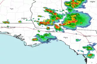
| Area Forecast Discussion National Weather Service Tallahassee FL 301pm EDT Monday April 29 2024 ...New NEAR TERM, SHORT TERM, LONG TERM, Marine IRE WEATHER,Hydrology Near Term (Through Tuesday) Issued at 258pm EDT Monday April 29 2024 Scattered showers this evening lifting northward mainly over portions of Southeast AL and the FL Panhandle have prompted Probability of Precipitation up to 25%. Do not expect any thunder with these as instability and lift are limited. Tonight, some patchy fog is possible over the aforementioned areas and possibly into the FL Big Bend, but confidence is not high in development. On Tuesday, a decent shortwave aloft and surface trough reflection swings through the region. While the best lift remains northwest, scattered showers and thunderstorms are expected mainly northwest of the FL Big Bend, where they could consolidate into a line. The main threat is gusty winds with stronger storms. .SHORT TERM... (Tuesday night through Wednesday night) Issued at 258pm EDT Monday April 29 2024 An H5 will be moving over the region in the wake of Tuesday's shortwave. This will help to dry things out and warm things up as temperatures return to the upper 80s to lower 90s for highs and overnight lows remain in the lower to middle 60s. A weak sea breeze is forecast to move inland Wednesday afternoon; however, drier air loft will preclude any showers or thunderstorms from developing. Long Term (Thursday through Sunday) Issued at 258pm EDT Monday April 29 2024 Dry and warm to very warm temperatures are expected to end the work week and into the weekend with widespread lower 90s forecast Thursday onward. This is thanks to an H5 ridge moseying through the Southeast. An H5 shortwave will translate east into the southeast later Friday into Saturday and will give us our next chance for rain, mainly along the sea breeze. Some weak troughiness and another weak vort max rolling through the Southeast later in the weekend will keep a small chance for rain along the sea breeze again on Sunday. Marine Issued at 258pm EDT Monday April 29 2024 The pressure gradient will continue to relax as high pressure settles over the northeastern Gulf of Mexico. Another, weaker, surge of easterly winds is expected tonight and may lead to a brief period of cautionary conditions. Otherwise, light winds are forecast the rest of the week with seas generally less than 2 feet. Fire Weather Issued at 258pm EDT Monday April 29 2024 Showers are expected on Tuesday mainly northwest of the FL Big Bend, with a return to dry weather on Wednesday and Thursday. The main fire weather concern will be high dispersions on Tuesday in portions of the FL and GA Counties, which may return on Thursday as well. Hydrology Issued at 258pm EDT Monday April 29 2024 The flood wave continues to inch down the Suwannee River with Flood Warnings continuing at Branford, Rock Bluff near Bell, and Manatee Springs. The good news is the warning at Branford could be cancelled as early as this evening with Rock Bluff and Manatee Springs taking a few more days to fall below Minor Flood Stage. While a few showers and storms are possible Tuesday and again Saturday, no additional riverine flooding is anticipated. There is a very small chance, less than 5%, of one or two locations picking up more than 3" of rain with the storms on Tuesday. This could lead to some localized flooding if those rain totals are realized. NOAA Tallahassee FL Office: Watches - Warnings - Advisories FL...High Rip Current Risk through late tonight for FLZ108-112-114- 115. GA...None. AL...None. GM...None. |
 Tallahassee FL Radar
 Gulf Radar