Apalachicola to Destin FL from 20 to 60 NM Marine Forecast
| Rest Of Today...Southeast Winds 15 To 20 Knots, Diminishing To 10 To 15 Knots This Afternoon. Seas 3 To 5 Feet, Occasionally To 6 Feet. Wave Detail: Southeast 5 Feet At 6 Seconds. Protected Waters Choppy. |
| Tonight...Southeast Winds 10 To 15 Knots. Seas 2 To 4 Feet. Wave Detail: South 4 Feet At 7 Seconds. Protected Waters A Moderate Chop. |
| Tuesday...Southeast Winds 10 To 15 Knots, Becoming South 5 To 10 Knots In The Afternoon. Seas 2 To 4 Feet. Wave Detail: South 4 Feet At 7 Seconds. Protected Waters A Moderate Chop. A Slight Chance Of Showers And Thunderstorms. |
| Tuesday Night...Southwest Winds 5 To 10 Knots. Seas 2 To 3 Feet. Wave Detail: South 3 Feet At 6 Seconds. Protected Waters A Light Chop. |
| Wednesday...East Winds Around 5 Knots, Becoming South In The Afternoon. Seas Around 2 Feet. Wave Detail: South 2 Feet At 6 Seconds. Protected Waters A Light Chop. |
| Wednesday Night...West Winds 5 To 10 Knots, Becoming Northwest After Midnight. Seas Around 2 Feet. Wave Detail: South 2 Feet At 6 Seconds. Protected Waters A Light Chop. |
| Thursday...Northeast Winds 5 To 10 Knots, Becoming Southeast In The Afternoon. Waves 1 Foot Or Less, Then Around 2 Feet In The Afternoon. Protected Waters A Light Chop. |
| Thursday Night...Southwest Winds 5 To 10 Knots, Becoming East After Midnight. Seas Around 2 Feet In The Evening, Then 1 Foot Or Less. Protected Waters A Light Chop. |
| Friday...Southeast Winds 5 To 10 Knots. Seas Around 2 Feet. Protected Waters A Light Chop. |
| Friday Night...Southwest Winds 5 To 10 Knots, Becoming Northeast After Midnight. Seas Around 2 Feet. Protected Waters A Light Chop. Winds And Waves Higher In And Near Thunderstorms. |
| Area Forecast Discussion National Weather Service Tallahassee FL 139pm EDT Monday April 29 2024 Near Term (Today and tonight) Issued at 232am EDT Monday April 29 2024 Surface high pressure off the Carolinas will keep southeasterly breezes in the forecast today with a gradual increase in low level moisture. Some of the hi-res guidance is suggesting a very low chance for an isolated shower in the Florida Panhandle into southeastern Alabama later this afternoon. However, anemic forcing and lack of deeper moisture is expected to keep rain chances below 20 percent for today. High temperatures are expected to reach the mid 80s away from the coast with overnight lows mostly in the 60s. .SHORT TERM... (Tuesday through Wednesday night) Issued at 232am EDT Monday April 29 2024 A shortwave looks to move across the region on Tuesday. With MLCAPE around or above 2000 J/kg and a little wind shear in place, we could see a few thunderstorms attempt to become sub-severe. Some gusty winds could be possible. Otherwise, expect scattered showers on Tuesday as the shortwave moves eastward. By Wednesday we're on the backside of the shortwave with northerly flow inland, before the sea breeze attempts to push north in the afternoon, and lowering dew points. Mostly clear and dry conditions are expected for Wednesday. Expect daytime highs generally in the mid to upper 80s with some 90s possibly sprinkled in on Wednesday. Overnight lows will generally be in the mid 60s. Long Term (Thursday through Sunday) Issued at 232am EDT Monday April 29 2024 Upper-level ridging will persist throughout the long term leading to rather benign conditions across the region. On Saturday, another shortwave looks to move across the southeast to our north. Although, when compared to the one in the short term, this shortwave will be lifting off to the northeast. Thus, it's ability to induce showers and storms across our region will be less than that of the previous shortwave. Probability of Precipitation look to generally remain below 25% Saturday afternoon. Expect warm temps throughout the long term, highs look to generally be in the upper 80s to low 90s. Overnight lows look to generally be in the mid 60s. Marine Issued at 232am EDT Monday April 29 2024 Another surge of strong east to southeast breezes is expected through sunrise this morning. Starting later this morning, pressure gradients will begin to gradually relax. A small bubble of high pressure will develop over the northeast and eastern Gulf on Tuesday afternoon, then persist through Friday. This will bring mainly light and gentle breezes for the second half of this week. Fire Weather Issued at 232am EDT Monday April 29 2024 Light to moderate southeasterly winds will continue today as moisture levels gradually increase. Isolated to scattered showers and thunderstorms are possible over most of the area on Tuesday. However, widespread wetting rains are not anticipated through at least the middle of the week. Locally high dispersions remain a concern across southeastern Alabama. When coupled with the recent dry spell, this could lead to slightly elevated fire weather conditions this afternoon. Dispersions are forecast to remain high for portions of the region on Tuesday. Hydrology Issued at 232am EDT Monday April 29 2024 Minor flooding continues along much of the Lower Suwannee River, though the river is falling in a characteristically slow fashion. The Flood Warning continues at Rock Bluff, Branford, and Manatee Springs. Manatee Springs is forecast to be the last river forecast point to fall below flood stage on Thursday morning. No new or additional flooding is expected for the next 7 days. NOAA Tallahassee FL Office: Watches - Warnings - Advisories FL...High Rip Current Risk through late tonight for FLZ108-112-114- 115. GA...None. AL...None. GM...None. |
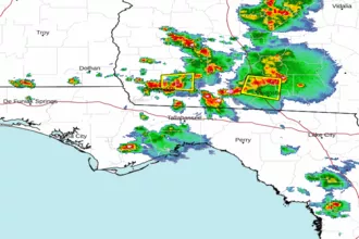 Tallahassee FL Radar
 Gulf Radar