Baffin Bay to Port Mansfield, TX Marine Forecast
| Rest Of Today...Southeast Winds 5 To 10 Knots Becoming East 10 To 15 Knots This Afternoon. Seas 4 To 5 Feet. A Slight Chance Of Showers And Thunderstorms Late This Morning. |
| Tonight...East Winds 10 To 15 Knots Becoming Southeast 5 To 10 Knots After Midnight. Seas 4 To 5 Feet. A Slight Chance Of Showers And Thunderstorms After Midnight. |
| Tuesday...Southeast Winds 5 To 10 Knots Becoming East 10 To 15 Knots In The Afternoon. Seas 4 To 5 Feet. A Chance Of Showers In The Morning. A Slight Chance Of Thunderstorms. A Slight Chance Of Showers In The Afternoon. |
| Tuesday Night...Southeast Winds 10 To 15 Knots. Seas 4 To 5 Feet. |
| Wednesday...Southeast Winds 10 To 15 Knots. Seas 4 To 5 Feet. |
| Wednesday Night...Southeast Winds 15 To 20 Knots. Seas 4 To 6 Feet, With Occasional Seas Up To 7 Feet. |
| Thursday...Southeast Winds 15 To 20 Knots. Gusts To 30 Knots In The Morning. Seas 5 To 7 Feet, With Occasional Seas Up To 8 Feet. |
| Thursday Night...Southeast Winds Around 15 Knots. Seas 4 To 5 Feet. |
| Friday...Southeast Winds 10 To 15 Knots. Seas 4 To 5 Feet. A Slight Chance Of Showers And Thunderstorms. |
| Friday Night...Southeast Winds 10 To 15 Knots. Seas 4 To 5 Feet. A Slight Chance Of Showers And Thunderstorms After Midnight. Winds And Seas Higher In And Near Thunderstorms. |
| Area Forecast Discussion National Weather Service Brownsville TX 1220pm CDT Monday April 29 2024 Long Term (Tuesday night through Sunday) Issued at 324am CDT Monday April 29 2024 Synoptic pattern has not varied much over the last few model runs with a quasi-zonal flow over much of the CONUS this week. The northern side a subtropical ridge edges into South Texas while farther north an elongated trough will pass west to east over the Northern Rockies to the Great Lakes. The subtropical ridge to provide above normal temperatures for much of the week with model guidance still indicating amonalies of 3 to 8 degrees for highs and lows which translates to highs in the 90s and lows in the 70s. Dew points remain high elevating after heat indices 100-107 each afternoon. The most dangerous heat days look to be Thursday and Friday where the probability of heat indices greater than 105 degrees are low to medium or 20-50%. A steady state moderate pressure gradient between ridging over the Gulf and low pressure across the Southern Plains maintains daily breezy to occasional windy conditions. On average the region can expect to see daytime breezes in the 15-25 mph range with Wednesday and Thursday looking like the windiest days Rain chances continue to be limited through the work week with isolated convection still in the offering Wednesday and Thursday with some added moisture depth working with a weak disturbances in the westerly flow. Better chance continue to be indicated Friday and Saturday as sufficient moisture pools in advance of a frontal boundary moving into Central or even Southcentral Texas. Probability of Precipitation remain low across the board, 20-40 percent with best chances west of I-69C. Marine Issued at 324am CDT Monday April 29 2024 Today through Tuesday..Conditions over the waters are expected to continue to improve during the day as the winds start to weaken. Light to moderate onshore flow with moderate seas is the expected trend through Tuesday. Isolated showers and thunderstorms are possible through Tuesday and may cause locally elevated winds and seas. Tuesday through Sunday: A static weather pattern will maintain a moderate pressure gradient for the remainder of the week and into next weekend. Weaker surface ridge extending over the Eastern Gulf to combine with lower pressure over NE Mexico and West Texas provide moderate onshore winds and a steady state sea state of 4 to 6 feet. This should be maintain periodic small craft caution wording for most of the week. NOAA Brownsville TX Office: Watches - Warnings - Advisories TX...High Rip Current Risk through Tuesday evening for TXZ451-454-455. GM...None. |
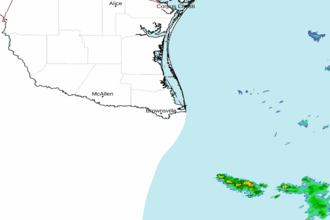 Brownsville TX Radar
 Gulf Radar