Bonita Beach to Englewood FL out 20 - 60 NM Marine Forecast
| Tonight...Southeast Winds 5 To 10 Knots, Becoming East After Midnight. Seas 2 To 3 Feet. A Slight Chance Of Showers After Midnight. |
| Tuesday...Southeast Winds 5 To 10 Knots. Seas Around 2 Feet. |
| Tuesday Night...Northwest Winds Around 5 Knots, Becoming East After Midnight. Seas Around 2 Feet In The Evening, Then 1 Foot Or Less. |
| Wednesday...East Winds Around 5 Knots. Seas 1 Foot Or Less. |
| Wednesday Night...Northwest Winds 5 To 10 Knots, Becoming Northeast After Midnight. Seas 1 Foot Or Less. |
| Thursday...East Winds 5 To 10 Knots, Becoming Southeast In The Afternoon. Seas 1 Foot Or Less. |
| Thursday Night...North Winds 5 To 10 Knots, Becoming East After Midnight. Seas 1 Foot Or Less. |
| Friday...Southeast Winds 5 To 10 Knots. Seas 1 Foot Or Less. |
| Friday Night...North Winds 5 To 10 Knots, Becoming East After Midnight. Seas 1 Foot Or Less. |
| Saturday...East Winds 5 To 10 Knots. Seas Around 2 Feet. |
| Area Forecast Discussion National Weather Service Tampa Bay Ruskin FL 234pm EDT Monday April 29 2024 ...NewARINE,Fire Weather Issued at 233pm EDT Monday April 29 2024 High pressure in the Atlantic remains in control with its associated ridge axis north of the area. This has favored an east-southeast flow today and a sea breeze collision along/near the I-75 corridor, which may allow for some isolated shower activity to develop this evening mostly around southwest FL but thunder chances are still expected to be too low to include in forecast. Meanwhile, a shortwave trough will swing across the lower Mississippi Valley tonight and track towards the Southeast US on Tuesday and this feature will bring an uptick in moisture and some forcing for ascent into the area. This will allow for better precipitation chances tomorrow across portions of the area and overall higher precipitation coverage, but the main focus will be interior areas as a weaker pressure gradient tomorrow will allow the sea breeze to spread further inland so most coastal areas should be dry. Models are also showing that there should be better instability tomorrow so isolated to scattered storms will be possible in interior areas where the best low level convergence is expected to occur and with 500mb temperatures around -10C/-11C, some small hail can't be ruled out but the activity should generally remain sub-severe. A lingering surface trough off the Southeast coast in the wake of the shortwave trough combined with the sea breeze should allow for another round of scattered showers and isolated storms on Wednesday with interior areas being favored once again as the sea breeze spreads inland. While rain chances will lower late week as upper ridging builds across the eastern US, there still could be some opportunity for showers and storms as weak troughing aloft lingers nearby and the sea breeze develops. By the weekend, conditions appear to be similar with low daily rain chances and highest coverage during the late afternoon and evening sea breeze as a mostly easterly flow sets up south of surface high pressure off the mid-Atlantic coast. Given the mostly easterly flow late week and through the weekend, temperatures remain above average in the upper 80s and low 90s into early next week. Marine Issued at 233pm EDT Monday April 29 2024 Atlantic high pressure will keep warm and mostly dry conditions in place this week across the Gulf waters, though some brief showers or an isolated storm will be possible near the coast mostly during the evening hours through mid week. Otherwise, the pressure gradient will weaken through tonight and allow wind speeds to decrease with winds then generally ranging from 5-10 kts through the remainder of the week and shifting onshore during the afternoon sea breeze. Fire Weather Issued at 233pm EDT Monday April 29 2024 Warm and dry high pressure continues over the region with minimum RH values approaching or perhaps reaching critical levels at times, particularly in interior areas. While fire danger remains slightly elevated today due to higher wind speeds, wind speeds will generally decrease over the next several days as the pressure gradient relaxes across the area so no red flag conditions are expected at this time. In addition, there will be a slight increase in rain chances into mid week as a disturbance approaches the area with scattered showers and isolated storms possible mostly in interior areas before mostly drier weather returns again late week. NOAA Tampa FL Office: Watches - Warnings - Advisories FL...None. Gulf waters...None. |
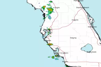 Tampa Bay FL Radar
 Gulf Radar