Buzzards Bay Marine Forecast
| This Afternoon...E Winds 10 To 15 Kt. Seas 1 Foot Or Less. Wave Detail: Ne 1 Ft At 3 Seconds And E 1 Ft At 10 Seconds. |
| Tonight...Se Winds 5 To 10 Kt, Becoming W After Midnight. Seas 1 Foot Or Less. Wave Detail: S 1 Ft At 4 Seconds And E 1 Ft At 11 Seconds. |
| Tue...E Winds 5 To 10 Kt, Increasing To 10 To 15 Kt In The Afternoon. Seas 1 Foot Or Less. Wave Detail: Se 1 Ft At 5 Seconds And E 1 Ft At 12 Seconds. |
| Tue Night...E Winds 5 To 10 Kt. Seas Around 2 Ft In The Evening, Then 1 Foot Or Less. Wave Detail: E 1 Ft At 3 Seconds And E 1 Ft At 10 Seconds. A Chance Of Showers. |
| Wed...Ne Winds 5 To 10 Kt, Increasing To 10 To 15 Kt In The Afternoon. Seas 1 Foot Or Less. Wave Detail: Ne 1 Ft At 3 Seconds And E 1 Ft At 10 Seconds. A Chance Of Showers. |
| Wed Night...Ne Winds 10 To 15 Kt, Diminishing To 5 To 10 Kt After Midnight. Seas 1 Foot Or Less. Wave Detail: Ne 1 Ft At 4 Seconds And E 1 Ft At 11 Seconds. |
| Thu Through Fri...Ne Winds 5 To 10 Kt With Gusts Up To 20 Kt. Seas 1 Foot Or Less. |
| Fri Night...E Winds Around 10 Kt. Seas 1 Foot Or Less. A Chance Of Showers. Seas Are Reported As Significant Wave Height, Which Is The Average Of The Highest Third Of The Waves. Individual Wave Heights May Be More Than Twice The Significant Wave Height. |
| Area Forecast Discussion National Weather Service Boston/Norton MA 146pm EDT Monday April 29 2024 Synopsis Enjoy the warm and partly sunny conditions today, a backdoor cold front will bring much cooler conditions, clouds, and spot showers on Tuesday. The greatest risk for a period of showers will be Tuesday night into Wednesday morning. Temperatures for late this week and next weekend are uncertain given the positioning of a backdoor cold front...but are looking more likely to end up on the cooler side especially along the coast. After a slight chance of showers Thursday, another round of showers may arrive late next weekend. Near Term - Through Tonight 140 PM Backdoor front has moved through much of northern and eastern MA with temps falling into the 60s and through the 50s along the immediate coast. 70s across RI and CT and may see a max of 80 in Hartford before frontal passage and falling temps. Area of showers moving SE from NH and may see a brief shower/sprinkle in NE MA during the next hour. Otherwise, weak instability with SBCAPES up to 500 J/kg has developed in CT. Can't rule out an isolated shower this afternoon across CT, but higher risk of convection to the SW where temps in 80s and SBCAPES up to 1500 J/kg. Increasing cloud cover post sunset as a 850mb warm front lifts from southwest to northeast. Can't rule out a few widely sct'd showers around midnight to 5/6am Tuesday. Maintained 20 to 40 POPs, 'Slight Chance' to 'Chance' POPs, mainly across northern Connecticut and western Massachusetts. A mild night as well with overnight lows in the upper 40s and low 50s. Short Term - Tuesday Highlights: * Much cooler on Tuesday, by as much as 10 or 15 degrees cooler due to a backdoor cold front. * Spot showers possible ahead of an approaching cold front late Tuesday. A noticeable difference come Tuesday, temperatures are roughly 10 to 15 degrees colder than the day prior, plus cloudy skies and chance for spot showers. We can thank a backdoor cold front for the cooler temperatures, brought on by an east to east- southeast wind throughout the day. This knocks back the warm temperatures to a range of what is considered 'normal' for late April. There will be a spread in temperatures from the low/mid 50s in Boston to the mid/upper 60s in Hartford to Springfield. In between, many locations achieve a high temperature in-between the lower and middle 60s. Coastal towns are much cooler, with highs in the low to mid 50s! As for precipitation, have maintained 'Slight Chance' POPs across western Massachusetts and northwest Connecticut for the early afternoon, but the POPs increase into the late afternoon. Do think the bulk of any rain will arrive overnight, which is discussed in the Long Term section of the AFD. Long Term - Tuesday Night Through Sunday Key Points... * Cool Wednesday with highs in the 50s coast & 60s inland. * Main threat for a period of showers Tuesday night into Wednesday morning. * Generally dry Thu & Fri but can't rule out some scattered showers on Thursday...large spread in potential high temps. * Another round of showers possible next weekend. Details... Tuesday Night and Wednesday... High pressure remains in control directing cool, NE flow into southern New England keeping highs once again in the low to mid 50s (east) and mid 60s (CT valley). A shortwave passing overhead coupled with a surface low moving from the mid-Atlantic passing south of the region will bring a round of showers moving in Tuesday night and continuing through at least Wednesday morning; there is a low probability that showers continue well into the evening before weak ridging moves in and things dry out a bit. Thursday And Friday An upper level ridge tries to build in for the latter half of the week, but latest guidance now indicates a shortwave suppressing the eastern periphery of the ridge over SNE on Thursday, so things aren't looking as dry for Thursday as they did 24 hours ago. Even so, weak forcing and PWATs (Precipitable Waters) <1" will keep any rainfall from being to impactful. By Friday with the ridge closer dry weather is more likely. The biggest forecast challenge for this period will be the potential for another backdoor cold front to accompany this shortwave on Thursday which would keep the earlier expected 70s from materializing. At this point there is a considerable amount of uncertainty, but odds shifting toward a cooler solution with temps more likely to be in the 50s and 60s each day rather than the 70s. Saturday and Sunday... The ridge axis arrives on Saturday with our next shortwave on its heels which brings the return of widespread rain chances as early as Saturday night. Confidence is low given significant spread in how the pattern evolves. Marine Forecaster Confidence Levels: Low - less than 30 percent. Medium - 30 to 60 percent. High - greater than 60 percent. Through Tuesday... High confidence. Low chance for coastal fog to develop early this morning across the eastern waters, nighttime RGB product does show an area of low clouds/fog across the Gulf of Maine and high-res model guidance shows the potential for this to drift south between 6AM and 10AM. Otherwise, dry and partly sunny Monday with east- southeast winds along the eastern coast of Massachusetts and south-southeast winds along the south coast of Massachusetts and Rhode Island. Winds are 10 to 15 knots and seas 2 to 4 feet. Tonight winds are light and variable. Tuesday, winds are east to southeast 8 to 12 knots, gusts around 15 knots. Seas 1 to 3 feet. A few showers are possible ahead of an approaching front during the afternoon. Outlook /Tuesday Night through Friday/... Tuesday Night: Winds less than 25 kt. Chance of rain showers, isolated thunderstorms. Wednesday: Winds less than 25 kt. Chance of rain showers. Wednesday Night through Friday: Winds less than 25 kt. Slight chance of rain showers. NOAA Boston MA Office: Watches - Warnings - Advisories CT...None. MA...None. RI...None. Marine None. |
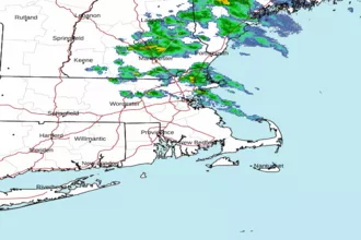 Boston MA Radar
 Northeast Radar
 East Coast Satellite