Cape Fear to Little River Inlet, SC out 20 NM Marine Forecast
| Through 7 Pm...Sw Winds 5 To 10 Kt. Seas 2 To 3 Ft. Wave Detail: S 2 Ft At 6 Seconds And E 2 Ft At 9 Seconds. |
| Tonight...S Winds 10 Kt. Seas 2 To 3 Ft. Wave Detail: S 2 Ft At 6 Seconds And E 2 Ft At 9 Seconds. |
| Tue...S Winds 5 To 10 Kt. Seas 2 To 3 Ft. Wave Detail: S 2 Ft At 5 Seconds And E 2 Ft At 10 Seconds. |
| Tue Night...S Winds 10 Kt. Seas 2 To 4 Ft. Wave Detail: S 3 Ft At 5 Seconds And E 2 Ft At 10 Seconds. A Chance Of Showers With A Slight Chance Of Tstms After Midnight. |
| Wed...S Winds 5 To 10 Kt. Seas 3 To 4 Ft. Wave Detail: S 3 Ft At 6 Seconds And E 1 Ft At 12 Seconds. A Chance Of Showers. A Slight Chance Of Tstms In The Morning, Then A Chance Of Tstms In The Afternoon. |
| Wed Night...S Winds 5 To 10 Kt. Seas 2 To 3 Ft. Wave Detail: S 3 Ft At 6 Seconds And E 1 Ft At 11 Seconds. A Chance Of Showers And Tstms In The Evening. |
| Thu...Ne Winds 5 Kt, Becoming E In The Afternoon. Seas 2 To 3 Ft. Wave Detail: S 2 Ft At 6 Seconds And E 1 Ft At 10 Seconds. |
| Thu Night...E Winds 5 To 10 Kt. Seas 2 Ft. |
| Fri...E Winds 5 To 10 Kt. Seas 2 Ft. |
| Fri Night...Se Winds 10 Kt. Seas 2 Ft. |
| Sat...E Winds 10 Kt. Seas 2 Ft. |
| Sat Night...Se Winds 10 Kt. Seas 2 To 3 Ft. Winds And Seas Higher In And Near Tstms. |
| Area Forecast Discussion National Weather Service Wilmington NC 407pm EDT Monday April 29 2024 Synopsis An upper level disturbance will lead to shower and thunderstorm chances from late Tuesday through Wednesday. Dry and sunny weather returns for Thursday and Friday. Thereafter, a cold front approaches the area, bringing chances for showers and storms over the weekend. Near Term - Through Tuesday Surface high pressure off the coast to keep the weather quiet but also mild through the period. Guidance is also in good agreement in no areas of fog developing like seen this morning. Towards the end of the period an upper level disturbance will be approaching from the west. An isolated storm cannot be ruled out over far western zones just prior to sunset, though forecast soundings are showing waning instability. Short Term - Tuesday Night Through Wednesday Night A sharpening shortwave trough will be on our doorstep at the start of the period. With good forcing for ascent and sufficient (but not impressive) moisture in place, expect scattered showers and isolated thunder to affect the area as the shortwave gradually shifts eastward over Tuesday night. The shortwave is expected to slow down and close off just offshore on Wednesday, which will allow for cool mid-level temps and steeper lapse rates to coincide with daytime heating on Wednesday. This should lead to weak surface-based instability in the 500-1000 J/kg range by Wednesday afternoon with rather modest effective shear magnitudes in the 15-25 kt range. Nevertheless, weak upper-level divergence in tandem with low- level convergence provided by a weak inland surface trough shifting southeastward along with the sea breeze should provide sufficient lift to get at least isolated to perhaps scattered convection going, with attendant threats for gusty winds and possibly small hail, if greater instability is realized. The weak shear will most likely limit storm organization and longevity, but it may be sufficient to help organize a short line of storms along an outflow boundary, which would increase the gusty wind threat. The thunderstorm threat should wane after sunset on Wednesday as nocturnal cooling reduces instability. Morning lows on Wednesday will be driven by overcast skies and shower activity with low-mid 60s forecast. On Wednesday morning, mid- level subsidence on the backside of the shortwave should produce breaks in the clouds which will permit warming back into the low- to perhaps mid-80s before convection develops. Over Wednesday night, the shortwave will continue to drift away while the surface trough shifts offshore. Low pressure off the coast should eventually turn the flow to N-NE by the end of the night, with weak cool advection helping to bring lows into the low 60s. Long Term - Thursday Through Monday Mid-level ridging and weak surface high pressure look to take control for Thursday and Friday with more summerlike conditions in place. Highs in the low-mid 80s amidst plentiful afternoon cumulus is expected and there may be an isolated pop-up shower or two along the sea breeze or inland near a weak Piedmont trough. Over the weekend, a cold front associated with low pressure occluding over the western Great Lakes into south- central Canada will bring our next chance for isolated to perhaps scattered showers and thunderstorms. However, with mid- level ridging firmly in place just offshore and the parent low so far away, expect this cold front to stall near or west of the area. Depending on where this front stalls, enhanced shower and thunderstorm activity could affect the inland zones on a daily basis from Saturday through Monday. High temperatures will be modulated by the outcome of the stalling cold front, but near-normal highs in the low 80s are presently expected over the weekend while lows fall into the low to perhaps mid-60s. Marine Through Tuesday... Pretty steady state conditions offshore as high pressure east of the area remains in place. Wind speeds will be in the 10-15kt range with a few mainly diurnal gusts to 20 mph. There will be a 2-3ft wind chop along with the easterly swell of 9-10 seconds. Tuesday night through Saturday... Modest southerly flow ahead of a surface trough will persist through Wednesday before swinging around to easterly on Thursday as the trough washes out and weak low pressure to our northeast briefly influences the flow. Behind the low, surface high will pressure will take control through the remainder of the period, with a generally easterly flow at around 10 kts dominating from Thursday afternoon through Saturday. Southerly wind waves in the 2-4 ft range on Tuesday night will gradually relax to around 2 ft on Thursday and remain around 2 ft through Saturday. NOAA Wilmington NC Office: Watches - Warnings - Advisories NC...None. SC...None. Marine None. |
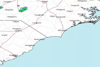
 Wilmington NC Radar
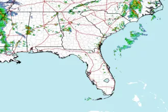
 Southeast Radar