Chesapeake Bay from Drum Point MD to Smith Point VA Marine Forecast
| Tonight...S Winds 10 Kt. Waves 1 To 2 Ft. |
| Tue...Sw Winds 10 To 15 Kt With Gusts To 20 Kt. Waves 2 Ft. |
| Tue Night...Sw Winds 10 To 15 Kt. Gusts Up To 20 Kt Until Early Morning. Waves 1 To 2 Ft. |
| Wed...W Winds 5 To 10 Kt. Waves 1 Ft. A Chance Of Showers And Tstms. |
| Wed Night...E Winds 5 To 10 Kt. Waves 1 Ft. |
| Thu...E Winds 5 To 10 Kt. Waves 1 Ft. |
| Thu Night...Se Winds 5 To 10 Kt. Waves 1 Ft. |
| Fri...Se Winds 10 To 15 Kt. Waves 1 To 2 Ft. |
| Sat...Se Winds 10 Kt. Waves 2 Ft. A Chance Of Showers Through The Night. Winds And Waves Higher And Visibilities Lower In And Near Tstms. |
| Area Forecast Discussion National Weather Service Baltimore MD/Washington DC 221pm EDT Monday April 29 2024 Synopsis Strong high pressure off the southeast U.S coast will result in near record warmth and mainly dry conditions today. Unseasonably warm temperatures continue Tuesday despite renewed chances for showers and thunderstorms as cold front crosses the region. Additional showers and thunderstorms are possible Wednesday for portions of the area as the front is slow to sink south and east. High pressure briefly returns Thursday into Friday before another cold front this weekend. Near Term - Through Tonight The new NWS Experimental HeatRisk has most of the area under a Moderate Risk for heat-related impacts this afternoon. Temperatures today are running 15 to 25 degrees warmer for highs and 10 to 15 degrees above normal for lows for this time of year. This level of heat early in the warm season could cause impacts to heat-sensitive populations, including those outdoors and without adequate cooling/hydration. Additional information about HeatRisk can be found at wpc.ncep.noaa.gov/heatrisk. It's a hot start to the workweek and final few days of April thanks to strong upper level ridging and surface high pressure off the southeast U.S coast. This will yield a continuation of dry conditions and perhaps a few broken temperature records (see climate section below) across the region. Afternoon highs will reach into the mid to upper 80s for most with lower 90s along the I-95 corridor south into the central VA Piedmont. Mountain locations will be a touch cooler in the upper 70s and low 80s. Humidity values will remain in check with dewpoints in the mid to upper 50s and low 60s. Heat index values as a result will remain below 95 degrees. An isolated late afternoon and evening thunderstorm cannot be ruled out over the mountains with chances less than 15 percent given weak upslope/orographic lift and instability build up during the course of peak heating. Scattered to widespread convection will be stunted due largely in part to the upper level ridge and a mid-level capping inversion overhead. Skies will remain mostly sunny otherwise with scattered to broken mid-high level strato-cumulus clouds building up especially around the terrain/near the waters this afternoon. Any shower and thunderstorm activity will quickly diminish after sunset although cloud cover will gradually increase from the west as a cold front pushes toward the region. As a result, little relief is expected overnight with lows in the low to mid 60s. Short Term - Tuesday Through Wednesday Night Subtle relief from the early warm season heat arrives late Tuesday into Wednesday as an upper level trough and associated cold front cross the region. The front will bring renewed chances for showers and thunderstorms to the region on both Tuesday and Wednesday afternoons. 12z model guidance continues to show a slower front/upper level trough arriving late Tuesday afternoon before finally pushing south and east of the area Wednesday into Wednesday night. This will lead to several rounds of scattered to widespread shower and thunderstorm activity mainly during the diurnal periods. Activity will wane during the overnight hours before re-firing in the afternoon especially along and east of the boundary as it passes through. As for the threat of severe weather it remains low, but not zero. Instability will remain fairly low on the order of 500-1000 j/kg with 0-6km bulk effective shear values running 20-30 kts. Both SPC, CSU Machine Learning, and CIPS analogue products continue to back off on the threat for a widespread severe weather event. Even with that said, one or two storms could become strong given the antecedent conditions. Biggest threats with any storms Tuesday or Wednesday look to be wind gusts 40-50 mph, frequent lightning, and locally heavy rainfall (PWATs (Precipitable Waters) running 0.75-1.25 inches). High temperatures Tuesday will push back into the mid to upper 80s with 70s over the mountains/near the bay. Lows Tuesday night will fall back into the upper 50s and low 60s with areas of patchy fog that due see the rain. The main upper trough/front is forecast to be east of the area Wednesday. An additional shortwave trough and weak front will quickly follow in it's wake Wednesday afternoon touching off additional showers and thunderstorms. The highest probabilities for precipitation will be along and east of the I-81 corridor. Drier conditions return as high pressure builds south from New England Wednesday evening and night. Highs Wednesday will push into the mid to upper 70s and low 80s with overnight lows in the mid to upper 50s. Long Term - Thursday Through Monday A ridge of high pressure will remain firm and in control Thursday through midday Friday. This ridge will keep the region very warm and dry throughout the period. Highs Thursday will be low to mid 80 s. Highs Friday, due to some increasing clouds, will not be as warm with temperatures in the upper 70s. These numbers are still above average for early May. Increasing clouds and showers arriving from west to east late Friday into Friday evening will be in response to the ridge of high pressure gradually breaking down and mid-level disturbance riding up and over the ridge. Showers aren't expected to be widespread but could be accompanied by a few thunderstorms, especially over the mountains and our far northwestern zones. The unsettled conditions of showers and additional thunderstorms could continue Friday night through Sunday, as multiple weak to modest mid-level disturbances continue their assault on the large ridge of high pressure in the east. With the expected cloud cover and precipitation throughout the weekend, temperatures will be more average or slightly below average. Any cooler temperatures will be compromised by any modest southerly flow around the backside of the ridge of high pressure. Highs Saturday and Sunday should be lower 70s for most, but cooler in the mountains. Marine Favorable marine conditions are expected through Tuesday morning as high pressure brings warm and dry conditions to the waters. Winds will remain out of the southwest today at 5-10 knots before increase to 10 to 15kts Tuesday with gusts up to 20 kts at times especially over the open waters Tuesday afternoon. A cold front is set to cross the local waters Tuesday afternoon and evening bringing scattered showers and thunderstorms. These storms will be capable of producing wind gusts of 35+ knots, frequent lightning, and locally heavy rainfall. Special Marine Warnings may be needed as these storms cross the waters Tuesday afternoon. Showers and thunderstorms push east of the waters Tuesday evening into Tuesday night. Winds will turn back toward the northwest at this point, but should remain below SCA (Small Craft Advisory) levels during this time. Northwest winds may come close to SCA (Small Craft Advisory) criteria Wednesday as a cold front pushes to the south. A thunderstorm is also possible. Winds will become southerly again Thursday and Friday. Marginal SCA (Small Craft Advisory) conditions could occur in channeling on the bay in the evening/overnight each day. No marine hazards expected Thursday through Friday night. Winds southeast around 10 knots Thursday and Thursday night. Winds southeast 10 to 15 knots Friday and Friday night. Climate Near-record to record warmth is likely this afternoon. Below is a list of record high temperatures for April 29th, and the year the record was set. April 29th Climate Site Record High Forecast High Washington-National (DCA) 91F (2017+) 92F Washington-Dulles (IAD) 89F (2017) 91F Baltimore (BWI) 91F (1951) 90F Martinsburg (MRB) 93F (1974) 88F Charlottesville (CHO)* 92F (1974) 90F Hagerstown (HGR)* 90F (1974) 88F Annapolis (NAK)* 92F (1974) 85F + denotes that multiple years reached this value, but the depicted year is the most recent * denotes sites where Record Event Reports (RERs) are not issued NOAA Baltimore MD/Washington DC Office: Watches - Warnings - Advisories DC...None. MD...None. VA...None. WV...None. Marine Small Craft Advisory from noon Tuesday to midnight EDT Tuesday night for ANZ530>543. |
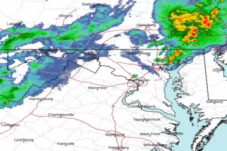 Baltimore/Washington Radar
 Northeast Radar
 East Coast Satellite