Chester River to Queenstown MD Marine Forecast
| This Afternoon...S Winds 5 Kt. Waves Less Than 1 Ft. |
| Tonight...S Winds 5 To 10 Kt. Waves 1 Ft. |
| Tue...S Winds 5 To 10 Kt. Waves 1 Ft. |
| Tue Night...Sw Winds 5 To 10 Kt. Waves 1 Ft. |
| Wed...Nw Winds 5 Kt. Waves Less Than 1 Ft. A Chance Of Showers. |
| Wed Night...E Winds 5 Kt. Waves Less Than 1 Ft. |
| Thu...Se Winds 5 To 10 Kt. Waves 1 Ft. |
| Fri...Se Winds 5 To 10 Kt. Waves 1 Ft. |
| Area Forecast Discussion National Weather Service Baltimore MD/Washington DC 1003am EDT Monday April 29 2024 Synopsis Strong high pressure off the southeast U.S coast will result in near record warmth and mainly dry conditions today. Unseasonably warm temperatures continue Tuesday despite renewed chances for showers and thunderstorms as cold front crosses the region. Additional showers and thunderstorms are possible Wednesday for portions of the area as the front is slow to sink south and east. High pressure briefly returns Thursday into Friday before another cold front this weekend. Near Term - Through Tonight The new NWS Experimental HeatRisk has most of the area under a Moderate Risk for heat-related impacts today. Temperatures today are running 15 to 25 degrees warmer for highs and 10 to 15 degrees above normal for lows for this time of year. This level of heat this early in the season could cause impacts to heat-sensitive populations, including those outdoors and without adequate cooling/hydration. Additional information about HeatRisk can be found at wpc.ncep.noaa.gov/heatrisk. It's a mild start to what will be a hot Monday ahead thanks to strong upper level ridging and surface high pressure off the southeast U.S coast. This will yield a continuation of dry conditions and perhaps the first 90 degree day of the year in many locations across the region. Afternoon highs will reach into the mid to upper 80s for most with lower 90s along the I-95 corridor south into the central VA Piedmont. Mountain locations will be a touch cooler in the upper 70s and low 80s. Humidity values will remain in check with dewpoints in the mid to upper 50s and low 60s. Heat index values as a result will remain below 95 degrees. An isolated late afternoon and evening thunderstorm cannot be ruled out over the mountains with chances less than 15 percent given weak upslope/orographic lift and instability build up during the course of peak heating. Scattered to widespread convection will be stunted due largely in part to the upper level ridge and a mid-level capping inversion overhead. Skies will remain mostly sunny otherwise with scattered to broken mid-high level strato-cumulus clouds building up especially around the terrain/near the waters this afternoon. Any shower and thunderstorm activity will quickly diminish after sunset although cloud cover will gradually increase from the west as a cold front pushes toward the region. As a result, little relief is expected overnight with lows in the low to mid 60s. Short Term - Tuesday Through Wednesday Night The ridge aloft moves east Tuesday as an upper trough and associated cold front approach from the west. The latest models indicate a slower moving trough that reaches the area Tuesday afternoon, and finally moving east of the area Wednesday night. This is going to generate a couple rounds of showers and storms across the area, beginning Tuesday afternoon as a cold front crosses the area. Scattered to widespread showers and scattered thunderstorms develop Tuesday early afternoon west of the Blue Ridge, pushing east of the Blue Ridge late afternoon into the evening. Most shower/storm activity dissipates by late evening, though isolated showers will be possible through the overnight. Come Wednesday morning, the main upper trough is forecast to be east of the Blue Ridge and the cold front east of the area. A reinforcing upper trough quickly crosses the area Wednesday, helping to produce scattered showers, mostly along/east of I-81. Some instability present east of the Blue Ridge should allow some thunderstorm activity in the afternoon. The entire system moves east of the area by Wednesday evening as dry conditions return. The prospects for severe storms on Tuesday continue to be low given low instability and very weak shear. If any strong storms do develop, they are most likely to occur west of the Blue Ridge Tuesday afternoon. Any strong storm will be capable of producing wind gusts of 40-50mph, in addition to frequent lightning strikes. Well above normal temperatures continue through mid week as highs reach the mid to upper 80s Tuesday, and low to mid 80s Wednesday. Very mild Tuesday night lows in the low to mid 60s, cooling slightly to the mid to upper 50s Wednesday night behind the front. Long Term - Thursday Through Sunday After a weak frontal passage Wednesday, strong ridging builds over the East Thursday and holds through the end of the week. The ridge pattern begins to break down Sunday as a weakening southern stream disturbance approaches from the west. A slow moving and decaying frontal zone will attempt to cross the area early next week bringing the threat of showers and thunderstorms Sunday. Moisture looks plentiful, but both forcing and instability look weak to support any significant threat of either severe weather or flooding. By Monday, the front appears to push far enough south to limit PoPs, but treating this like a summer front, when models are too fast in pushing fronts through the area. Marine Favorable marine conditions likely today through Tuesday morning as high pressure brings mostly dry and warm conditions to the local waters. A cold front will cross the waters Tuesday late afternoon to evening, bringing scattered showers and thunderstorms. Some of these storms will be capable of producing wind gusts of 35 knots or greater and lightning strikes. Special Marine Warnings may be needed as these storms cross the waters. Most of the shower and storm activity dissipates by late Tuesday evening. Southerly channeling is possible Tuesday afternoon and evening ahead of the front, which could produce a period of SCA (Small Craft Advisory) conditions in the open waters of the Chesapeake Bay. Winds are forecast to remain below SCA (Small Craft Advisory) criteria Wednesday. SCA (Small Craft Advisory) conditions possible Friday into the weekend. Climate Near-record to record warmth is likely this afternoon. Below is a list of record high temperatures for April 29th, and the year the record was set. April 29th Climate Site Record High Forecast High Washington-National (DCA) 91F (2017+) 92F Washington-Dulles (IAD) 89F (2017) 91F Baltimore (BWI) 91F (1951) 90F Martinsburg (MRB) 93F (1974) 88F Charlottesville (CHO)* 92F (1974) 90F Hagerstown (HGR)* 90F (1974) 88F Annapolis (NAK)* 92F (1974) 85F + denotes that multiple years reached this value, but the depicted year is the most recent * denotes sites where Record Event Reports (RERs) are not issued NOAA Baltimore MD/Washington DC Office: Watches - Warnings - Advisories DC...None. MD...None. VA...None. WV...None. Marine None. |
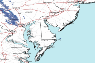 Dover DE Radar
 Northeast Radar