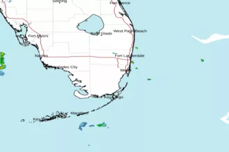
Chokoloskee to Bonita Beach FL out 20 NM Marine Forecast
| Rest Of Today...Se Winds 5 To 10 Kt With Gusts To Around 20 Kt Near Shore...Except Se 10 To 15 Kt With Gusts To Around 20 Kt Well Offshore. Seas Less Than 2 Ft Near Shore And 2 To 4 Ft, Occasionally To 5 Ft Well Offshore. Period 4 Seconds. Bay And Inland Waters Light Chop. |
| Tonight...E Winds 5 To 10 Kt Near Shore...Except E 10 To 15 Kt Well Offshore. Seas Less Than 2 Ft Near Shore And Around 2 Ft Well Offshore. Period 4 Seconds. Bay And Inland Waters A Light Chop. |
| Tue...Se Winds 5 To 10 Kt. Seas 2 Ft Or Less. Period 3 Seconds. Bay And Inland Waters A Light Chop. A Slight Chance Of Showers In The Morning. A Chance Of Showers With A Slight Chance Of Tstms. |
| Tue Night...E Winds 5 To 10 Kt. Seas Less Than 2 Ft. Period 3 Seconds. Bay And Inland Waters A Light Chop. A Slight Chance Of Showers And Tstms Late In The Evening. |
| Wed...Near Shore, E Winds Around 5 Kt Becoming S In The Afternoon. Well Offshore, E Winds 5 To 10 Kt Becoming N In The Evening. Seas Less Than 2 Ft. Bay And Inland Waters A Light Chop. A Slight Chance Of Showers. A Slight Chance Of Tstms. |
| Wed Night...Ne Winds Around 5 Kt Becoming E After Midnight. Seas 0 To 1 Ft. Bay And Inland Waters A Light Chop. |
| Thu...E Se Winds 5 To 10 Kt Becoming S With Gusts To Around 20 Kt. Seas Less Than 2 Ft. Bay And Inland Waters A Light Chop. |
| Thu Night...E Winds 5 To 10 Kt. Near Shore, Gusts Up To 20 Kt Late In The Evening. Seas Less Than 2 Ft. Bay And Inland Waters A Light Chop. |
| Fri...E Se Winds 5 To 10 Kt Becoming S With Gusts To Around 20 Kt. Seas Less Than 2 Ft. Bay And Inland Waters A Light Chop. |
| Area Forecast Discussion National Weather Service Miami FL 1237pm EDT Monday April 29 2024 Long Term (Tuesday night through Sunday) Issued at 302am EDT Monday April 29 2024 Long term begins with mid level ridging over the eastern seaboard gradually migrating into the western Atlantic, while persisting surface high pressure keeping a relatively stable air mass over South Florida through at least the middle of the work week. As the mid level ridge moves further away from the region, pressure gradients across the area will relax and allow for the breezy periods to subside. Meanwhile, low-level winds across South Florida gradually veer SE by this time, allowing for a very modest moisture advection to briefly raise chances of rain into the teens to low 20s, mainly over the east coast and interior areas. But showers in general will remain very limited through the long term as relatively dry/stable air stays in place. Afternoon high temperatures through Wednesday are expected to reach the low-mid 80s near the coasts, and upper 80s to around 90 inland. Then by the end of the work week, the mid level ridge strengthens and drives high temperatures into the upper 80s near the coasts and low 90s inland. Marine Issued at 1219pm EDT Monday April 29 2024 Conditions will continue to improve today as winds and seas gradually decrease. Calmer conditions should return for the middle of this week. Beaches Issued at 1219pm EDT Monday April 29 2024 A high risk of rip currents will linger across the Atlantic beaches through mid week. Conditions may start to improve towards the end of the week as onshore flow decreases, however, the rip current risk may potentially remain elevated during this time frame. NOAA Miami FL Office: Watches - Warnings - Advisories FL...High Rip Current Risk through Tuesday evening for FLZ168-172-173. AM...None. GM...None. |
 Miami FL Radar
 Southeast Radar