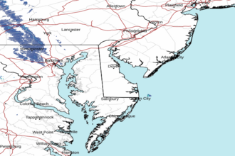
Delaware Bay north of East Point NJ to Slaughter Beach DE Marine Forecast
| This Afternoon...Se Winds Around 5 Kt, Increasing To 5 To 10 Kt Late. Waves 1 Foot Or Less. |
| Tonight...S Winds 5 To 10 Kt. Waves 1 Foot Or Less. |
| Tue...Sw Winds 5 To 10 Kt. Waves 1 Foot Or Less. |
| Tue Night...Sw Winds 5 To 10 Kt. Waves 1 Foot Or Less. |
| Wed...W Winds 5 To 10 Kt, Becoming N In The Afternoon. Waves 1 Foot Or Less. A Chance Of Showers. |
| Wed Night...E Winds 5 To 10 Kt. Waves 1 Foot Or Less. A Chance Of Showers In The Evening. |
| Thu...Se Winds 5 To 10 Kt. Waves 1 Foot Or Less. |
| Thu Night...Se Winds 5 To 10 Kt. Waves 1 Foot Or Less. |
| Fri...Se Winds 5 To 10 Kt. Waves 1 Foot Or Less. |
| Fri Night...Se Winds Around 10 Kt. Waves Around 2 Ft In The Evening, Then 1 Foot Or Less. |
| Area Forecast Discussion National Weather Service Mount Holly NJ 108pm EDT Monday April 29 2024 Synopsis An upper-level high pressure ridge will build along the East coast bringing unseasonably warm temperatures today. A backdoor cold front will approach this evening and hang across our region on Tuesday, while an upper-level trough approaches. Showers and thunderstorms return later Tuesday and possibly linger into Wednesday, before weak high pressure builds in for Thursday. A cold front could approach from the west later Friday and pass through during the weekend. Near Term - Through Tonight Through early afternoon...weather conditions remain quiet across the region, with a rather 'muggy' feel to the air for one of the first times this year. Temperatures have risen into the 80s just about everywhere except the shore, where a cool sea breeze is gradually making its way inland. Dewpoints have crept into the low 60s across the region, which will feel very comfortable and refreshing in a few months, but most of us haven't acclimated yet. Refined POPs for this afternoon and this evening given the latest CAMs. Generally no change with respect to the expectation of some scattered showers and perhaps a thunderstorm north of an Allentown to Trenton to Tom's River line, mainly between 4pm and 8 PM. Otherwise for today...500 mb heigheights look to be near 580 dam, values more typical of summertime. At the surface, high pressure will remain centered offshore of the Carolinas, helping to advect warmer and more moist air into the region. The result of this will be very warm day for the region with much above normal temperatures. High temperatures are expected to soar into the mid to upper 80s in most interior locations under partly cloudy skies. Highs in the more urbanized areas could top out closer to 90 degrees, though readings of 90 degrees or higher still appear unlikely. Northwest flow will add a downsloping component to the winds and thus also help to boost temperatures locally near the urban corridor. The offshore wind will also allow for a notable warmup even along the immediate coast, with highs getting to the low to mid 70s before a sea breeze kicks in. As the gradient flow weakens and shifts eventually to the southwest then south, a sea breeze will likely make significant inland progress into the I-95 corridor and perhaps even farther inland from there during the evening. This will cool temperatures off into the 70s and 60s by late evening. Dewpoints will remain near or above 60F for most of our region; humid for late April, but nothing that will bring the Heat Index much higher than the actual air temperatures. With some additional weak shortwave energy rounding the top of the upper- level ridge, some isolated showers or storm are possible north of Philly, however the subsidence will be quite strong and any convection will likely struggle to materialize. Tonight...Overall, another warm night anticipated. A backdoor front will sag over the region from the north/northeast and become stationary. Where exactly the front ends up stalling will be a forecast challenge. Low temperatures expected to be in the low to mid 60s southwest of the front and in the mid to upper 50s northeast of the front for most locations. Mostly cloudy skies anticipated for areas northeast of the front; mostly clear to partly cloud skies anticipated for areas southwest of the front. With some lingering shortwave energy, some isolated showers remain possible, mainly for our northern areas. Model soundings support fog development once again during the early morning hours; cannot rule out patchy fog development once again. Short Term - Tuesday Through Wednesday High pressure starts to give way on Tuesday as an upper level trough digs into the Carolinas region. This starts to being a return of some moisture to the area however the moisture looks to ride along the top of the departing ridge. The net effect is that Tuesday remains abnormally warm across DelMarVa and southern PA/NJ with some near normal temps working in over the Poconos and northern NJ. Cloud cover will likely be the determining factor in how warm or cold temps end up as guidance suggests a stalled front should hang slightly to the north Trenton. Aside from the temperatures Tuesday, we will have to keep an eye out for showers and thunderstorms developing across central and eastern PA ahead of the approaching upper-level trough. The southern stream portion of the trough will split and hang back across the Tennessee Valley, with the northern stream shortwave tending to 'pull-up' and weaken as it approaches. Additionally, a new surface low will develop around SE PA into northern Delaware on Tuesday, before tracking ENE offshore Tuesday night. All of this will tend to limit instability and forcing from the Delaware Valley eastward across NJ, so that storms will eventually weaken as they head into that airmass. That said, guidance does indicate 1000-2000 j/kg of CAPE and perhaps 30-35 kt of deep layer shear, so there is potential for some strong to possible severe thunderstorms to develop. However currently the missing ingredient is a trigger to fire the storms. Do not expect widespread storms though, with fairly limited rainfall area-wide Tuesday afternoon and evening. By Wednesday the low pressure pushes offshore, however while temps drop, humidities levels increase. Thus with a slowing of the upper- level trough passage there may be a few spotty showers lingering along with a fair amount of cloud- cover. Lowered high temperatures a bit from NBM guidance otherwise area-wide, as much of our region will be more exposed to cooler east- northeast flow, keeping highs mainly in the low to mid 70s from the Delaware Valley west, and in the 60s toward the shore. Long Term - Wednesday Night Through Sunday High pressure returns for the middle of the week and should persist through the end of the week. While upper- level ridging will start to shift eastward across the Appalachians toward Friday, another surface high pressing southward from New England may bring another backdoor front with associated cold air advection, keeping at least much of the shore and perhaps much of northern NJ in the 60s to low 70s. Sensible weather is expected to be dry with fairly plentiful sunshine, and slightly above normal temperatures farther southwest from the marine influence. Some showers may threaten as early as late in the day Friday, with increasing clouds toward eastern PA, as the next storm system approaches. That looks to be another surface low lifting across the Great Lakes, with a weakening surface cold front heading our way over the weekend. Stayed with NBM POPs. Not looking like a washout, but some scattered showers and possibly some thunderstorms possible. Temperatures should remain pretty close to typical values for early May, if not slightly above normal. Marine No marine headlines anticipated through Monday night. WSW winds 5-10 kts will shift briefly W then NW this early morning due to a land breeze. Winds shift to the SSE/S by late morning then hold S through Monday night. Seas 2-3 feet. Outlook... Winds and seas expected to be sub SCA (Small Craft Advisory) through the period. Generally south to southwest winds through Wednesday veering to the northeast then onshore late Wednesday. Fairly persistent onshore flow anticipated through the end of the week. Medium chance (40-50%) of scattered showers with isolated thunderstorms Tuesday night into Wednesday morning. Climate Near record breaking high temperatures are forecast today. Records for our climate sites are listed below: Daily Record High Temperatures for April 29th Site Record/Year Allentown (ABE) 86/1974 AC Airport (ACY) 92/1974 AC Marina (55N) 88/2017 Georgetown (GED) 91/2017 Mount Pocono (MPO) 82/1974 Philadelphia (PHL) 90/1974 Reading (RDG) 91/1888 Trenton (TTN) 88/1974 Wilmington (ILG) 91/1974| NOAA Mount Holly NJ Office: Watches - Warnings - Advisories PA...None. NJ...None. DE...None. MD...None. Marine None. |
 Dover DE Radar
 Northeast Radar