Destin to Pensacola FL out 20 NM Marine Forecast
| Rest Of Today...Southeast Winds 15 To 20 Knots. Seas 4 To 6 Feet. Dominant Wave Period 8 Seconds. A Slight Chance Of Showers This Afternoon. |
| Tonight...Southeast Winds 10 To 15 Knots With Gusts Up To 20 Knots. Seas 4 To 5 Feet. Dominant Wave Period 7 Seconds. A Chance Of Showers With A Slight Chance Of Thunderstorms. |
| Tuesday...Southwest Winds 5 To 10 Knots. Seas 3 To 5 Feet. Dominant Wave Period 7 Seconds. A Chance Of Showers With A Slight Chance Of Thunderstorms In The Morning. |
| Tuesday Night...Southwest Winds 5 To 10 Knots. Seas 2 To 3 Feet. Dominant Wave Period 7 Seconds. |
| Wednesday...East Winds Around 5 Knots, Becoming South In The Afternoon. Seas 2 To 3 Feet. Dominant Wave Period 6 Seconds. |
| Wednesday Night...South Winds 5 To 10 Knots. Seas Around 2 Feet. Dominant Wave Period 6 Seconds. |
| Thursday...East Winds 5 To 10 Knots, Becoming Southeast In The Afternoon. Seas Around 2 Feet. Dominant Wave Period 6 Seconds. |
| Thursday Night...South Winds 5 To 10 Knots. Seas Around 2 Feet. Dominant Wave Period 5 Seconds. |
| Friday...Southeast Winds 5 To 10 Knots. Seas Around 2 Feet. Dominant Wave Period 5 Seconds. |
| Friday Night...Southeast Winds 5 To 10 Knots. Seas Around 2 Feet. Dominant Wave Period 6 Seconds. Winds And Seas Higher In And Near Thunderstorms. |
| Area Forecast Discussion National Weather Service Mobile AL Issued by National Weather Service New Orleans LA 1248pm CDT Monday April 29 2024 Near Term (Now through Tuesday) Issued at 439am CDT Monday April 29 2024 We will finally be looking at a chance for rain today and tonight, as as upper level ridging slides eastward and out over the western Atlantic. At the same time, a couple of upper level shortwaves will move into the Lower Mississippi Valley region and across our area. The remnants of a MCS (Mesoscale Convective System, a complex of thunderstorms which becomes organized on a scale larger than the individual thunderstorms) that is moving east-southeast across LA early this morning will move into our area from the west this afternoon in association with the first shortwave, but will likely be dissipating as it does so. Even as it dissipates, still looking at about a 40-60 percent Probability of Precipitation over the western half of our forecast area (especially for our MS zones) by late this afternoon, where scattered to locally numerous showers and a few thunderstorms will be possible. There could be a break in the showers and storms this evening, but coverages will likely increase again overnight (especially after midnight) in association with the second shortwave that is expected to move east across the area when we will again be looking at about a 40-60 percent Probability of Precipitation across the area. There are still some discrepancies in the models in both how much the current MCS remnants hold together as they move into the area this afternoon, and especially as to the coverage of the possible overnight into Tuesday activity. MLCAPE values could still increase up to 500-1000 J/KG, locally 1500 J/KG this afternoon across southeast Mississippi and far southwest Alabama this afternoon, which will be sufficient to support thunderstorms. However, low level and deep layer shear does not appear to be overly impressive so the overall severe threat remains marginal, and mainly over our MS zones at this time, per the Marginal Risk from SPC. If the convective line is able to maintain itself tomorrow afternoon, there could be a strong or perhaps severe storm tomorrow afternoon capable of producing damaging wind gusts mainly over our southeast Mississippi and southwest Alabama counties, but confidence in this potential remains low at this time. Some guidance indicates a slightly more unstable airmass over the region late tonight into early Tuesday morning, and some slightly increased shear as well, so if storms do redevelop overnight into Tuesday with the passage of the second shortwave, there could be a minimal severe risk (mainly strong winds) then as well. Will maintain about a 40 percent Probability of Precipitation across the area during the day on Tuesday. Highs both today and Tuesday will mainly in the low 80s (with a few mid 80s over interior MS zones on Tuesday). Lows tonight will range from the lower 60s inland to the mid and upper 60s closer to and along the coast (maybe a few lower 70s on the barrier islands). Beach Note: Persistent onshore flow will continue to result in deadly rip currents and increased surf heigheights along all area beaches through the early part of the week. The HIGH risk of rip currents remains in effect through late Tuesday night, and a High Surf Advisory remains in effect through early this evening as surf in the 3-5 foot range continues. DS/12 SHORT THROUGH Long Term (Monday night through Sunday) Issued at 439am CDT Monday April 29 2024 In the wake of an exiting shortwave trough over the Southeast, an upper ridge builds north over the eastern Conus. Deep layer southerly flow becomes organized through the latter half of the week, bringing Gulf moisture inland. The influx of moisture is well west of the forecast area mid week, but shifts eastward into the weekend. Shortwave troughs pass Friday into Friday night, then again Sunday. The upper ridge maintains enough strength to deflect the bulk of the energy north of the forecast area, limiting best Probability of Precipitation to northwest and northern portions of the forecast area with each passing trough, along with limiting rain chances to isolated to low end scattered. Subsidence from the upper ridge will help to keep temperatures above to well above seasonal norms through the period. High temperatures in the mid to upper 80s well inland with around 80 near and along the coast are expected. Low temperatures are expected to range from around 60 to the low 60s north of Highway 84 to mid 60s/upper 60s closer to and along the coast. /16 NOAA Mobile AL Office: Watches - Warnings - Advisories AL...High Rip Current Risk through late Tuesday night for ALZ265-266. High Surf Advisory until 7pm CDT this evening for ALZ265-266. FL...High Rip Current Risk through late Tuesday night for FLZ202-204- 206. High Surf Advisory until 7pm CDT this evening for FLZ202-204- 206. MS...None. GM...None. |
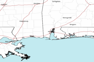 Mobile AL Radar
 Gulf Radar