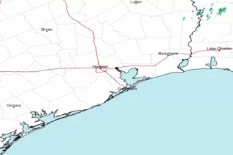
Freeport to Matagorda Ship Channel, TX Marine Forecast
| Tonight...Southeast Winds 5 To 10 Knots. Seas 3 To 5 Feet. |
| Tuesday...East Winds 5 To 10 Knots. Seas 3 To 4 Feet. A Slight Chance Of Showers And Thunderstorms. |
| Tuesday Night...Southeast Winds 10 To 15 Knots. Seas 2 To 4 Feet. |
| Wednesday...Southeast Winds 10 To 15 Knots. Seas 2 To 4 Feet. A Chance Of Showers And Thunderstorms Late. |
| Wednesday Night...Southeast Winds 15 To 20 Knots. Seas 3 To 4 Feet. A Chance Of Showers And Thunderstorms Early In The Evening. |
| Thursday...Southeast Winds 15 To 20 Knots. Seas 3 To 5 Feet. |
| Thursday Night...Southeast Winds 15 To 20 Knots, Diminishing To Around 15 Knots After Midnight. Seas 4 To 5 Feet. A Chance Of Showers And Thunderstorms. |
| Friday...Southeast Winds 10 To 15 Knots. Seas 4 To 5 Feet. |
| Friday Night...Southeast Winds 10 To 15 Knots. Seas 3 To 5 Feet. |
| Saturday...East Winds 10 To 15 Knots. Seas 3 To 4 Feet. |
| Saturday Night...Southeast Winds 10 To 15 Knots. Seas 3 To 4 Feet. Winds And Seas Higher In And Near Thunderstorms. |
| Area Forecast Discussion National Weather Service Houston/Galveston TX 334pm CDT Monday April 29 2024 ...New SHORT TERM, LONG TERM, Marine trong>Hydrology .SHORT TERM... (This evening through Tuesday Night) Issued at 335pm CDT Monday April 29 2024 Surface high pressure slides eastward into the Lower Mississippi River Valley this evening, allowing onshore winds to gradually return overnight. Light winds, ample low level moisture and recent rainfall may allow for patchy fog to develop throughout portions of SE Texas overnight into the early morning hours of Tuesday. High resolution models indicate the possibility of a showers/storms near the coast/offshore during this early morning period, though model trends seems to indicate coverage will be isolated in nature. Lows for Tuesday morning will be in the 60s to lower 70s. Onshore flow strengthens on Tuesday, increasing WAA (Warm Air Advection - the movement of warm air) and allowing moisture to gradually increase. Isolated shower/storms will be possible in areas south of I-10 during the day as a weak shortwave passes overhead. Rain chances dwindle that evening as the shortwave exists east of our area. Highs will be in the upper 70s/80s with lows in the 60s/lower 70s. 03 Long Term (Wednesday through next Sunday) Issued at 335pm CDT Monday April 29 2024 The developing west to southwest flow aloft will allow for a series of disturbances/impulses/weaknesses to move across the state and bring periods of showers/thunderstorms to parts of our area. Generally looking at Wednesday night through Thursday night as our next best/highest rain chances, especially for our northern counties (Brazos Valley and Piney s areas). An approaching cold front could bring some additional rounds of showers/storms to some of our northern region at the end of the week. Heading into the weekend, showing much less rain coverage and lower rain chances with the most concentration across our far inland spots and close to zero chances near the coast/beaches. With the clouds/rains in the forecast for Wednesday through Friday, generally have high temperatures in the low to mid 80s. Over the weekend (less clouds/rains), expecting to see slight warmer temperatures with some upper 80s in the forecast. For lows, anticipating an upper 60s to lower 70s range for a majority of the area. 42 Marine Issued at 335pm CDT Monday April 29 2024 Any lingering showers and thunderstorms will come to an end by this evening. Lowering winds and decreasing seas can be expected though Tuesday. A mainly light to moderate onshore flow and somewhat elevated seas are anticipated this week and into the start of the weekend. Caution flags might occasionally be needed. Periods of unsettled weather are possible, though better shower and thunderstorm chances should be situated a bit further inland for much of the forecast period as the next cold stays away from the coast. 42 Hydrology Issued at 335pm CDT Monday April 29 2024 5-10 inches with isolated totals of 10-12+ inches of rainfall have fallen over the past 24 hours causing minor to major river flooding along the Trinity River and its tributaries. Lake Livingston is showing inflows of near 160,000 cfs and is currently releasing 98,400 cfs. Expected impacts include extensive inundation of agricultural land, widespread street flooding, and structure flooding along the lowest areas of the Trinity River. Many impacts are already occurring upstream of Lake Livingston and along tributaries. Additional impacts are expected to worsen over the next 6-12 hours downstream of the lake and will persist for several days. Additional minor to moderate river flooding is expected along the E.F. San Jacinto and Navasota Rivers. Primary impacts include street flooding and isolated structure flooding. Rises to action stage are expected across the majority of the San Jacinto and Brazos River basins. Most impacts will occur within the next 24-48 hours, with some impacts lingering into the end of the week. Please monitor updated forecasts via the NWS AHPS website and/or the new NWS NWPS webpage (https://water.noaa.gov/) as the river flood threat continues. NOAA Houston/Galveston TX Office: Watches - Warnings - Advisories TX...Beach Hazards Statement until 9pm CDT this evening for TXZ436>439. GM...Small Craft Advisory until 4pm CDT this afternoon for GMZ370- 375. |
 Houston/Galveston TX Radar
 Gulf Radar