Intracoastal City to Cameron, LA Marine Forecast
| Rest Of Today...South Winds 15 To 20 Knots, Diminishing To 10 To 15 Knots Late. Seas 3 To 5 Feet, Occasionally To 6 Feet. Patchy Fog Late This Morning. Thunderstorms Likely Late This Morning. Showers. A Chance Of Thunderstorms This Afternoon. |
| Tonight...Southeast Winds 5 To 10 Knots. Seas 2 To 3 Feet. A Slight Chance Of Showers And Thunderstorms. Patchy Fog After Midnight. |
| Tuesday...East Winds 5 To 10 Knots, Becoming Southeast In The Afternoon. Seas Around 2 Feet. Patchy Fog In The Morning. A Chance Of Showers And Thunderstorms. |
| Tuesday Night...Southeast Winds 5 To 10 Knots. Seas Around 2 Feet. |
| Wednesday...Southeast Winds 10 To 15 Knots. Seas 2 To 3 Feet. A Slight Chance Of Showers And Thunderstorms. |
| Wednesday Night...Southeast Winds 10 To 15 Knots, Increasing To 15 To 20 Knots After Midnight. Seas 2 To 4 Feet. |
| Thursday...Southeast Winds 15 To 20 Knots. Seas 2 To 4 Feet. A Slight Chance Of Showers And Thunderstorms In The Afternoon. |
| Thursday Night...Southeast Winds Around 15 Knots. Seas 2 To 4 Feet. A Slight Chance Of Showers And Thunderstorms. |
| Friday...Southeast Winds 10 To 15 Knots. Seas 2 To 4 Feet. A Chance Of Showers And Thunderstorms, Mainly In The Morning. |
| Friday Night...Southeast Winds 10 To 15 Knots. Seas 2 To 3 Feet. Winds And Seas Higher In And Near Thunderstorms. |
| Area Forecast Discussion National Weather Service Lake Charles LA 100pm CDT Monday April 29 2024 .SHORT TERM... (Tonight through Tuesday night) Wx map shows surface high pressure off the East Coast and a low pressure trough across the Central Plains southward to Central Texas. Over our region, the pressure gradient is slowly relaxing, allowing for winds to diminish for all areas except the immediate coastal parishes. Thus, have trimmed back the Wind Advisory for SE TX and the I-10 corridor of Southern Louisiana. Minor coastal flooding continuing with values peaking between 1.5 to 1.8 feet Mean Higher High Water (MHHW) earlier this morning along the coast, and this afternoon across the Sabine and Calcasieu basins. Considering the duration of these southeast winds keeping tides 1-2 feet above astronomical tide over two days now, sufficient infiltration into the marshes and low lying coastal areas have likely occurred. Thus, will keep the ongoing Coastal Flood Warning for Southern Jefferson & Orange Counties and Cameron & Southern Calcasieu Parishes. Further east across coastal Vermilion, Iberia, and St. Mary Parishes, tides reached 1.5 feet Mean Higher High Water (MHHW) during the times of high tide. Thus, kept the ongoing Coastal Flood Advisory. With southeast winds expected to diminish before next high tide cycle, lower tides are expected. Therefore, the Coastal Flood Warnings and Advisories will not be reissued for Monday. The approaching longwave mid to upper level trough over Central Plains southward to Texas expected to move slowly as the shortwave within the base of the trough ejects northeastward through Monday. Showers and thunderstorms have reformed across Central and Northeast Texas. This area is expected to move across Northeast Texas this evening, with development further southwest. This area is expected to either maintain or redevelop as an MCS (Mesoscale Convective System, a complex of thunderstorms which becomes organized on a scale larger than the individual thunderstorms) into the overnight hours through Monday morning. Severe weather will be possible, with the greatest risk across Inland SE TX late this evening/early Monday morning. Storm Prediction Center has Enhanced Risk for Tyler & Northern Jasper, and Slight Risk for remainder of area into Central and Southern Louisiana, expect Marginal Risk over Lower Acadiana. All modes of severe weather will be possible. The other item will be the expected rainfall of 3 to 5 inches with locally higher amounts through Monday evening. This areal extent has shifted southward, thus have extended the Flood Watch southward as well to include all of Southeast Texas and along the I-10 corridor northward across Central and Southern Louisiana. Did not include Lafayette parish and the remainder of Lower Acadiana as the totals here at this time only ranging from 1.5 to 2.0 inches. Expect lingering moisture and lift to generate scattered showers and thunderstorms for Tuesday, with chances around 30-40%. Otherwise, south to southeast winds and above normal temperatures expected to continue. Long Term (Wednesday through next Saturday) Ample moisture will remain in the area during the mid to late week period. No significant system is expected over the area Wednesday or Thursday, however with the lack of any ridging locally and weak disturbances aloft passing to the north, isolated to scattered mainly diurnal showers and storms will be possible. Friday into the weekend a weak front may move into the area. This boundary may provide an uptick in coverage before washing out or lifting back north late in the weekend. 05 NOAA Lake Charles LA Office: Watches - Warnings - Advisories LA...None. TX...None. GM...Small Craft Advisory until 1pm CDT this afternoon for GMZ430- 432-435-436-450-452-455-470-472-475. |
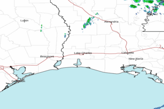 Lake Charles LA Radar
 Gulf Radar