Little Egg Inlet to Great Egg Inlet NJ out 20 NM Marine Forecast
| Tonight...Se Winds 5 To 10 Kt, Becoming E Late. Seas Around 3 Ft. Wave Detail: E 3 Ft At 12 Seconds And S 2 Ft At 5 Seconds. Patchy Fog Late With Vsby 1 To 3 Nm. |
| Tue...Se Winds 5 To 10 Kt. Seas 3 To 4 Ft. Wave Detail: S 3 Ft At 5 Seconds And E 3 Ft At 12 Seconds. Patchy Fog In The Morning With Vsby 1 To 3 Nm. |
| Tue Night...S Winds 10 To 15 Kt With Gusts Up To 20 Kt, Becoming Sw 5 To 10 Kt After Midnight. Seas 3 To 4 Ft. Wave Detail: S 4 Ft At 6 Seconds And E 2 Ft At 9 Seconds. |
| Wed...N Winds 5 To 10 Kt, Becoming Ne In The Afternoon. Seas 2 To 3 Ft. Wave Detail: S 3 Ft At 6 Seconds And E 2 Ft At 9 Seconds. A Chance Of Showers. |
| Wed Night...E Winds 5 To 10 Kt. Seas 2 To 3 Ft. Wave Detail: S 2 Ft At 5 Seconds And E 2 Ft At 7 Seconds. |
| Thu...E Winds 5 To 10 Kt, Becoming Se In The Afternoon. Seas 2 To 3 Ft. Wave Detail: E 2 Ft At 9 Seconds And S 1 Ft At 5 Seconds. |
| Thu Night...Se Winds 5 To 10 Kt. Seas 2 To 3 Ft. |
| Fri...E Winds Around 10 Kt. Seas 2 To 3 Ft. |
| Fri Night...E Winds 10 To 15 Kt. Seas 2 To 3 Ft. |
| Sat...E Winds 10 To 15 Kt. Seas 2 To 3 Ft. |
| Sat Night...Se Winds 10 To 15 Kt. Seas 3 To 4 Ft. A Chance Of Showers After Midnight. |
| Area Forecast Discussion National Weather Service Mount Holly NJ 538pm EDT Monday April 29 2024 Synopsis A back door cold front will approach the region this evening and stall across the area on Tuesday as an upper trough approaches. Showers and thunderstorms return later Tuesday and possibly into Wednesday, before weak high pressure builds in for Thursday and Friday. Another cold front approaches by the weekend which may bring some unsettled weather through early next week. Near Term - Through Tuesday At 5 pm, many observations across the region were still well into the 80s. 70s were being reported near the coast. Showers and thunderstorms were in the vicinity of the back door cold front across northern NJ, southern NY and CT. Heading through tonight it will be unseasonably mild once again, with lows in the low 60s for much of our area. However, the back door front will press in from the northeast as surface high pressure noses southward across New England. That will bring a push of cooler air on northeast to east winds, as well as some low clouds and perhaps even patchy fog from midnight through early Tuesday morning. Model guidance varies on how far south that will reach, but it could come close to Philly by morning. That will have an effect on high temperatures on Tuesday, even while the clouds lift back north and scatter. For now am still forecasting low 80s around Philly, but only near 70F at Trenton, and much of north NJ to the Poconos and down the shore will be stuck in the 60s with some clouds hanging around on Tuesday...a stark contrast from Monday. By later Tuesday afternoon, we will once again need to watch out for showers and thunderstorms, this time approaching from eastern Pennsylvania. Outside of the influence of the cooler airmass from the backdoor front and onshore flow, CAPE may reach 1000-2000 j/kg along with shear of 30-35 kt of bulk shear. With some larger scale synoptic forcing from an approaching shortwave trough, and an associated weakening cold front, that should help support some stronger thunderstorms. However, it is questionable how far east across PA the better instability will extend, especially as we start to lose daytime heating toward sunset. As a result, showers and storms will likely weaken as they approach the I-95 corridor toward or shortly after sunset. Short Term - Tuesday Night Through Thursday Any thunderstorm and shower activity that does enter our northwestern areas will begin to dwindle and lose their punch as we move deeper into Tuesday night. Not to say that embedded rumbles of thunder won't continue, but the firepower of the storms compared to during the day will be much less due to the loss of diurnal heating. Regardless, best chances for showers/thundershowers on Tuesday night continue to be north and west of the I-95 corridor where up to a half inch of rain is possible. For areas south and east, most places are expected to remain quite dry aside for a passing shower under mostly cloudy skies. Lows will be in the 50s for most, with temps remaining in the 60s across the Delmarva. By Wednesday the low pressure moves offshore, however while temps drop, humidities levels increase as dew points remain in the upper 50s. With upper trough slowing down as it passes by, there likely will be a few showers lingering across South Jersey and the Delmarva into Wednesday afternoon with rainfall amounts up to a tenth of an inch in these areas. Most places north of Philadelphia should dry out despite stubborn cloud cover hanging around most of the day. Temps will be in the 70s for much of the area except along the shore which will be stuck in the low 60s with continued onshore flow. By Wednesday night and Thursday, upper trough moves far enough offshore that the area is no longer impacted as upper ridge begins to approach from the west. Coinciding high pressure builds nearby as well leading to the return of sunny skies by Thursday. Lows will be in the mid 40s to mid 50s on Wednesday night before getting back up into the mid 70s to around 80 degrees on Thursday. Long Term - Thursday Night Through Monday High pressure remains nearby Thursday night and Friday before beginning to vacate the area into Friday night. As it does so, guidance is keen on having another backdoor cold front sinking southwestward across the area with another push of some cooler air. On the synoptic scale back to the west, another upper trough will begin to approach the area over the weekend which will lead to periods of showers and possible thunderstorms throughout the weekend. Not looking like a washout by any means as Probability of Precipitation are only in the 30-50% range, but definitely think there will be some shower activity around with abundance of low-level moisture and approaching cold front from the west. Depending on timing of the front, shower activity may linger into the start of next week as well, but the exact details on this is yet to be seen considering it is a week away. Temperatures throughout the long term period are forecast to be quite seasonable for early May with a mixed bag of 60-70s across the area. Marine No marine headlines anticipated through Tuesday. S to SE winds around 10 kt will become more SW later tonight into Tuesday near and south of Atlantic City, while ENE winds will persist on Tuesday farther north. Those southerly winds could gust 20-25 kt Tuesday afternoon, with seas building above 4 ft, which could briefly flirt with SCA (Small Craft Advisory) criteria. Outlook... Tuesday night through Saturday...Winds and seas on both the ocean waters and the Delaware Bay are expected to remain below SCA (Small Craft Advisory) criteria. Onshore flow varying between NE to SE winds are expected through the period. Shower activity is possible Tuesday night into Wednesday with another period possible on Saturday. Climate We are processing the climate data as I write. Any RERs will be released in a bit. But it looks like Allentown broke the previous daily record and Philadelphia tied. Check out the RERs shortly. NOAA Mount Holly NJ Office: Watches - Warnings - Advisories PA...None. NJ...None. DE...None. MD...None. Marine None. |
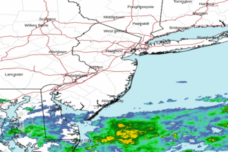 Mount Holly NJ Radar
 Northeast Radar
 East Coast Satellite