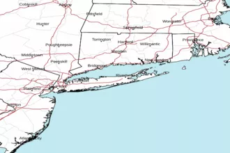
Long Island Sound East of New Haven CT/Port Jefferson NY Marine Forecast
| This Afternoon...S Winds 5 To 10 Kt. Seas 1 Ft Or Less. |
| Tonight...Se Winds 5 To 10 Kt. Seas 1 Ft Or Less. Wave Detail: Se 1 Ft At 2 Seconds. Isolated Showers. |
| Tue...E Winds 10 To 15 Kt. Seas Around 2 Ft. Wave Detail: E 2 Ft At 3 Seconds. Slight Chance Of Showers In The Morning. |
| Tue Night...E Winds 10 To 15 Kt, Becoming Ne 5 To 10 Kt After Midnight. Seas Around 2 Ft In The Evening, Then 1 Ft Or Less. Wave Detail: E 2 Ft At 3 Seconds, Becoming E 1 Ft At 3 Seconds. Chance Of Showers And Slight Chance Of Tstms After Midnight. |
| Wed...Ne Winds 5 To 10 Kt. Seas 1 Ft Or Less. Wave Detail: Ne 1 Ft At 3 Seconds. Chance Of Showers. |
| Wed Night...E Winds 5 To 10 Kt. Seas 1 Ft Or Less. Wave Detail: E 1 Ft At 2 Seconds. |
| Thu...Se Winds 5 To 10 Kt. Seas 1 Ft Or Less. |
| Thu Night...Sw Winds 5 To 10 Kt. Seas 1 Ft Or Less. |
| Fri...E Winds 5 To 10 Kt. Seas 1 Ft Or Less. |
| Fri Night...Se Winds Around 10 Kt. Seas 1 Ft Or Less. Winds And Seas May Be Higher In And Near Tstms. |
| Area Forecast Discussion National Weather Service New York NY 218pm EDT Monday April 29 2024 Synopsis A back door cold front moves through the region this evening, and becomes nearly stationary into Tuesday. A frontal wave then moves through the area Tuesday night into Wednesday, with high pressure returning thereafter for the end of the week. Another frontal system is expected for the weekend. Near Term - Through Tuesday Temperatures along the coast have peaked as sea breezes were moving northward, while inland temperatures have risen into the mid 80s. Cumulus have developed along the sea breezes and inland, across northern New Jersey and into New York City mixed layer CAPE of around 500 J/kg has developed along with surface based instability. Slightly increased the probabilities of precipitation in these areas with CAMs showing development of convection possible as sea breeze boundaries and backdoor cold front pushes into the region. Limiting factor will be the ridge axis moving toward the area with dry upper levels and subsidence. Ridging continues to build in aloft over the eastern CONUS, with the axis expected to be overhead sometime early Tuesday. Today will be the warmest day of the year so far, with some humidity too, with dew points into the lower 60s, and highs into the lower to mid 80s for most. Bit of a tricky temperature forecast with the timing of the front, sea breezes and any clouds this morning being huge factors. The thinking is that skies will be mostly sunny this morning and temps will rise quickly with decent mixing in a northwest flow. Once the sea breezes kick in, temperatures will drop as always this time of the year. Long Island, coastal CT and portions of NYC and northeast NJ will likely see their highs in the early afternoon. With sea breeze boundaries and some energy rounding the base of the ridge aloft, some afternoon convection is possible as SBCAPE values will be around 500-1000 J/kg for NYC north and west. Have added a slight chance of thunder to the forecast. The CAMs are in pretty good agreement with the location of any convection being NYC north and west. Thicker cloud cover returns tonight with a moist onshore flow. lows will be in the upper 40s in the eastern half of the area and mid 50s in the western half. Short Term - Tuesday Night Through Wednesday Night A frontal boundary likely remains just south of the area through Tuesday night. As previously mentioned, the upper ridge axis will pass overhead early Tuesday. A shortwave then approaches with associated surface frontal wave Tuesday night. This will bring the next shot of rain to the area with chances Tuesday evening through the first half of Wednesday. Capped at 50% Probability of Precipitation for now, with the most likely period being Tuesday night. There is also a slight chance of thunder. High pressure starts building in from the north and east Wednesday night. Temperatures will be cooler on Tuesday and Wednesday than they will be today, but still at or above normal for late April/early May. Long Term - Thursday Through Monday No major changes were made to the forecast Thursday through the upcoming weekend *Key Points* *Dry conditions expected Thursday and Friday. *The next frontal system may impact the area for the upcoming weekend, bringing the next chance of showers. *Temperatures will continue running slightly above normal. Shortwave troughing that will be moving across the region Wednesday pushes offshore on Thursday. Upper ridging will reestablish itself over the eastern states to end the week. Another upper trough then lifts north out of the intermountain west on Friday, then up into the Great Lakes over the weekend. This will send another weakening frontal system into the area Saturday into Sunday. The modeling has been slowing down the timing for the ridge axis to weaken or shift east. This has also slowed down when higher probabilities for showers exist across the region. It may take until late Saturday or Saturday night for the ridge to weaken enough to allow the front to enter the area. Showers are possible late Saturday into Saturday night. Model spread increases further for Sunday with several solutions showing ridging trying to return and the front dissipating. There are also solutions showing the ridge moving to the western Atlantic on Sunday with a larger upper trough trying to edge closer to the east coast, which would act on the front to bring higher chances of showers. Maintained the chance of showers on Sunday based on the latest NBM. Did not include thunder as there is too much uncertainty with the mesoscale environment at this time range. Temperatures Thursday and Friday will reach the lower to middle 60s near the coast with onshore component to the wind. Further inland, highs should reach the lower to potentially middle 70s. Highs are much more uncertain this weekend with NBM box and whisker plots showing ranges of highs from the lower 60s to the upper 70s, especially away from the immediate coast. This is likely due to the aforementioned uncertainties with cloud cover, potential showers, and proximity of the front. Marine No changes to the winds and seas at this time. Given a weak pressure gradient over the area for several days, winds and waves will remain below Small Craft Advisory criteria through the first half of the weekend. Hydrology There are no hydrologic concerns through the weekend. Climate Here are the record high temperatures for Monday, April 29: EWR: 91/1974 BDR: 86/2017 NYC: 89/1974 LGA: 88/2017* JFK: 85/2017 ISP: 85/2017 *Also occurred in previous years NOAA New York NY Office: Watches - Warnings - Advisories CT...None. NY...None. NJ...None. Marine None. |
 New York Radar
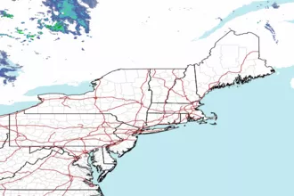
 Northeast Radar
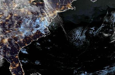
 East Coast Satellite