Port Mansfield, TX to the Rio Grande River Marine Forecast
| Tonight...East Winds 10 To 15 Knots Becoming Southeast 5 To 10 Knots After Midnight. Seas 4 To 5 Feet. A Slight Chance Of Showers After Midnight. |
| Tuesday...Southeast Winds 5 To 10 Knots Becoming East 10 To 15 Knots In The Afternoon. Seas 4 To 5 Feet. A Slight Chance Of Showers. A Slight Chance Of Thunderstorms In The Afternoon. |
| Tuesday Night...Southeast Winds 10 To 15 Knots. Seas 4 To 5 Feet. |
| Wednesday...Southeast Winds 10 To 15 Knots Increasing To 15 To 20 Knots In The Afternoon. Seas 4 To 5 Feet. A Slight Chance Of Showers And Thunderstorms In The Afternoon. |
| Wednesday Night...Southeast Winds 15 To 20 Knots. Seas 4 To 5 Feet Building To 5 To 7 Feet, With Occasional Seas Up To 8 Feet After Midnight. |
| Thursday...Southeast Winds 15 To 20 Knots. Seas 5 To 7 Feet, With Occasional Seas Up To 8 Feet. |
| Thursday Night...Southeast Winds 15 To 20 Knots Decreasing To 10 To 15 Knots After Midnight. Seas 4 To 6 Feet, With Occasional Seas Up To 7 Feet. |
| Friday...Southeast Winds Around 10 Knots. Seas 4 To 5 Feet. A Slight Chance Of Showers And Thunderstorms. |
| Friday Night...East Winds 10 To 15 Knots. Seas 4 To 5 Feet. |
| Saturday...Southeast Winds 10 To 15 Knots. Seas 4 To 5 Feet. |
| Saturday Night...Southeast Winds 10 To 15 Knots. Seas 4 To 5 Feet. Winds And Seas Higher In And Near Thunderstorms. |
| Area Forecast Discussion National Weather Service Brownsville TX 237pm CDT Monday April 29 2024 ...New SHORT TERM, LONG TER Marine .SHORT TERM... (Tonight through Tuesday night) Issued at 237pm CDT Monday April 29 2024 Key Messages: - There is a marginal risk for severe thunderstorms this afternoon and evening across the Northern Ranchlands. - A high risk of rip currents along the Lower Texas beaches through Tuesday evening. - Above normal temperatures continue across Deep South Texas. The short term period will feature low precipitation chances, partly to mostly cloudy skies, and above normal temperatures across all of Deep South Texas. Persistent low level southerly to southeasterly flow across the region has maintained warm and humid conditions. The 12Z BRO sounding indicated precipitable water values (PWATs) around 1.5 inches this morning, and GOES-16 Total Precipitable Water satellite imagery measures PWATs (Precipitable Waters) ranging from 1.55 to 1.65 inches across Deep South Texas. Meanwhile, a weak boundary north of the region will allow for isolated to scattered showers and thunderstorms to develop late this afternoon and into tonight. High res guidance indicates the presence of steep mid-level lapse rates, modest instability, and sufficient bulk shear values to support the development of isolated severe thunderstorms with primarily a hail and damaging wind gust threat, but lack of large scale forcing will limit this potential. If any severe thunderstorms were to develop, the best timing would be late this afternoon and overnight, mainly over the Northern Ranchlands. However, convective allowing models continue to indicate a mostly rain/storm-free afternoon and overnight period, with mainly warm air advection showers developing overnight across portions of Deep South Texas and the Gulf waters. Isolated to scattered showers may continue throughout the day on Tuesday, with the development of isolated thunderstorms possible during the afternoon hours as instability increases. Isolated thunderstorms may develop off of the Sierra Madre, but should dissipate before reaching the region late Tuesday afternoon/evening. Otherwise, a mild and overcast night is expected tonight and Tuesday night with lows in the 70s. Highs on Tuesday will range from the upper 70s along the Lower Texas beaches to mid 90s across the Northern Ranchlands. Long Term (Wednesday through next Monday) Issued at 237pm CDT Monday April 29 2024 Key Messages: - Daily low (20-30%) precipitation chances for portions of Deep South Texas continue through the end of the week. - Above normal temperatures persist through the weekend. Breezy winds will return across Deep South Texas by the start of the long term period as the pressure gradient tightens in response to an upper level trough digging into the Rockies. Sustained winds around 15-20 MPH with gusts up to 30 MPH are likely on Wednesday, with similar wind speeds expected on Thursday as the trough and attendant surface features track across the Northern Plains. As low level southerly to southeasterly flow continues to transport rich Gulf moisture northward and results in increasing PWATs, weak disturbances embedded within westerly to southwesterly flow aloft will result in daily low precipitation chances. The aforementioned trough will send a cold front southward by the end of the week, but model guidance continues to struggle with the timing of the front and the southward extent before stalling. Unfortunately, this will leave us with above normal temperatures and humid conditions through the weekend with highs ranging from the low 80s across the Lower Texas beaches to the mid 90s across the Northern Ranchlands and lows in the 70s. With the steady increase of low-level moisture and temperatures, we'll have to keep an eye on heat index values mid week. The latest guidance indicates heat indices will approach 100-106 degrees across most of the region, including the Mid/Upper Valley and the Northern Ranchlands, Wednesday through Friday. Marine Issued at 237pm CDT Monday April 29 2024 Tonight through Tuesday night...Light to moderate east to southeast winds and moderate seas will prevail through the period. Isolated to scattered showers and thunderstorms will be possible tonight into Tuesday, which may result in higher winds and seas. Wednesday through Sunday night...A tightening pressure gradient will result in increased wind speeds on Wednesday, which may approach Small Craft Exercise Caution to Small Craft Advisory conditions beginning late Wednesday afternoon into Thursday. Wave heigheights will respond and may reach 7-8 feet by Thursday. Conditions should improve heading into the weekend. NOAA Brownsville TX Office: Watches - Warnings - Advisories TX...High Rip Current Risk through Tuesday evening for TXZ451-454-455. GM...None. |
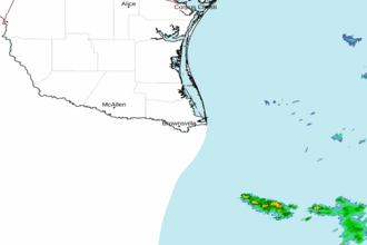 Brownsville TX Radar
 Gulf Radar