South Santee River to Edisto Beach, SC Marine Forecast
| Tonight...S Winds 10 Kt. Seas 2 To 3 Ft. Wave Detail: E 3 Ft At 9 Seconds. |
| Tue...S Winds 5 To 10 Kt. Seas 3 Ft. Wave Detail: Se 3 Ft At 6 Seconds And E 3 Ft At 9 Seconds. |
| Tue Night...S Winds 10 Kt. Seas 3 To 4 Ft. Wave Detail: Se 3 Ft At 6 Seconds And E 2 Ft At 10 Seconds. A Slight Chance Of Showers And Tstms In The Evening, Then A Chance Of Showers And Tstms After Midnight. |
| Wed...Sw Winds 5 To 10 Kt. Seas 3 To 4 Ft. Wave Detail: Se 3 Ft At 6 Seconds And E 2 Ft At 12 Seconds. A Chance Of Showers And Tstms In The Morning, Then A Chance Of Showers With A Slight Chance Of Tstms In The Afternoon. |
| Wed Night...Sw Winds 5 To 10 Kt. Seas 2 To 3 Ft. Wave Detail: Se 3 Ft At 6 Seconds And E 1 Foot At 11 Seconds. A Slight Chance Of Showers And Tstms In The Evening. |
| Thu...N Winds 5 Kt, Becoming E In The Afternoon. Seas 2 To 3 Ft. Wave Detail: Se 2 Ft At 6 Seconds And E 1 Foot At 10 Seconds. |
| Thu Night...E Winds 5 To 10 Kt. Seas 2 Ft. |
| Fri...E Winds 5 To 10 Kt. Seas 2 Ft. |
| Fri Night...Se Winds 10 Kt. Seas 2 Ft. |
| Sat...Se Winds 5 To 10 Kt. Seas 2 Ft. A Slight Chance Of Showers And Tstms. |
| Sat Night...Se Winds 10 Kt. Seas 2 To 3 Ft. A Slight Chance Of Showers And Tstms. Winds And Seas Higher In And Near Tstms. |
| Area Forecast Discussion National Weather Service Charleston SC 329pm EDT Monday April 29 2024 Synopsis High pressure will prevail through much of the week. A weak disturbance will move through Tuesday and Wednesday, then a weak cold front will stall in the vicinity this weekend. Near Term - Until 6am Tuesday Morning Tonight: Aloft, the main axis of a mid-upper level ridge will nudge east offshore in advance of h5 shortwave energy associated with a trough advancing across the Deep South. At the sfc, high pressure will remain in control, extending from the western Atlantic through the night. Guidance still suggests a few showers potentially developing across the Gulf Stream late, but activity is not expected to shift across land. Diurnally driven clouds will erode early, favoring a fair amount of radiational cooling as surface winds become light within a few hours after sunset. However, cirrus associated with the activity across the Deep South will likely arrive late night, limiting overall cooling potential within a few hours prior to daybreak. In general, lows should range between the upper 50s to lower 60s, cooler across parts of southeast South Carolina away from the coast. Coastal locations should remain in the mid 60s with a light onshore wind through the night. There remains some potential for patchy fog well inland late tonight, but increasing clouds should limit coverage. Short Term - 6am Tuesday Morning Through Thursday An upper shortwave will pass across the region Tuesday into Tuesday night and provide a bit more active weather than recent days. The first half of Tuesday is expected to be mostly dry then there will be an uptick in convective coverage as we move into the afternoon and persisting through the evening and the overnight. Less coverage is expected on Wednesday as the upper wave shifts offshore, but a surface trough lingering in the vicinity could still trigger isolated to perhaps scattered showers and thunderstorms. High temperatures generally peak in the mid 80s inland of the beaches, while lows stay in the 60s. Ridge builds over the region on Thursday which will act to limit rain chances. It will be the warmest day of the set, with highs reaching the upper 80s to near 90 away from the immediate coast. Long Term - Thursday Night Through Monday Mid level ridge extending across the region on Friday will slide east over the weekend as a weakening shortwave moves in. The surface pattern largely features high pressure although a weak surface trough will linger in the area. These features will support low-end rain chances (generally 20-30%) over the weekend, with the highest coverage inland. Marine Tonight: High pressure centered across the western Atlantic will extend across the region, maintaining quiet marine conditions across local waters. In general, winds will remain at or below 10-15 kt, slightly veering to south-southeast overnight. Seas will range between 2-4 ft, largest across offshore Georgia waters. Tuesday through Saturday: Atlantic high pressure will remain the dominant feature Tuesday through Saturday, with winds generally no higher than 10-15 kt and seas 2-4 ft. A moderate coastal sea breeze will develop each afternoon. Rip Currents A small swell every 9 or 10 seconds and continued onshore winds will result in a Moderate Risk of rip currents at all beaches into early evening. NOAA Charleston SC Office: Watches - Warnings - Advisories GA...None. SC...None. Marine None. |
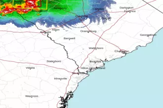 Charleston SC Radar
 Southeast Radar