VA-NC border to Currituck Beach Light, NC out 20 nm Marine Forecast
| Through 7 Pm...Sw Winds 10 Kt. Seas 2 To 3 Ft. Wave Detail: E 3 Ft At 10 Seconds And Sw 2 Ft At 3 Seconds. |
| Tonight...Sw Winds 10 Kt. Seas 2 To 3 Ft. Wave Detail: E 3 Ft At 10 Seconds And Sw 2 Ft At 3 Seconds. |
| Tue...Sw Winds 10 To 15 Kt. Seas 3 To 4 Ft, Occasionally To 5 Ft. Wave Detail: S 3 Ft At 4 Seconds And E 3 Ft At 12 Seconds. |
| Tue Night...S Winds 10 To 15 Kt With Gusts Up To 20 Kt. Seas 3 To 4 Ft, Occasionally To 5 Ft. Wave Detail: Se 3 Ft At 5 Seconds And E 3 Ft At 12 Seconds. |
| Wed...Sw Winds 5 To 10 Kt. Seas 3 To 4 Ft, Occasionally To 5 Ft. Wave Detail: S 3 Ft At 4 Seconds And E 2 Ft At 11 Seconds. A Chance Of Showers. A Chance Of Tstms In The Afternoon. |
| Wed Night...Se Winds 5 To 10 Kt, Becoming Ne After Midnight. Seas 2 To 3 Ft. Wave Detail: Se 2 Ft At 5 Seconds And Ne 2 Ft At 10 Seconds. A Chance Of Tstms In The Evening. A Chance Of Showers. |
| Thu...Ne Winds 10 Kt. Seas 2 To 3 Ft. |
| Thu Night...E Winds 5 To 10 Kt. Seas 2 To 3 Ft. |
| Fri...Ne Winds 5 To 10 Kt. Seas 2 To 3 Ft. |
| Fri Night...Se Winds 10 Kt. Seas 2 To 3 Ft. Winds And Seas Higher In And Near Tstms. |
| Area Forecast Discussion National Weather Service Wakefield VA 301pm EDT Monday April 29 2024 Synopsis High pressure remains centered off the Southeast coast through midweek with a ridge remaining overhead through the week. Well above normal temperatures are expected through much of the week. A weak cold front crosses the area Tuesday night into Wednesday with scattered showers and storms possible Wednesday. Precipitation chances increase this weekend, as another cold front approaches the area. Near Term - Until 6am Tuesday Morning As of 1010am EDT Monday... Key Messages: -Near record high temperatures today. Late this morning, surface high pressure was centered off the SE coast. Under a sunny sky, temps were ranging through the 70s. A strong upper level ridge was in place from the Florida coast nwrd into PA. Dry and hot this afternoon with SW or W winds 5-10 mph N and 10-15 mph S. Highs will range from the mid 80s to around 90. Record highs today are generally in the 90s apart from 89 at SBY (see climate section below for more information). As such, most areas will be a few degrees shy of records except SBY, which may reach or exceed the daily record high. Mostly clear and mild tonight with lows in the upper 50s to lower 60s. Short Term - 6am Tuesday Morning Through Wednesday Night As of 340am EDT Monday... Key Messages: -Well above normal temperatures Tuesday. -Scattered showers and storms possible Wednesday with a cold front passage. Aloft, a ridge weakens Tuesday and Wednesday as a shortwave moves through. At the surface, a weak area of low pressure moves E through the Mid Atlantic and off the coast Tuesday into early Wednesday with high pressure building in behind it. This pushes a weak cold front through the area late Tuesday night into Wed. A few isolated showers/storms are possible across the Piedmont Tuesday afternoon/evening with the shortwave. Temps will once again be well above normal on Tuesday with highs in the upper 80s for most. SBY may once again reach or exceed the daily record high (see climate section below for more information). PoPs increase Wednesday morning into Wednesday afternoon as scattered showers/storms develop along and behind the cold front moving through the area. Probability of Precipitation has trended higher (35-55%) with the best chance for rain across SE VA/NE NC where around ~0.25" of rain is possible. The rain ends by Wednesday evening with dry weather expected Wednesday night. Highs Wednesday will be largely dependent upon timing of the front/rain with a faster FROPA allowing for warmer temps in interior portions of the FA. For now, have highs mainly in the lower 80s inland (locally mid 80s) and upper 70s along the coast. Long Term - Thursday Through Monday As of 400am EDT Monday... Key Messages: -Above normal temperatures inland continue through the weekend. -Trending cooler along the coast with onshore flow. -Scattered showers/storms are possible Saturday and Sunday ahead of a cold front. Aloft, a ridge builds across the East Coast from mid-late week with above normal temps expected inland. At the sfc, high pressure builds E of the area Thu into Fri with onshore flow everywhere Thu and along the coast Fri. This will keep temps cooler along the coast and warmer inland. Highs in the mid 80s W to the upper 60s to near 70F E Thu and mid 80s W to mid 70s E Fri (coolest along the Atlantic beaches of the Eastern Shore). Additionally, with high pressure overhead, dry weather is expected both days apart from a low chance for an isolated shower/storm across the Piedmont Fri evening/night. A cold front approaches from the W Sat into Sun, slowing/stalling once it reaches the local area. As such, the weekend looks unsettled with scattered showers/storms possible both Sat and Sunday (45-50% Probability of Precipitation Sat and 35-40% Probability of Precipitation Sun). Shower/storm chances continue even into Monday with 25-35% PoPs. Given widespread cloud cover and scattered convection, highs will be cooler (but still mild) this weekend. Highs in the 70s NE to lower 80s for most Sat, mid 70s NE to around 80F SW Sun, and mid-upper 70s NE to the lower 80s SW Mon. Lows remain in the 50s and 60s. Marine As of 300pm EDT Monday... Generally benign, sub-SCA (Small Craft Advisory) conditions, are expected through the forecast period though some gusts to around 20 kt are possible at times. High pressure remains centered off of the Carolinas with an area of low pressure west of the Great Lakes. This is placing the region under a persistent southwest flow around 10 to 15 knots. Seas persist around 2 to 3 feet (up to 4 feet offshore), and waves in the bay are running around 1 foot (up to 2 feet at the mouth). Southwesterly flow continues overnight and decreases with the loss of mixing. For Tuesday southwest winds should increase a little after daybreak with mixing resulting to 10 to 15 kt with a few higher gusts possible over the Bay and near shore waters closer to land. A cold front approaches the waters from the north and northwest late Tuesday night pushing south past Ocean City and the Potomac River in the morning reaching the lower Bay and NC waters later in the afternoon. S to SW winds will increase slightly ahead of the front (~15 knots over the bay and ~15 to 20 knots over the coastal waters) Tuesday afternoon into Tuesday evening. Seas increase some due to the stronger S winds, with seas approaching 4 to 5 feet out 20 nm, especially north of Cape Charles Light. Winds shift to the N and NE behind the front Wednesday morning and remain around 10 to 15 kt. Generally onshore flow from the NE then E is expected from late Wednesday into Friday. Have increased the NE winds a little with this forecast updated based on the models, but winds remain below SCA (Small Craft Advisory) criteria around 15 kt with some gusts to near 20 kt possible at times. Another front potentially approaches the waters later this weekend. Climate Record highs for April 29th and April 30th: 4/29 4/30 RIC 94/1974 93/1974 ORF 92/1974 93/1988 SBY 89/1974 86/2017 ECG 90/1974 90/1974 NOAA Wakefield VA Office: Watches - Warnings - Advisories MD...None. NC...None. VA...None. Marine None. |
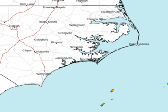 Newport NC Radar
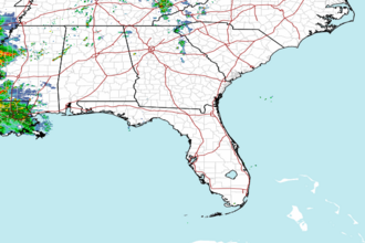 Southeast Radar
 East Coast Satellite