Hurricane Center - Atlantic
Tropical Outlook
Tropical Weather Outlook
NWS National Hurricane Center Miami FL
700 PM EST Thursday November 30 2023
For the North Atlantic...Caribbean Sea and the Gulf of Mexico:
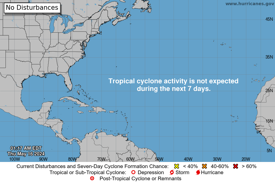
Tropical cyclone formation is not expected during the next 7 days.
This is the last regularly scheduled Tropical Weather Outlook of the 2023 Atlantic Hurricane Season. Routine issuance of the Tropical Weather Outlook will resume on May 15, 2024. During the off-season, Special Tropical Weather Outlooks will be issued as conditions warrant.
Forecaster: John Cangialosi, National Hurricane Center
2021 Storm Names
• Anna (May 22 - 23, 45 mph, 1004mb)
• Bill (June 14 - 16, 60 mph, 998mb)
• Claudette (June 19 - 22, 45 mph, 1004mb)
• Danny (June 28 - 29, 45 mph, 1009mb)
• Elsa (July 1 - 9, 85 mph, 991mb)
• Fred (Aug 11 - 18, 65 mph, 993mb)
• Grace (Aug 13 - 21, 125 mph, 962mb)
• Henri (Aug 16 - 24, 75 mph, 986mb)
• Ida (Aug 26 - Sept 2, 150 mph, 933mb)
• Julian (Aug 29 - 30, 60 mph, 995mb)
• Kate (Aug 28 - Sept 1, 40 mph, 1004mb)
• Larry (Aug 31 - Sept 11, 125 mph, 955mb)
• Mindy (Sept 8 - 10, 45 mph, 1002mb)
• Nicholas (Sept 12 - 17, 75 mph, 988mb)
• Odette (Sept 17 - 18, 45 mph, 1002mb)
• Peter (Sept 19 - 22, 50 mph, 1007mb)
• Rose (Sept 19 - 23, 40 mph, 1007mb)
• Sam (Sept 22 - Oct 5, 145 mph, 943mb)
• Teresa (Sept 24 - 25, 45 mph, 1008mb)
• Victor (Sept 29 - Oct 4, 65 mph, 997mb)
• NEXT: Wanda
• Adria
• Braylen
• Caridad


Tropical Discussion
Atlantic Tropical Weather Discussion
NWS National Hurricane Center Miami FL
2:05PM EDT (1805 UTC)
Monday Apr 29 2024
Tropical Weather Discussion for North America, Central America Gulf of Mexico, Caribbean Sea, northern sections of South America, and Atlantic Ocean to the African coast from the Equator to 31N. The following information is based on satellite imagery, weather observations, radar and meteorological analysis.
Based on 1200 UTC surface analysis and satellite imagery through 1600 UTC.
Monsoon Trough And Intertropical Convergence Zone - ITCZ
(The ITCZ is also known by sailors as the doldrums)
The monsoon trough reaches the Atlantic through the coast of Senegal near 11N16W and continues southwestward to 07N20W. The ITCZ extends from 07N20W to 01N30W to 00N42W. Numerous moderate to isolated strong convection is observed south of 07N and east of 40W.
Discussion: Gulf Of Mexico
A line of strong thunderstorms are impacting the nearshore waters of the northwest Gulf of Mexico north of 27N and west of 91W. Otherwise, a broad subtropical ridge in the western Atlantic supports moderate to occasionally strong SE winds and moderate seas over much of the Gulf
For the forecast, the aforementioned high-pressure system will weaken over the next few days, resulting in diminishing winds and decreasing seas across the basin. Elsewhere, winds will pulse to fresh to strong speeds near the Yucatan Peninsula and south- central Gulf each evening through the forecast period.
Discussion: Caribbean Sea
Moderate to fresh easterly trade winds and moderate seas are present south of Hispaniola, Windward Passage, and Gulf of Honduras. Moderate easterly breezes and moderate seas are found across the remainder of the central and NW Caribbean waters. Elsewhere, moderate or weaker winds and slight to moderate seas prevail. Pockets of low-level moisture traveling across the Caribbean are producing isolated, weak showers.
For the forecast, high pressure centered between the Southeast US and Bermuda will gradually weaken over the next few days. Fresh to locally strong easterly winds at night in the Gulf of Honduras, Windward Passage, and offshore southern Hispaniola will diminish midweek. Northerly swell will push rough seas through the passages in the NE Caribbean through Wed. Otherwise, gentle to moderate easterly winds are forecast for the eastern half of the Caribbean Thursday and Friday while light to gentle winds will dominate elsewhere.
Discussion: Atlantic Ocean
A cold front extends from 31N43W to 21N55W, with a pre-frontal trough analyzed from 24N47W to 14N50W. A few showers are observed east of the trough to 40W and north of 23N. Fresh to strong southerly winds and moderate seas are noted ahead of the front to 37W and north of 27N. Behind the front, rough seas prevail to 70W with moderate to fresh W to NW winds observed north of 28N to 63W. The remainder of the SW North Atlantic is under the influence of a broad subtropical ridge centered between the SE US and Bermuda with moderate or weaker winds and moderate seas.
The rest of the central and eastern Atlantic is dominated by a 1030 mb high pressure system located over the Azores. The pressure gradient between this ridge and lower pressures over western Africa support fresh to strong NE to E winds north of 15N and east of 35W and moderate to rough seas. Elsewhere, moderate or weaker winds and moderate seas are prevalent.
For the forecast west of 55W, moderate to fresh W to NW winds behind a cold front that moved to the central subtropical Atlantic waters this morning will continue to affect the NE offshore waters north of 28N through Tuesday evening. Long-period northerly swell with peak seas to 13 ft will start subsiding this evening as the front continues to shift eastward. Fresh to locally strong winds will continue over the waters south of 23N and west of 70W through late today, especially in the approaches of the Windward Passage. More tranquil marine conditions are expected afterwards as high pressure becomes centered over the NW waters.
Nepaul