Alligator River Marine Forecast
| Today...Sw Winds 5 To 10 Kt, Increasing To 10 To 15 Kt This Afternoon. Waves Light Chop, Increasing To A Moderate Chop. A Slight Chance Of Showers And Tstms Early This Afternoon. A Chance Of Showers And Tstms Late. |
| Tonight...Sw Winds 10 To 15 Kt. Waves A Moderate Chop. A Chance Of Showers And Tstms. |
| Thu...Sw Winds 10 To 15 Kt. Waves A Moderate Chop. A Chance Of Showers And Tstms In The Morning, Then Showers And Tstms Likely In The Afternoon. |
| Thu Night...Sw Winds 10 To 15 Kt. Waves A Moderate Chop. Showers And Tstms Likely, Mainly In The Evening. |
| Fri...W Winds Around 10 Kt. Waves Light Chop. A Chance Of Showers. A Slight Chance Of Tstms In The Morning, Then A Chance Of Tstms In The Afternoon. |
| Fri Night...Nw Winds 10 To 15 Kt. Waves A Moderate Chop. A Chance Of Showers And Tstms In The Evening. |
| Sat...N Winds 10 To 15 Kt, Becoming Ne 5 To 10 Kt In The Afternoon. Waves A Moderate Chop, Diminishing To Light Chop In The Afternoon. |
| Sat Night...S Winds 5 To 10 Kt, Becoming Sw After Midnight. Waves Light Chop. |
| Sun...W Winds Around 10 Kt. Waves Light Chop. |
| Sun Night...S Winds Around 10 Kt, Becoming Sw After Midnight. Waves Light Chop. Winds And Waves Higher In And Near Tstms. |
| Area Forecast Discussion National Weather Service Wakefield VA 424am EDT Wednesday May 8 2024 Synopsis Summer-like conditions with daily showers and storms are expected through Thursday, with a cold front expected to push through the region late Thursday through Friday. An upper level trough will keep a chance for showers late Saturday into Sunday, with dry conditions expected Monday. Near Term - Through Tonight As of 330am EDT Wednesday... Key Messages: -Marginal SVR risk today for most of the region (slight risk SW zones) - Hot today with highs in the upper 80s/lower 90s The latest WX analysis indicates surface low pressure over the upper peninsula of Michigan, with high pressure well off the SE coast, and a lee trough over the local area. Aloft, there are two separate areas of low pressure: one across the Dakotas/nrn rockies, and another near the surface low over northern Michigan. There is a weak ridge aloft locally, but that will be flattening out later today as the upper trough over Michigan translates E to upstate NY and New England by this evening. It remains mild and dry early this morning with temperatures mostly in the 60s. Partly cloudy, except for the MD eastern shore where some low clouds and fog remain in place through the next few hrs. There is a large scale area of showers/thunderstorms over thr OH Valley that m,may spread a shower to the far twds sunrise but for the most part this will only lead to some additional high clouds. Storm Prediction Center has a Marginal risk for severe for most of the CWA (County Warning Area) today, with a Slight across the SW zones (from about Farmville to Bertie Co. NC). Shear will be increasing today as the H5 gradient tightens in response to the trough moving from MI to New England. The 0-6km shear this aftn/evening will increase to ~40 kt, and ML CAPE will be 1000-2000 J/Kg (highest over the south). As such, any storms that do develop will have the potential to become severe w/ wind as the primary threat (though mid level lapse rates are modestly steeper than yesterday so some large hail will also be possible). Probably the main reason that most of the CWA is only in a Marginal is due to the lack of a trigger for convection other than a weak lee trough. Probability of Precipitation this afternoon will mostly hold off until late aftn/early evening and will be highest across the south (30-40%), and lowest over the NE (~20%). It will be hot with highs into the upper 80s to lower 90s. The bulk of guidance suggests that the best chance for storms will actually be this evening as a band of slightly steeper mid level lapse rates are forecast to push through. Probability of Precipitation diminish for awhile late in the evening/early thu morning, but then most of the CAMs depict an MCS (Mesoscale Convective System, a complex of thunderstorms which becomes organized on a scale larger than the individual thunderstorms) potentially moving in from the W between 06-12Z Thu morning. Will show Probability of Precipitation ramping up to 40-50% late. Warm with lows in the mid to upper 60s. Short Term - Thursday Through Friday Night As of 350am EDT Wednesday... While somewhat uncertain given the potential MCS (or remnants) passing through the region Thursday morning, Storm Prediction Center maintains a SLight Risk for Severe across the entire FA. This as the mid level wind field increase further (H5-H7 flow to >50kt), along with the approaching upper trough leading to height falls and provide more widespread forcing for ascent. The timing will be tricky and have enough support for high chance to low-end likely PoPs Thursday morning (this could be one of the relatively rare cases where we see decent tstm activity during the morning hrs). The degree to which thisam shower/storm activity lingers into the late morning/midday hrs Thursday could have impacts on the afternoon instability to some extent. However, it is notoriously difficult to time these features (even in the <24 hr timeframe) and the models tend to perform poorly in their development and evolution. Damaging winds and large hail continue to look like the most likely threats from any storm. Given the frontal forcing, it seems probable that storms would eventually grow upscale in a linear or broken line feature, with widespread damaging winds becoming increasingly favored. Low- level hodograph curvature is also somewhat enhanced near the front, though high LCLs would argue against a robust tornado threat. With more clouds around, high temps will be cooler and generally in the upper 70s/lower 80s N to the mid/upper 80s SE. PoPs diminish from W to E Thursday evening, then dry overnight. Turning cooler Thu night with lows in the upper 50s-low 60s. Friday starts off mainly dry, but scattered showers are expected to redevelop as the upper trough swings through and the associated shortwave moves across VA and the Carolinas. There will be limited sfc-based instability but the cold pool(a region of relatively cold air) aloft could set off some thunderstorms. mainly across the southern 1/2 of the CWA. At this time, severe weather is not expected. Highs on Fri will be cooler, mainly in the lower to mid 70s (upper 70s possible far S). Probability of Precipitation are highest over the SE (~50%) and lowest over the far W. Drying out Fri night and cooler with lows mid/upper 40s W to the lower 50s E. Long Term - Saturday Through Tuesday As of 415am EDT Wednesday... There remains some uncertainty for the weekend, but overall the model agreement is improved compared to yesterday's 12Z runs. The main WX maker will be yet another shortwave dropping SE and pushing across the mid Atlantic late Sat through Sunday. This pattern favors increasing clouds Sat afternoon. with low chance Probability of Precipitation pushing into the NW by late afternoon. spreading through the region Sat night/early Sunday. The airmass will be cooler and fairly dry so not expecting much Quantitative Precipitation Forecast with this system (unless the trough and shortwave were to push farther S than any of the guidance currently shows). Will keep ~30% Probability of Precipitation over the N Sat night into early Sunday, with Probability of Precipitation only ~10% in NC. The models start to differ more on Sunday, with the deterministic ECMWF (European Centre for Medium-Range Weather Forecasts) the southern outlier regarding the track of the upper trough. The NBM as well as the GFS (Global Forecast System) and Canadian are drier so will only keep PoPs around 20% through Sunday afternoon over the north. It looks dry from late Sunday through midday Tuesday with some low chance Probability of Precipitation possible by later Tuesday as the next upper trough approaches from the lower MS/Tn VAlley. Temperatures will be near to slightly below normal Sat-Sunday (highs upper 60s to mid 70s), warming a bit by Mon- Tuesday (highs mid/upper 70s). Marine As of 330am EDT Wednesday... Surface high pressure remains off the Southeast coast with multiple areas of low pressure over the Plains and another low centered near Michigan. Flow aloft is largely from the SW between a closed low over the northern Plains and ridging over the Gulf of Mexico. Winds are S at 5-10 kt early this morning with waves around 1 foot and seas 2-3 ft. Satellite and surface/buoy observations continue to show areas of fog over the northern coastal waters where a Marine Dense Fog Advisory continues until 7am. SW winds will generally stay in the 5- 10 kt range today ahead of weak lee troughing over inland areas. Guidance is mixed with respect to the potential and coverage of showers and thunderstorms across the waters this afternoon/evening. However, the environment will support strong storms if they are able to form and locally enhanced winds/waves/seas are likely in and near any convection that is able to materialize. Sub-SCA (Small Craft Advisory) flow continues Thursday and with somewhat greater potential for strong storms (highly dependent on how convection evolves upstream). Flow becomes westerly on Friday as the surface front crosses the region. 00z guidance has come into better agreement showing a period of cold advection/stronger NW winds Friday night into early Saturday. This period may require SCA (Small Craft Advisory) headlines in subsequent forecasts. The NNW surge looks to be short-lived with SE flow reestablishing for the second half of Saturday. Another front potentially moves through the region on Sunday with winds becoming NW behind the boundary, though currently forecast to stay below SCA (Small Craft Advisory) thresholds. Waves will generally maintain 1-2 ft through the period but could increase to 2- 3 ft Friday night/early Saturday. Near-shore seas will average 2-3 ft with 3-4 ft more prevalent out near 20 NM. Tides / Coastal Flooding As of 330am EDT Wednesday... All coastal flood advisories have been cancelled. Additional nuisance to minor coastal flooding is possible with the high tide cycle late tonight and further headlines will be issued later this morning. Climate Record highs for today May 8th: * RIC: 92 (1936) * ORF: 95 (1880) * SBY: 93 (1936) * ECG: 91 (2010) NOAA Wakefield VA Office: Watches - Warnings - Advisories MD...None. NC...None. VA...None. Marine Dense Fog Advisory until 7am EDT this morning for ANZ650-652. |
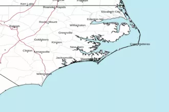 Newport NC Radar
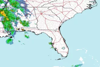 Southeast Radar
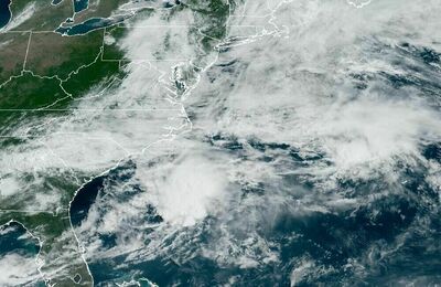 East Coast Satellite