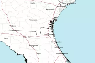
Altamaha Sound to Fernandina Beach FL Marine Forecast
| Rest Of Today...South Winds 5 To 10 Knots, Becoming Southeast 10 To 15 Knots This Afternoon. Seas 2 To 3 Feet. Wave Detail: Southeast 3 Feet At 5 Seconds. Intracoastal Waters Becoming A Light Chop. |
| Tonight...South Winds Around 15 Knots, Becoming Southwest 10 To 15 Knots After Midnight. Seas 3 To 4 Feet, Occasionally To 5 Feet. Wave Detail: Southeast 4 Feet At 5 Seconds. Intracoastal Waters A Moderate Chop. |
| Thursday...South Winds 10 To 15 Knots, Becoming Southeast During The Afternoon. Seas Around 3 Feet. Wave Detail: Southeast 3 Feet At 6 Seconds. Intracoastal Waters A Light Chop. A Slight Chance Of Showers And Thunderstorms Late In The Afternoon. |
| Thursday Night...Southwest Winds 10 To 15 Knots. Seas 3 To 4 Feet, Occasionally To 5 Feet. Wave Detail: Southeast 3 Feet At 6 Seconds. Intracoastal Waters A Light Chop. A Chance Of Showers And Thunderstorms. |
| Friday...Southwest Winds 10 To 15 Knots. Seas 2 To 3 Feet. Wave Detail: Southwest 3 Feet At 6 Seconds. Intracoastal Waters A Light Chop. A Chance Of Showers And Thunderstorms In The Morning, Then Showers And Thunderstorms Likely In The Afternoon. Strong To Severe Thunderstorms Will Be Possible, With Damaging Wind Gusts, Frequent Lightning Strikes, And Hail Within Stronger Storms. |
| Friday Night...West Winds Around 15 Knots, Becoming Northwest After Midnight. Seas 2 To 3 Feet. Wave Detail: West 3 Feet At 4 Seconds. Intracoastal Waters A Moderate Chop. A Chance Of Showers And Thunderstorms In The Evening. |
| Saturday...East Winds 10 To 15 Knots. Seas 2 To 3 Feet. Intracoastal Waters A Light Chop. |
| Sunday...East Winds 10 To 15 Knots. Seas 2 To 3 Feet. Intracoastal Waters A Light Chop. |
| Sunday Night...Southeast Winds 5 To 10 Knots. Seas Around 2 Feet. Intracoastal Waters Mostly Smooth. A Slight Chance Of Showers After Midnight. Winds And Waves Higher In And Near Thunderstorms. |
| Area Forecast Discussion National Weather Service Jacksonville FL 1232pm EDT Wednesday May 8 2024 ...NEAR RECORD HIGHS CONTINUE THROUGH THURSDAY... ...SQUALL LINE OF STRONG TO SEVERE THUNDERSTORMS POSSIBLE ON THURSDAY AFTERNOON AND EVENING FOR LOCATIONS NORTH OF I-10... ...STRONG TO ISOLATED SEVERE STORMS POSSIBLE ON FRIDAY... For the latest NE FL and SE GA Daily Key Messages please visit: https://www.weather.gov/media/jax/briefings/nws-jax-briefing.pdf Issued at 1232pm EDT Wednesday May 8 2024 Early afternoon surface analysis depicts Atlantic high pressure (1018 millibars) centered to the south of Bermuda, with this feature extending its axis westward across the FL peninsula. Meanwhile, a wavy surface front extends from New England and the Mid-Atlantic states westward across the Great Lakes states and then southwestward across the Ohio and Tennessee Valleys, the Ozarks, Southern Plains, and Desert Southwest. Aloft...ridging centered over the Bay of Campeche (southwestern Gulf of Mexico) continues to build northeastward across the Gulf of Mexico and along the southeastern seaboard. Otherwise, a blocking pattern was in place over the Rockies and Plains states, while a potent shortwave trough was progressing east-southeastward across eastern portions of the Great Lakes. Low stratus cloud cover over inland portions of southeast GA early this morning has since lifted to a healthy cumulus field, while mid-level cloud cover earlier this morning that was pushing across north central and portions of northeast FL have dissipated, leaving behind fair skies with pockets of mainly flat cumulus cloud cover. Temperatures at the noon hour were climbing through the mid and upper 80s at most locations, with dewpoints generally in the mid 60s to lower 70s. The blocking pattern aloft currently in place across the Rockies and Plains states will retrograde westward on Thursday and Friday, allowing for a potent shortwave trough currently near Hudson Bay, Canada to dive southward across the Great Lakes region by Thursday afternoon and night. This digging shortwave trough will flatten ridging in place across the Gulf of Mexico and the southeastern seaboard, allowing for a more zonal flow pattern to develop across the southeastern states by Thursday afternoon and night. A dry, hot, and subsident air mass will remain in place locally until this ridging begins to flatten, with breezy west- southwesterly winds boosting highs to near daily record highs (see Climate section below) this afternoon for inland locations west of I-95, where temperatures will climb to the low and mid 90s, with a few upper 90s possible across north central FL. The Atlantic sea breeze will develop along the coast during the early to mid afternoon hours, keeping coastal highs closer to 90. Dewpoints falling through the 60s this afternoon will keep Heat Index values generally in the 95-100 range at inland locations, except for north central FL, where values may top out just above 100 this afternoon. Breezy southwesterly winds in the boundary later overnight will likely advect another stratus layer inland from the northeast Gulf of Mexico across the Suwannee Valley and inland southeast GA after midnight, with this stratus layer then potentially shifting eastward across U.S. Highway 301 during the predawn hours. Lows tonight will only fall to the upper 60s and lower 70s area-wide. As ridging aloft flattens on Thursday in response to the potent shortwave trough digging across the Great Lakes region, strengthening westerly flow aloft will begin to advect shortwave energy across the Deep South. Meanwhile, a 110-knot jet streak at 250 millibars (around 35,000 feet) at the base of this digging shortwave trough will traverse the Ohio and Tennessee Valleys during the late afternoon and evening hours. In addition, a 40-50 knot low level southwesterly jet at 850 millibars (around 5,000 feet) will develop across south central and southeast GA during the afternoon and evening hours on Thursday. Strengthening winds aloft and steep low and mid level lapse rates could propel a squall line of strong to severe thunderstorms ahead of a cold front that will be entering the southeastern states, with short- term, high resolution guidance suggesting that this line may traverse southeast GA during the afternoon hours, potentially approaching I-95 towards or just after sunset. The Storm Prediction Center has placed these areas within a Slight Risk (level 2 out of 5) for severe thunderstorm development, with damaging wind gusts, hail, and isolated tornadoes possible within severe thunderstorms that develop along this potential squall line that could impact our area (especially for locations along and north of I-10) on Thursday afternoon and evening. Breezy west-southwesterly winds will likely delay the development of the Atlantic sea breeze on Thursday, allowing near record heat to extend all the way to coastal locations, with low to mid 90s forecast for much of our area on Thursday afternoon before thunderstorm activity potentially increases. Marine Issued at 1232pm EDT Wednesday May 8 2024 Atlantic high pressure will continue to extend its axis westward across the Florida peninsula through Thursday night. Southerly evening wind surges are expected this evening and again on Thursday evening, bringing wind speeds up to Caution levels of 15 to 20 knots for the offshore waters. Seas of 2-4 feet will prevail through Thursday night for the near shore waters, with 3-5 foot seas prevailing offshore. Meanwhile, a strong cold front will enter the southeastern states on Thursday night, with chances for showers and thunderstorms increasing ahead of this boundary from Thursday afternoon through Friday evening. A few rounds of strong to severe thunderstorms will be possible during this time frame, with damaging wind gusts, hail, and frequent lightning strikes possible within any severe thunderstorms that develop. The cold front will cross our local waters on Friday afternoon and evening, with high pressure then gradually building to the north of our area later this weekend and early next week in the wake of this frontal passage, resulting in prevailing onshore winds during this time period. Seas of 2-4 feet will prevail both near shore and offshore from Friday through the weekend. Rip Currents Breezy onshore winds developing this afternoon and again on Thursday afternoon will combine with a northeasterly ocean swell to create a moderate rip current risk at all area beaches on both afternoons. Breezy offshore winds on Friday should reduce the risk to low at all area beaches. Fire Weather Issued at 1232pm EDT Wednesday May 8 2024 Southwesterly transport winds will become breezy at most inland locations this afternoon, with breezy onshore surface winds expected to develop by the mid-afternoon hours at coastal locations as the Atlantic sea breeze boundary moves slowly inland. Breezy transport winds will combine with elevated mixing heights to create high daytime dispersion values for locations along the U.S. Highway 301 corridor, with good dispersion values expected elsewhere. Southwesterly transport winds will strengthen further on Thursday, creating high daytime dispersion values for most locations east of the Interstate 75 corridor during the afternoon hours. Otherwise, a hot and dry air mass over our region will result in minimum relative humidity values falling to around 35 percent at most inland locations this afternoon, with minimum values again around 35 percent forecast for most locations east of I-75 on Thursday afternoon. Strong west-southwesterly transport winds on Friday will again create good to marginally high daytime dispersion values, except for high values across portions of north central FL. A few rounds of strong to severe thunderstorms will be possible from Thursday afternoon through Friday evening, with damaging wind gusts, hail, and frequent lightning strikes possible within any severe thunderstorms that develop. Climate Issued at 1232pm EDT Wednesday May 8 2024 Daily record Maximum Temperatures at the local climate sites for... Today, May 8th...JAX 96/1959...CRG 93/1977...GNV 97/1955...AMG 95/1962 Thursday, May 9th...JAX 96/1962...CRG 93/2008...GNV 95/2011...AMG 95/1962 Friday, May 10th...JAX 94/2017...CRG 95/2003...GNV 95/2011...AMG 95/2011 NOAA Jacksonville FL Office: Watches - Warnings - Advisories FL...None. GA...None. AM...None. |
 Jacksonville Radar
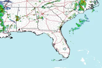
 Southeast Radar