Biscayne Bay Marine Forecast
| Rest Of Today...E Se Winds 5 To 10 Kt. Bay Waters A Light Chop. |
| Tonight...Se Winds 5 To 10 Kt. Bay Waters A Light Chop. |
| Wed...Se Winds 10 To 15 Kt. Bay Waters A Moderate Chop. |
| Wed Night...Se Winds 10 To 15 Kt. Bay Waters A Moderate Chop. |
| Thu...S Se Winds 10 To 15 Kt. Bay Waters A Moderate Chop. |
| Thu Night...S Se Winds 10 To 15 Kt. Bay Waters A Moderate Chop. |
| Fri...S Winds 10 To 15 Kt. Bay Waters A Moderate Chop. |
| Fri Night...Sw Winds 5 To 10 Kt. Bay Waters A Light Chop. A Slight Chance Of Showers After Midnight. |
| Sat...Sw Winds 10 To 15 Kt. Bay Waters A Moderate Chop. A Chance Of Showers With A Slight Chance Of Tstms. |
| Area Forecast Discussion National Weather Service Miami FL 343am EDT Wednesday May 8 2024 ...New SHORT TERM, LONG TERM, Marine EACHES... .SHORT TERM... (Today through Thursday) Issued at 303am EDT Wednesday May 8 2024 Warm and dry conditions will be the story through the short term period as ridging builds over the region. Chances for showers and thunderstorms will be very limited between PWAT (Precipitable Water) values dropping to around 1" and overall subsidence from the ridge. Under mostly clear skies, high temperatures today will soar into the upper 80s across the East Coast metro, with low to mid 90s across interior and Gulf Coast areas. Temperatures will warm a few more degrees on Thursday as the ridge continues to build in and the airmass heats up. Highs will reach the upper 80s to low 90s along the East Coast metro and Gulf Coast, with mid to even upper 90s over interior areas. Heat index values may reach the triple digits in some areas, and will need to be monitored. Long Term (Thursday night through Tuesday) Issued at 303am EDT Wednesday May 8 2024 As we wrap up the week, the surface ridge axis will remain sitting over South FL allowing for mostly sunny and dry conditions on Friday. The warming trend will to continue with widespread 90 degree high temperatures across the region. Some inland portions of South Florida could see temperatures reach the upper 90s. The heat indices will approach the upper 90s into low 100s, especially for the inland regions of the eastern counties. The next frontal boundary will move across the southeastern United States late Friday as a Canadian upper level low and trough make their way into the eastern CONUS. With increasing moisture, it will lead to our next opportunity for showers and thunderstorm activity on Saturday. However, the front is expected to weaken as it progresses across the FL Peninsula. Therefore, current models are not forecasting much activity and rainfall associated with this front as it moves south and settles across South FL through the weekend. The EURO ensemble & Canadian are showing the most confidence in rainfall with 30-50% chance of rain across land and the Atlantic waters with less than 0.10" expected. Low confidence in specifics at the moment due to varying forecasts between the models. Temperatures will cool slightly with the additional cloud cover and rainfall. However, Saturday appears it will be more of a transition day where the temperatures could again reach well into the 90s, most likely over the east coast metro. With heat indices approaching 100 again, caution needs to be taken when spending time outdoors with heat safety measures in place. When looking further into the extended outlook, temperatures continue to remain above normal, in the 90s, with more active weather to begin the start of the new week. Marine Issued at 303am EDT Wednesday May 8 2024 A gentle to moderate southeasterly wind flow will continue through Thursday across most of the local waters. The exception to this will be over the Gulf waters where winds will shift to the southwest each afternoon as a Gulf breeze develops. Winds will gradually become south to southwesterly across all local waters heading towards the end of the week as a frontal boundary approaches from the north. Seas across the Atlantic waters will remain at 3 feet or less through the middle of the week while seas across the Gulf waters remain at 2 feet or less. Beaches Issued at 303am EDT Wednesday May 8 2024 The rip current risk will remain elevated throughout the rest of the week across the Atlantic Coast beaches, with the highest chances of rip currents remaining over the Palm Beaches. NOAA Miami FL Office: Watches - Warnings - Advisories FL...High Rip Current Risk through this evening for FLZ168. AM...None. GM...None. |
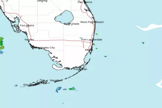 Miami FL Radar
 Southeast Radar