Bonita Beach to Englewood FL out 20 - 60 NM Marine Forecast
| Today...Southeast Winds 5 To 10 Knots. Seas 1 Foot Or Less. Wave Detail: Southeast 1 Foot At 4 Seconds. |
| Tonight...South Winds 5 To 10 Knots, Becoming Southeast 10 To 15 Knots With Gusts Up To 20 Knots After Midnight. Seas 1 Foot Or Less, Then Around 2 Feet After Midnight. Wave Detail: South 1 Foot At 5 Seconds, Becoming South 2 Feet At 4 Seconds. |
| Thursday...South Winds 5 To 10 Knots. Seas Around 2 Feet. Wave Detail: South 2 Feet At 5 Seconds. |
| Thursday Night...South Winds 5 To 10 Knots. Seas Around 2 Feet. Wave Detail: Southeast 2 Feet At 5 Seconds. |
| Friday...Southwest Winds 5 To 10 Knots. Seas Around 2 Feet. Wave Detail: South 2 Feet At 5 Seconds. |
| Friday Night...West Winds 5 To 10 Knots. Seas Around 2 Feet. Wave Detail: Southwest 2 Feet At 4 Seconds. A Slight Chance Of Thunderstorms. A Slight Chance Of Showers In The Evening, Then A Chance Of Showers After Midnight. |
| Saturday...Northwest Winds Around 10 Knots. Seas Around 2 Feet. A Slight Chance Of Thunderstorms. A Chance Of Showers, Mainly In The Morning. |
| Saturday Night...Northwest Winds Around 10 Knots. Seas Around 2 Feet. |
| Sunday...Northeast Winds Around 10 Knots, Diminishing To Around 5 Knots In The Afternoon. Seas Around 2 Feet. Winds And Seas Higher In And Near Thunderstorms. |
| Area Forecast Discussion National Weather Service Tampa Bay Ruskin FL 908am EDT Wednesday May 8 2024 ...New Issued at 906am EDT Wednesday May 8 2024 Another clear and mild morning across West Central Florida. We will once again see dry conditions and temperatures warming up quickly. Highs are expected to get into the mid to upper 90's in the interior of the state. No changes needed to the forecast at this time. Issued at 331am EDT Wednesday May 8 2024 Today and Thursday, high pressure will dominate the weather pattern, with broad ridging building in over the eastern Gulf of Mexico and Florida Peninsula, and a strong surface ridge extending from the Atlantic across central Florida. This stacked ridging will favor warm and dry conditions, with afternoon high temperatures running several degrees above normal, and rain free conditions holding. Apart from the heat, the main weather concern will be for some patchy fog this morning over the Nature Coast. On Friday, a shortwave trough will swing through the northeastern US, followed quickly by another shortwave Saturday night and Sunday. At the surface, this will result in a cold front pushing into northern Florida Friday and temporarily stalling out, then getting a secondary push Saturday and Saturday night to clear the forecast area. This will cause increasing rain chances early Friday through Saturday morning, then drier air fills in for the rest of the weekend. The frontal boundaries will also moderate temperatures. Monday and Tuesday, another shortwave will eject out of the southern plains and into the southeastern US, allowing a surface low to develop over the northern Gulf of Mexico. Southerly low level flow ahead of this system will result in building moisture and increasing rain chances Monday and Tuesday. Marine Issued at 331am EDT Wednesday May 8 2024 Atlantic high pressure will ridge into the eastern Gulf of Mexico through Thursday night, with south and southeast flow less than 15 knots, turning onshore with the afternoon seabreeze. Dry air will prevent significant rain chances. The ridge will shift south Friday through the weekend as a couple of fronts push southeast into the waters. This will result in winds briefly increasing on Friday to around Exercise Caution levels and turning to westerly and then northerly. Rain chances will also increase on Friday and Saturday with the frontal passages. Fire Weather Issued at 331am EDT Wednesday May 8 2024 Relative humidity will drop to near critically low levels this afternoon. Even drier air is forecast to fill in on Thursday afternoon with a few hours of relative humidity percentages below 35 expected over the interior. However, wind speeds are not forecast to be fast enough to cause Red Flag conditions. Sea Breeze Thunderstorm Regime For Wednesday: 4 Sea Breeze Thunderstorm Regime For Thursday: 5 For additional information on sea breeze regimes, go to: https://www.weather.gov/tbw/ThunderstormClimatology NOAA Tampa FL Office: Watches - Warnings - Advisories FL...None. Gulf waters...None. |
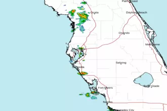 Tampa Bay FL Radar
 Gulf Radar