Calcasieu Lake Marine Forecast
| Today...South Winds Around 10 Knots. Lake Waters Light Chop. Areas Of Dense Fog Early This Morning. |
| Tonight...South Winds Around 10 Knots. Lake Waters Light Chop. Patchy Fog. |
| Thursday...South Winds 5 To 10 Knots. Lake Waters Light Chop. Patchy Fog In The Morning. |
| Thursday Night...Southeast Winds 5 To 10 Knots. Lake Waters Light Chop. A Slight Chance Of Showers And Thunderstorms In The Evening. |
| Friday...Northeast Winds 5 To 10 Knots. Lake Waters Light Chop. |
| Friday Night...Northeast Winds 5 To 10 Knots. Lake Waters Light Chop. |
| Saturday...East Winds 10 To 15 Knots. Lake Waters Choppy. |
| Saturday Night...Southeast Winds 5 To 10 Knots. Lake Waters Light Chop. A Slight Chance Of Showers And Thunderstorms After Midnight. |
| Sunday...East Winds 10 To 15 Knots. Lake Waters Choppy. A Chance Of Showers And Thunderstorms. |
| Sunday Night...Southeast Winds 10 To 15 Knots. Lake Waters Choppy. A Chance Of Thunderstorms. A Chance Of Showers. Winds And Waves Higher In And Near Thunderstorms. |
| Area Forecast Discussion National Weather Service Lake Charles LA 651am CDT Wednesday May 8 2024 Long Term (Saturday through Wednesday) Issued at 400am CDT Wednesday May 8 2024 As the period kicks off on Saturday, conditions will still be quite pleasant. The area of high pressure will be centered over the Southern Plains with northwesterly flow aloft. This pattern will change going into Sunday. The high pressure will slip off to the east allowing for southerly flow to return. Additionally, we will see a series of disturbances move across the area, leading to showers and storms picking up. Going into Monday, an upper level trough will exit the Rockies, moving into the Central Plains with a warm front slowly lifting into our Gulf waters. Widespread precipitation is expected to ramp up over the day and heavy rainfall can be expected. Part of our area is in a Slight to Marginal risk for excessive rainfall. Model guidance is still a bit murky in the extended period, especially in regard to where the upper level trough will be early to mid next week. If it is slower to move off to the east, we could see an additional days of scattered precip. Temperatures will rise slowly but will be near our normals for this time of year with MaxTs in the 80s and MinTs in the 60s. Stigger/87 Marine Issued at 400am CDT Wednesday May 8 2024 A light to moderate onshore flow and seas with seas 2 to 3 feet will prevail through Thursday. Areas of light fog/haze will continue over the coastal waters through late morning, improving briefly this afternoon before redeveloping early this evening into Thursday. A cold front will push through the coastal waters Thursday night accompanied by isolated showers and thunderstorms. Offshore flow will develop behind the front Friday and Saturday. Onshore flow becomes reestablished Sunday as high pressure slides east of the area. Precipitation chances will also increase again Sunday and Monday as a series of upper level disturbance moves across the area. NOAA Lake Charles LA Office: Watches - Warnings - Advisories LA...None. TX...None. GM...None. |
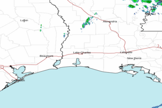 Lake Charles LA Radar
 Gulf Radar