Cameron, LA to High Island, TX Marine Forecast
| Tonight...South Winds 10 To 15 Knots. Seas 2 To 3 Feet. Wave Detail: South 2 Feet At 5 Seconds. Areas Of Fog Early This Evening, Then Patchy Fog Late This Evening And Overnight. |
| Wednesday...South Winds 10 To 15 Knots With Gusts Up To 20 Knots. Seas 2 To 3 Feet. Wave Detail: South 3 Feet At 6 Seconds. Areas Of Fog In The Morning, Then Patchy Fog In The Afternoon. |
| Wednesday Night...South Winds 15 To 20 Knots, Diminishing To 10 To 15 Knots After Midnight. Seas 2 To 3 Feet. Wave Detail: South 3 Feet At 6 Seconds. Patchy Dense Fog In The Evening. Widespread Dense Fog After Midnight. |
| Thursday...Southeast Winds 10 To 15 Knots. Seas 2 To 3 Feet. Wave Detail: South 3 Feet At 7 Seconds And Southeast 2 Feet At 4 Seconds. |
| Thursday Night...South Winds 10 To 15 Knots With Gusts Up To 20 Knots, Becoming Northwest 5 To 10 Knots After Midnight. Seas 2 To 3 Feet. Wave Detail: Southeast 3 Feet At 4 Seconds And South 3 Feet At 7 Seconds. A Slight Chance Of Showers And Thunderstorms. |
| Friday...North Winds 15 To 20 Knots, Diminishing To 10 To 15 Knots In The Afternoon. Seas 2 To 4 Feet. Wave Detail: North 3 Feet At 4 Seconds And South 2 Feet At 7 Seconds. |
| Friday Night...North Winds Around 15 Knots With Gusts Up To 20 Knots. Seas 2 To 3 Feet. |
| Saturday...Northeast Winds 10 To 15 Knots, Becoming East In The Afternoon. Seas 2 To 3 Feet. |
| Saturday Night...Southeast Winds Around 10 Knots. Seas Around 2 Feet. |
| Sunday...East Winds 10 To 15 Knots. Seas Around 2 Feet. A Slight Chance Of Showers In The Morning, Then A Chance Of Showers With A Slight Chance Of Thunderstorms In The Afternoon. |
| Sunday Night...Southeast Winds 10 To 15 Knots. Seas 2 To 3 Feet. A Slight Chance Of Showers And Thunderstorms In The Evening, Then A Chance Of Showers And Thunderstorms After Midnight. Winds And Seas Higher In And Near Thunderstorms. |
| Area Forecast Discussion National Weather Service Lake Charles LA 1127pm CDT Tuesday May 7 2024 Long Term (Friday through next Monday) Issued at 307pm CDT Tuesday May 7 2024 Longterm period starts off fairly dry behind a passing cool front and under increasing heigheights aloft. The ridging that does build in Friday and Saturday will be weak, but combined with slightly drier airmass, no rain chances are anticipated on these days. Surface high pressure ridge moves to the east on Sunday allowing for return flow and meager rain chances during the afternoon in western zones. Best chance for showers and thunderstorms occurs on Monday and again Tuesday with the arrival of a series of shortwave trough. over the region. Broad lift ahead of trough.ng will lift a warm front into coastal areas Monday; widespread convection is expected throughout the remainder of the day. Fcst CAPE profiles look very meager on globals, pointing to warm cloud layer processes and very efficient rainfall under forcing from the trough (forecast PWATs (Precipitable Waters) well above 1.75 inches once again). So long as precipitation remains progressive and we get a downpour that moves along quickly, flooding concerns will be lower than previous weeks. All concerned parties should monitor the forecast for any changes in the coming days. Rain chances pick up oncemore on Tuesday with another weak shortwave pulse moving over the coastal warm front. Thanks to rain-cooled airmass and ambient cloud cover, temperatures will be held in check through the longterm. High temps in the lower 80s are on tap. 11/Calhoun Marine Issued at 307pm CDT Tuesday May 7 2024 High pressure at the surface off the southeast US coast will ridge into the coastal waters over the next couple of days, and this will allow light to moderate onshore flow with mainly low to modest seas to continue. Late Thursday, a surface front will move through the coastal waters with a few showers or storms. A moderate offshore flow will then develop behind the front for Friday into the weekend. NOAA Lake Charles LA Office: Watches - Warnings - Advisories LA...None. TX...None. GM...None. |
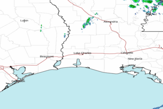 Lake Charles LA Radar
 Gulf Radar