Cape Henlopen to Fenwick Island DE out 20 nm Marine Forecast
| Today...S Winds Around 10 Kt. Seas 2 To 3 Ft. Wave Detail: S 2 Ft At 6 Seconds And E 2 Ft At 11 Seconds. Areas Of Fog Early This Morning. A Slight Chance Of Showers And Tstms Early This Morning, Then A Chance Of Showers With A Slight Chance Of Tstms Late This Morning. Vsby 1 To 3 Nm Early This Morning. |
| Tonight...Sw Winds 5 To 10 Kt. Seas 2 To 3 Ft. Wave Detail: S 2 Ft At 6 Seconds And E 2 Ft At 11 Seconds. |
| Thu...S Winds 5 To 10 Kt, Becoming E 10 To 15 Kt With Gusts Up To 20 Kt In The Afternoon. Seas 2 To 3 Ft. Wave Detail: S 2 Ft At 5 Seconds And E 2 Ft At 10 Seconds. A Chance Of Showers In The Morning, Then Showers In The Afternoon. |
| Thu Night...E Winds 10 To 15 Kt With Gusts Up To 20 Kt, Becoming Ne 5 To 10 Kt After Midnight. Seas 2 To 4 Ft. Wave Detail: S 3 Ft At 6 Seconds And E 1 Foot At 10 Seconds. Showers With A Chance Of Tstms In The Evening, Then A Chance Of Showers After Midnight. |
| Fri...Ne Winds 10 To 15 Kt. Seas 2 To 4 Ft. Wave Detail: Nw 3 Ft At 6 Seconds And E 2 Ft At 10 Seconds. A Chance Of Showers In The Afternoon. |
| Fri Night...N Winds 10 To 15 Kt With Gusts Up To 20 Kt. Seas 3 To 4 Ft. Wave Detail: Nw 2 Ft At 6 Seconds And Ne 2 Ft At 7 Seconds. A Chance Of Showers In The Evening. |
| Sat...Nw Winds 10 To 15 Kt, Becoming S In The Afternoon. Seas 2 To 4 Ft. |
| Sat Night...S Winds Around 10 Kt. Seas 2 To 4 Ft. A Chance Of Showers. |
| Sun...W Winds Around 10 Kt. Seas 2 To 4 Ft. A Chance Of Showers In The Morning. |
| Sun Night...W Winds Around 10 Kt. Seas 2 To 3 Ft. Winds And Seas Higher In And Near Tstms. |
| Area Forecast Discussion National Weather Service Mount Holly NJ 540am EDT Wednesday May 8 2024 Synopsis An area of low pressure tracks by to our north early this morning. This will be followed by a stronger area of low pressure moving across the region Thursday. This low will track east of the area Friday with additional upper level disturbances tracking through the area this weekend. A warmer, drier pattern looks to return early next week. Near Term - Through Thursday 540 AM...As of early this morning, a warm front associated with an area of low pressure over the Great Lakes has lifted north of the region placing us in the system's warm sector. Meanwhile, a weakening area of showers and storms is beginning to move into our eastern PA zones. Expect that this will be moving through the I-95 corridor including the Greater Philadelphia area around the 7-8am time frame. No severe weather is expected but storms could produce locally gusty winds and heavy rainfall that could bring a quick quarter to to half inch of rain in spots. Also, the timing of this is not ideal since it will be right around the morning commute. The good news is that the precipitation will be moving through pretty quickly and be out of the area by around mid morning as it moves off the coast. Otherwise, the clouds will diminish by the afternoon allowing temperatures to rise quite a bit. Highs will be the warmest of the week, with temperatures ranging from the upper 70s well north and west to the mid to upper 80s south away from the cooler waters. It will become breezy with southwest to west winds gusting 20-25 mph. Earlier it had looked like we could see some additional isolated storms in the afternoon but at this point it looks quite dry through the column so we keep afternoon POPs below 15 percent. That said, if something did manage to form it could produce gusty winds given inverted-V soundings. As we head into tonight, initial area of low pressure continues moving east off the coast of New England and out to sea. This will push a weak cold front offshore through the evening. Meanwhile by the overnight period the next wave of low pressure will be approaching as it moves eastward through the midwestern states and this will start to push the front back to the north as a warm front. Clouds will once again be on the increase by the late overnight and it's possible we could see some showers start to enter the region towards dawn, however the trend has been slower with these arriving later. Expect lows ranging from the 50s north to the low 60s south. Thursday is still shaping up to be more unsettled as this next area of low pressure referenced above moves across the region bringing additional rounds of showers and storms. What's worth noting though is that the model guidance continues to trend farther south with the track of this system...likely tracking the low east through Delmarva or perhaps even slightly to the south of here. This should tend to limit the threat for severe weather Thursday afternoon to Delmarva and perhaps extreme SE PA and southern NJ. Confidence on exactly where this threat sets up though is still not that high as there could be further changes to the track of the low. If it keeps trending farther south, this could keep the severe weather threat even south of Delmarva while a trend back to the north would allow the warm front to get farther north into PA and NJ leading to a more expansive severe threat. Right now the Storm Prediction Center has Delmarva in a SLIGHT risk for severe storms for Thursday with a narrow area of a MARGINAL risk north of here clipping SE PA and southern NJ. One thing to point out though is that both speed and directional shear will be quite strong near the track of the low so if there is enough instability that makes it into the area, all threats will be on the table...Damaging winds, large hail, and even the potential for a tornado or two. The clouds and showers/storms will keep it cooler for Thursday with highs generally in the 70s. Short Term - Thursday Night Through Friday Night With an overall slower trend with the system, showers/storms could last through a good portion of Thursday night (PoPs mainly 55-65 percent) although any severe weather threat should diminish through the nighttime hours with the loss of daytime heating. Lows generally in the low 50s. On Friday, our earlier low pressure will track east of the region while an upper level trough axis lags behind and pushes through the mid Atlantic. This will keep chances for showers in the forecast, especially north (POPs ranging from around 40 percent south to 60 percent north), under generally overcast skies. It will also be cooler with highs mostly in the upper 50s to mid 60s. Shower chances continue into Friday night but should gradually diminish as the upper level trough pushes through later overnight. Lows mainly in the mid-upper 40s. Long Term - Saturday Through Tuesday In the big picture, the weather pattern will remain on the unsettled side through the weekend as a long wave upper level trough lingers in the east. This should be followed by a drying trend into early next week. Heading into Saturday, chances for showers diminish, as the initial shortwave trough moves out and shortwave ridging builds in briefly for a time. However by late day the next disturbance will be approaching and this could bring some more showers back into the region, especially over eastern PA. So we keep the mention of shower chances in the forecast but POPs are generally only in the 20 to 30 percent range. Expect highs mainly in the 60s under a mix of sun and clouds so certainly not a washout. A better chance for showers arrives Saturday night into Sunday as the next shortwave trough swings through (POPs 30 to 50 percent) and there will also be more in the way of cloud cover. Finally by early next week it should start to trend warmer (highs mainly in the upper 70s) and drier (PoPs generally less than 25 percent) as the upper trough moves out and the flow over the east becomes more zonal. Marine Conditions will remain below Small Craft Advisory levels through the day today but expect some fog over the waters through the first part of this morning...especially off the coast of southern NJ and Delaware. The fog should diminish by later in the morning as some showers move over the waters. It will be quiet on the waters tonight but then expect more rounds of showers with some storms as well during the day Thursday as the next low approaches. East winds increase through the day to around 15 gusting 20 to 25 knots by late day. Seas should generally be around 3 feet through today and Thursday. Outlook... Thursday night through Sunday...Overall, mainly sub-SCA (Small Craft Advisory) conditions expected through the period but winds and seas may briefly increase to around 20-25 knots and 4-5 feet, most likely later in the day on Friday. Tides / Coastal Flooding Tidal ranges increasing this week with the new moon on Tuesday evening. Limited onshore flow means that there won't be much in the way of serious flooding concerns, but still another round of widespread minor coastal flooding is expected for Atlantic coastal zones, the Delaware Bay, and the tidal Delaware River with the high tide cycle tonight. Therefore, another Coastal Flood Advisory is in place for these areas as a result. Additional rounds of minor coastal flooding remain possible with the evening/overnight high tides through the end of the week. Flooding is not expected for our Maryland zones along the Chesapeake. |
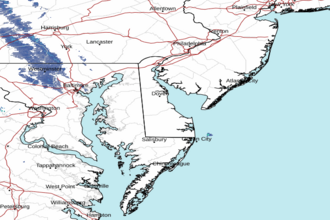 Dover DE Radar
 Northeast Radar