Cape Shoalwater WA to Cascade Head OR out 10 NM Marine Forecast
| Rest Of Today...Sw Wind 5 Kt. Wind Waves Sw 1 Ft At 4 Seconds. Nw Swell 2 Ft At 9 Seconds. Widespread Dense Fog In The Morning. Areas Of Dense Fog In The Afternoon. |
| Tonight...Nw Wind To 5 Kt. Wind Waves Nw 1 Ft At 4 Seconds. Nw Swell 2 Ft At 9 Seconds. Areas Of Dense Fog In The Evening. Patchy Dense Fog After Midnight. |
| Wed...N Wind 5 To 10 Kt. Wind Waves N 1 Ft At 4 Seconds. Nw Swell 2 Ft At 9 Seconds. |
| Wed Night...N Wind 5 To 10 Kt. Wind Waves N 2 Ft At 4 Seconds. Nw Swell 3 Ft At 9 Seconds. |
| Thu...Ne Wind To 5 Kt, Backing To Nw In The Afternoon. Wind Waves Ne 1 Ft At 4 Seconds, Shifting To The Nw At 4 Seconds In The Afternoon. Nw Swell 3 Ft At 10 Seconds. |
| Thu Night...Nw Wind 5 Kt. Wind Waves N 1 Ft At 4 Seconds. Nw Swell 3 Ft At 10 Seconds. |
| Fri...Nw Wind 5 To 10 Kt. Wind Waves 2 Ft. Nw Swell 4 Ft. |
| Sat...Nw Wind 5 To 10 Kt. Wind Waves 2 Ft. Nw Swell 4 Ft. |
| Area Forecast Discussion National Weather Service Portland OR 1050am PDT Wednesday May 8 2024 Updated Aviation discussion Synopsis High pressure will build across the region into the upcoming weekend, resulting in a prolonged period of dry weather with rapidly warming temperatures. Near record breaking heat is in store Friday and Saturday with widespread highs between 85-91 degrees across inland valleys. Offshore flow transitions back onshore Sunday, resulting in slightly cooler temperatures. There is no precipitation in the forecast over the next week. Wednesday through Tuesday night...After a chilly start to the day with areas of early morning frost in outlying rural areas, temps will quickly rebound Wednesday afternoon. Given plenty of strong May sunshine and 850 mb temps around +6C, expect high temps near 70 degrees over the Portland metro and mid to upper 60s over the Cowlitz Valley and central/southern Willamette Valley. Despite plenty of sun at the coast as well, light onshore flow during the afternoon will prevent highs from warming much beyond 58-61 degrees according to the latest iteration of the NBM. Suspect highs at the coast will occur during the late morning/early afternoon before a sea breeze develops and brings temps down a bit. Temps will rapidly warm across the region Thursday into the weekend as high pressure strengthens aloft and low-level offshore flow develops. The latest suite of model ensemble guidance remains in excellent agreement regarding exact temps, which is reflected well on the NBM 1D Viewer's box and whisker plots for forecast highs (the model spread is extremely small with the NBM 10-90th percentile only differing by three to four degrees or so). This means confidence is high in regards to the temperature forecast. So, how warm will it get? Given low-level offshore flow will be ramping up Thursday with 850 mb temps warming to +10 to +12C by Thursday afternoon, would expect widespread high temps in the low 80s over inland valley. The latest NBM probabilistic data still shows a 60-85% chance of reaching 80 degrees or warmer for the entire Willamette Valley, with chances exceeding 90% for the lowlands of the Portland metro area. Temps will warm even more Friday and Saturday as strong ridging settles in, resulting in widespread highs in the mid to upper 80s (except around 90 degrees over the Portland metro). Even portions of the coast have a shot at reaching 80 degrees on Friday (50-70% chance along the central coast, 10-30% north coast). Will need offshore winds at the coast for most of the day for this to occur, and it is not yet clear where the exact placement of the thermal trough will be (slightly offshore versus hugging the coastline versus slightly inland). Regardless of the outcome, the coast will certainly be cooler Saturday when compared to Friday as the thermal trough will almost certainly shift farther inland by then. More widespread cooling is likely on Sunday as the thermal trough focuses in on the Columbia Basin and pulls onshore flow all the way to the Cascades. The marine layer will likely remain too shallow for much in the way of morning cloudiness inland through Sunday, but the upper ridge may weaken enough for some low clouds to push into the inland valleys for a few hours Monday morning. Cannot rule out patchy light drizzle at the coast Monday morning as well. The unseasonably warm temperatures will no doubt cause some people to flock to the rivers, lakes, and ocean beaches of SW Washington and NW Oregon. It is important to remember that rivers and lakes remain dangerously cold with water temperatures mainly in the 40s. Such temperatures can easily cause cold water shock for those without proper cold water gear. The bright sun and warm temperatures can make the cold water look refreshing, but the consequences of jumping in could be deadly. Be sure to bring a life vest and be extremely cautious around area rivers, especially given the swift currents also in place. Temps will likely cool back to seasonable normals early next week, but conditions are still likely to trend dry as Probability of Precipitation are generally <15%. -TK/Weagle/HEC Marine High pressure is beginning to build across the waters, bringing more tranquil weather. Winds turn northerly as high pressure persists offshore and the thermal trough strengthens along the CA/OR coast. This summer like pattern will bring breezy north winds with gusts to 30 kt on Wednesday. Small Craft Advisory remains on track for Wednesday afternoon through Wednesday night. Winds ease somewhat Thursday morning, before pressure gradients strengthen again through Thu evening. /DH NOAA Portland OR Office: Watches - Warnings - Advisories OR...None. WA...None. PZ...Small Craft Advisory from 2pm this afternoon to 2am PDT Thursday for PZZ251-271. Small Craft Advisory until 5am PDT Thursday for PZZ252-253-272- 273. |
 Portland OR Radar
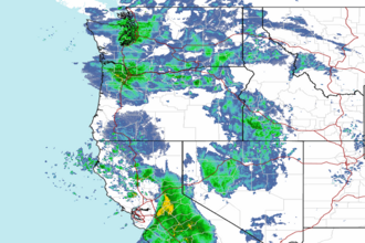 Northwest Radar