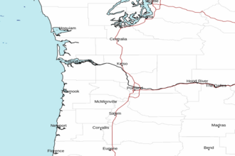
Cascade Head to Florence, OR out 10 NM Marine Forecast
| Rest Of Today...Sw Wind To 5 Kt. Wind Waves Sw 1 Ft At 4 Seconds. Nw Swell 2 Ft At 9 Seconds. Widespread Dense Fog And A Chance Of Showers In The Morning, Then Areas Of Dense Fog In The Afternoon. |
| Tonight...N Wind To 5 Kt. Wind Waves N 1 Ft At 4 Seconds. Nw Swell 3 Ft At 9 Seconds. Areas Of Dense Fog In The Evening. Patchy Dense Fog After Midnight. |
| Wed...N Wind 5 Kt. Wind Waves N 1 Ft At 4 Seconds. Nw Swell 3 Ft At 9 Seconds. Patchy Dense Fog In The Morning. |
| Wed Night...Nw Wind 5 Kt. Wind Waves W 1 Ft At 4 Seconds. Nw Swell 3 Ft At 9 Seconds. |
| Thu...Se Wind 5 Kt, Veering To W In The Afternoon. Wind Waves Se 1 Ft At 4 Seconds, Shifting To The W At 4 Seconds In The Afternoon. Nw Swell 3 Ft At 10 Seconds. |
| Thu Night...N Wind 5 To 10 Kt. Wind Waves N 1 Ft At 4 Seconds. Nw Swell 3 Ft At 10 Seconds. |
| Fri...N Wind 5 To 10 Kt. Wind Waves 2 Ft. Nw Swell 3 Ft. |
| Sat...Nw Wind 5 To 10 Kt. Wind Waves 2 Ft. Nw Swell 4 Ft. |
| Area Forecast Discussion National Weather Service Portland OR 314pm PDT Wednesday May 8 2024 Synopsis A stout ridge of high pressure continues to build across the region the latter half of the week resulting in a prolonged period of dry weather and rapidly warming temperatures day to day. It still appears near record breaking heat is in store Friday into Saturday – daytime highs climb in the mid 80s to near 90 across the inland valleys. Cooler onshore flow returns Saturday night into Sunday resulting in slightly cooler temperatures for the early to middle portion of next week albeit still near to slightly above seasonal norms. .SHORT TERM...Tonight through Saturday...Visible satellite imagery this afternoon shows little in the way of cloud-cover thanks to the influence of a ridge of high pressure building over the far eastern Pacific. Tonight and Thursday night we’ll still need to keep our eye on pockets of fog developing near sunrise in some of the more sheltered locations across region particularly the central and south Willamette Valley due to light winds, clear skies, and lingering surface moisture however impacts should be rather negligible and localized. Going forward through Thursday and Friday the ridge will continue to amplify, tilting eastward into British Columbia and increasing offshore flow over the Pacific Northwest. Temperatures rapidly warm as a result with excellent agreement between deterministic and ensemble guidance into the weekend. Given the development of low-level offshore flow and surface thermal trough building overhead as well, confidence is very high(90-99%) in afternoon temperatures reaching into the upper 70s to low 80s across the inland valleys Thursday followed by another 6-10 degree jump into the mid/upper 80s to near 90 Friday. Temperatures across the Willamette Valley, SW Washington, and other inland valleys appear very similar on Saturday compared to the day prior (Friday) - both days present a 60-80% chance to break 90 degrees in the Portland/Vancouver Metro according to the NBM. The greatest uncertainty in the temperature forecast lies along the coast where low-level (925-850mb) offshore winds aided by down-sloping off the coast range will attempt to usurp any weak marine/sea-breeze influence intent on keeping afternoon high temperatures suppressed. Will need offshore surface winds at the coast for most of the day for this to occur, and the placement of the aforementioned thermal trough is still marginal for inland-like temperatures to extend this far westward. Should the axis thermal trough trend slight more offshore (current set- up hugs the coastline) temperatures would likely jump into the 80-85 range for many of the beaches south of Cape Falcon on Friday. Regardless of the outcome, the progression the thermal trough eastward and increasing westerly flow at the coast will almost certainly lead to cooling on Saturday when compared to Friday. These unseasonably warm temperatures will no doubt cause some people to flock to the rivers, lakes, and ocean beaches of SW Washington and NW Oregon. It is important to remember that rivers and lakes remain dangerously cold with water temperatures mainly in the 40s. Such temperatures can easily cause cold water shock for those without proper cold water gear. The bright sun and warm temperatures can make the cold water look refreshing, but the consequences of jumping in could be deadly. Be sure to bring a life vest and be extremely cautious around area rivers, especially given the swift currents also in place! -Schuldt Long Term Sunday through Wednesday...More widespread cooling is expected on Sunday as the ridge of high pressure withers in response to a weak upper-level shortwave pressing eastward towards the coast. The axis of the near surface thermal trough also shifts east of the Cascades into the Columbia Basin - widespread westerly onshore flow returns. The marine layer will likely remain too shallow for much in the way of morning cloudiness inland through Sunday, but the upper ridge may weaken enough for some low clouds to push into the inland valleys for a few hours Monday morning. Cannot rule out patchy light drizzle at the coast Sunday night into Monday morning as well, especially given the weak upper- level shortwave progressing overhead providing some added support. Beyond this point guidance is a little more uncertain resolving the large scale upper-level pattern. This is largely derived from the development of a second ridge of high pressure over the eastern Pacific although the exact longitudinal placement and amplification will heavily modulate temperatures by Tuesday and Wednesday. Around 40% of ensemble members favor a solution which brings a more amplified ridge overhead by the middle of the week allowing temperatures to climb back into at least the upper 70s to low 80s while 45% of members shunt the ridge further west to varying degrees - mostly dry with highs in the 60s to near 70 if this solution occurs. The remaining 15% dig a trough over WA/OR spelling the return of showers and cooler conditions. So the main takeaway is mostly dry and near to above normal temperatures remain favored(~85%) int the middle next week but we can’t completely rule out the off-chance(~15%) of a wetter pattern as of now. At least there will be plenty of sunshine and warm temperatures to enjoy before we make it to that juncture. -Schuldt Marine Strong high pressure is currently centered about 400 miles offshore while a thermally induced inverted trough of low pressure is hugging the coast along northern CA into southern OR. The tightened pressure gradients across the coastal waters will produce breezy northerly winds with gusts up to 30 kt through tonight, strongest south of Tillamook Bay. The northerlies ease somewhat on Thursday, but can expect gusts to 25 kt across much of the coastal waters south of Cape Falcon to return by Thu afternoon and into the evening. Winds ease further by Friday as high pressure weakens and shifts westward and the thermal trough extends just off the Oregon coast into SW Washington. This will also allow for a more offshore northeasterly wind Friday morning. Then, winds are expected to return N/NW around 10-20 kt through the remainder of the weekend. Seas will likely hover around 7 to 9 feet through the end of the week, and then to around 5 to 6 ft over the weekend. /DH NOAA Portland OR Office: Watches - Warnings - Advisories OR...None. WA...None. PZ...Small Craft Advisory from 4am to 8am PDT Thursday for PZZ210. Small Craft Advisory until 5am PDT Thursday for PZZ251-271. Small Craft Advisory until 11pm PDT Thursday for PZZ252-253. Small Craft Advisory until 5am PDT Friday for PZZ272-273. |
 Portland OR Radar
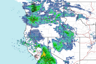 Northwest Radar