Chandeleur Sound Marine Forecast
| Rest Of Today...South Winds 15 To 20 Knots With Gusts Up To 25 Knots. Waves 2 To 4 Feet. |
| Tonight...South Winds 15 To 20 Knots With Gusts Up To 25 Knots. Waves 3 To 5 Feet. |
| Thursday...South Winds 10 To 15 Knots With Gusts Up To 20 Knots. Waves 2 To 3 Feet. A Slight Chance Of Thunderstorms In The Morning. |
| Thursday Night...Southwest Winds 10 To 15 Knots. Waves 2 To 3 Feet. A Slight Chance Of Thunderstorms In The Evening, Then A Chance Of Showers And Thunderstorms After Midnight. |
| Friday...West Winds 10 To 15 Knots, Becoming Northwest In The Afternoon. Waves Around 2 Feet. A Chance Of Showers And Thunderstorms, Mainly In The Morning. |
| Friday Night...North Winds 10 To 15 Knots, Becoming Northeast 15 To 20 Knots After Midnight. Waves 2 To 4 Feet. |
| Saturday...Northeast Winds 15 To 20 Knots, Becoming East 5 To 10 Knots In The Afternoon. Waves 2 To 4 Feet In The Morning, Then 1 Foot Or Less. |
| Saturday Night...South Winds 5 To 10 Knots, Becoming Northeast After Midnight. Waves 1 Foot Or Less. |
| Sunday...East Winds Around 10 Knots. Waves Around 2 Feet. A Slight Chance Of Showers. A Slight Chance Of Thunderstorms In The Afternoon. |
| Sunday Night...Southeast Winds 10 To 15 Knots. Waves 2 To 3 Feet. A Slight Chance Of Thunderstorms. A Slight Chance Of Showers In The Evening, Then A Chance Of Showers After Midnight. Winds And Waves Higher In And Near Thunderstorms. |
| Area Forecast Discussion National Weather Service New Orleans LA 352pm CDT Wednesday May 8 2024 ...New SHORT TERM, LONG TER Marine .SHORT TERM... (This evening through Thursday night) Issued at 321pm CDT Wednesday May 8 2024 The forecast for the rest of today looks to be on track with high temperatures sitting right around their peak for the day, in the upper 80s to lower 90s. Temperatures for tomorrow will be even warmer ahead of a cold front that will be approaching. NBM deterministic was running a touch warmer than MOS data and guidance, so ran the 50th percentile for MaxT's. This brings afternoon highs for tomorrow into the low to mid 90s for most of the CWA. Heading into Friday, bumped temperatures up a bit as the NBM seems to be banking on clouds sticking around longer than they look to. Still about a 5 degree "cooldown" from Thursday with temps in the mid to upper 80s. Now onto the main story of the short term period, tomorrow chance of severe weather. The northern half of our CWA (County Warning Area) is highlighted in a SLIGHT Risk by Storm Prediction Center for mainly wind and hail. Currently there is quite a bit of model discrepancies. Many of them show an MCS forming somewhere back in TX and they diverge from there. Most have this MCS (Mesoscale Convective System, a complex of thunderstorms which becomes organized on a scale larger than the individual thunderstorms) staying to our north, however as we have seen with past events until this system actually forms it can have a more north bias. So the 00z CAMs tonight and the 12z CAMs tomorrow morning will be very telling. For now didn't adjust Probability of Precipitation a ton, with them peaking in the early morning hours Friday. Taking a look at model soundings, one thing that will not be an issue is CAPE with ~3000-3500J/Kg available. There isn't much in the way of directional shear, but decent speed shear, so tornadoes are less of an issue for our area. 500mb temps are around -10C which isn't crazy but is plenty cold for us to have some large hail. Long Term (Friday through Tuesday night) Issued at 321pm CDT Wednesday May 8 2024 Long Term Saturday through mid-week... Saturday and most of Sunday, zonal flow will dominate the upper level pattern. Northerly surface winds during this time will help to suppress humidities and keep instability down, which will reduce PoPs. So, not much rain expected Saturday into Sunday morning. Temperatures will be fairly nice over the weekend with highs in the low to mid 80s Saturday and upper 70s to low 80s Sunday with lows in the low 60s. An upper level impulse moves through the area Sunday night into Monday morning with multiple small upper level impulses in close succession through the early part of next week. For the impulse moving into the area Sunday into Monday, southerly surface winds will help advect moisture and instability ahead of the system. The bulk of the best moisture and forcing looks to be for our northernmost areas, but that could definitely shift as things develop over the next few days. This is where there is some model uncertainty over the location of the highest rainfall/strong weather. This will hopefully become more clear in the coming days. As stated above, more upper level impulses will be influencing the area after Monday through the workweek. There is still a lot of model variability and uncertainty surrounding the strength of these troughs and timing. But it is becoming increasingly likely that we will see multiple rounds of rainfall Monday through Thursday of next week with near normal temperatures. More details will become a little more defined as we get toward the beginning of next week. MSW Marine Issued at 321pm CDT Wednesday May 8 2024 Flow will persist out of the southeast around 10 to 15 knots through the rest of today with some locally higher gusts, strengthening to 15 to 25 knots tonight into Thursday ahead of an approaching cold front. This brings a Small Craft Advisory that will be in effect overnight. The front will pass through the coastal waters Thursday night or early Friday. Winds then shift to the north and east to 10 to 15 Friday and Saturday. Seas will generally be between 1 and 3 feet over the period, but will briefly increase to 3 to 6 feet on Thursday. By Sunday, another area of low pressure will begin to approach the area and winds will turn easterly and then southerly ahead of this low. NOAA New Orleans LA Office: Watches - Warnings - Advisories LA...None. GM...Small Craft Advisory from 7pm this evening to 7am CDT Thursday for GMZ532-534-536-538-550-552-555-557-570-572-575-577. MS...None. GM...Small Craft Advisory from 7pm this evening to 7am CDT Thursday for GMZ534-536-538-550-552-555-557-570-572-575-577. |
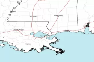 New Orleans LA Radar
 Gulf Radar