Chesapeake Bay from New Point Comfort to Little Creek VA Marine Forecast
| Rest Of Today...Nw Winds 25 To 30 Kt With Gusts Up To 40 Kt. Waves 4 To 5 Ft, Occasionally To 6 Ft. A Chance Of Snow Late This Morning. |
| Tonight...Nw Winds 30 To 35 Kt With Gusts Up To 45 Kt, Diminishing To 25 To 30 Kt With Gusts Up To 40 Kt After Midnight. Waves 5 To 6 Ft, Occasionally To 8 Ft. Light Freezing Spray. |
| Mon...Nw Winds 20 To 25 Kt With Gusts Up To 30 Kt, Becoming W 10 To 15 Kt With Gusts Up To 20 Kt In The Afternoon. Waves 3 To 4 Ft, Occasionally To 5 Ft. |
| Mon Night...Sw Winds 15 To 20 Kt With Gusts Up To 25 Kt. Waves 2 To 3 Ft. |
| Tue...W Winds 10 To 15 Kt, Becoming Sw 5 Kt In The Afternoon. Waves 1 To 2 Ft. |
| Tue Night...S Winds 5 To 10 Kt, Becoming Sw 10 To 15 Kt After Midnight. Waves 1 To 2 Ft. |
| Wed...Sw Winds 10 To 15 Kt With Gusts Up To 20 Kt. Waves 1 To 2 Ft. |
| Wed Night...Sw Winds 5 To 10 Kt With Gusts Up To 15 Kt, Becoming Nw After Midnight. Waves 1 Foot. |
| Thu...Se Winds 10 Kt, Becoming S 15 To 20 Kt In The Afternoon. Waves 1 To 2 Ft. |
| Thu Night...S Winds 20 To 25 Kt With Gusts Up To 30 Kt. Waves 4 To 5 Ft, Occasionally To 6 Ft. A Chance Of Rain In The Evening, Then Rain Likely After Midnight. |
| Area Forecast Discussion National Weather Service Wakefield VA 204pm EST Sunday Dec 14 2025 Synopsis Arctic air moves in behind a cold front this evening into tonight, and provides a cold start to the week. The very cold temperatures do quickly give way to relatively milder temperatures for the middle to end of this week. Near Term - Through Tonight As of 200pm EST Sunday... - Cold Weather Advisories remain in effect for the entire area for bitterly cold temps tonight/Monday morning with wind chills in the single digits. - There is a slight chance for a few bay effect snow showers on the Virginia Eastern Shore this evening-tonight. A strong upper trough continues to amplify over the eastern CONUS with an Arctic front now well to our south (though the strongest Cold Air Advection arrives this evening). The snow has ended, with totals of 1 to locally 2 inches from Caroline County, VA to the Lower MD Eastern Shore, with only a few tenths of an inch in the RIC Metro as the initial push of cold air this morning was not as strong as a lot of the models showed. Temperatures are only in the lower-mid 30s, with upper 20s at Cambridge/Salisbury. NW winds are gusting to 30-40 mph at this hour. The strongest push of Cold Air Advection arrives this evening, with much colder and drier air filtering in tonight. Winds will peak during the evening, with gusts of 30-45 mph (locally 45-50 mph on the VA Eastern Shore and in VA Beach/Eastern Currituck where Wind Advisories remain in effect). Mostly clear for the vast majority of the area tonight with lows in the mid teens for inland portions of the area and upper teens/around 20F at the coast. Wind Chills will be in the single digits across the entire FA. The Cold Weather Advisory issued remains unchanged since the initial issuance yesterday. Lastly, still can't rule out a few bay effect snow showers on the VA Eastern Shore between 7 PM-1 AM, which would only amount to a few tenths of an inch of accumulation in a high-end scenario. Short Term - Monday Through Wednesday As of 200pm EST Sunday... Key Messages: - Chilly and dry Monday and Monday night with a slow moderating trend beginning on Tuesday. Highs should reach the 50s by Wednesday. Strong Arctic high pressure behind the cold front builds into the area Monday as the upper trough moves well offshore. It will be pretty chilly on Monday with highs only in the mid 30s. The good news is that it will be mostly sunny and much less windy with the high overhead. The high shifts to our S or SE by Monday night, allowing the low-level flow to become light out of the south. Lows Monday night will be in the low to mid 20s for most, but some of the colder rural spots could see the upper teens. Temperatures start to moderate on Tuesday under mostly sunny skies. Forecast highs are in the upper 30s in the far NE and low to mid 40s elsewhere. Lows Tuesday night will be in the mid to upper 20s. The moderating trend continues on Wednesday (with dry weather expected) as the high shifts well offshore, upper heigheights rise, and the flow aloft becomes W-WSW. Highs on Wednesday will be in the lower-mid 50s. Long Term - Wednesday Night Through Saturday As of 200pm EST Sunday... Key Messages: - Much warmer temperatures (compared to the first half of December) continue on Thursday. - Another (weaker) cold front brings a good chance for showers Thursday night. Strong low pressure tracks well to our north Thursday night into Friday morning, which will drag another cold front through the area. Rather mild (especially considering how cold it has been) on Thursday with highs potentially reaching the lower-mid 60s over portions of the area. There is a good chance for showers along and ahead of the cold front Thursday evening into early Friday morning, and it looks like the area could see a widespread 0.25-0.5" of rain. In fact, the 12z global ensembles have high (80%+) probs of 0.1" and better than 50% probs for at least 0.25" of rain. Forecast highs on Fri are still in the 50s, but drop back off to around average by Saturday as high pressure returns. Marine As of 200pm EST Sunday... Key Messages: - Gale Warnings are in effect for all waters through Monday morning due to the strong northwest winds. - Light freezing spray is also possible tonight due to the cold air temperatures and strong winds. - Generally lighter winds are expected later Monday through the first part of Thursday, though occasional SCA (Small Craft Advisory) conditions are possible in the Chesapeake Bay. Winds rapidly increased across the local waters earlier this morning as a cold front moved through. As of this afternoon, winds remain elevated to 25-35 kt with gusts up to around 40 kt. Given the NNW wind direction, wind speeds are highest on the eastern shore of the Chesapeake Bay and over the ocean. Regardless, water conditions are chaotic and rough areawide and boaters should utilize extreme caution and/or consider rescheduling travel. Later this evening, a very strong push of cold air advection (with 850 mb temps as low as -20 C) overspreads the waters, with peak winds expected during this timeframe (roughly from 22z/5pm today through 06z/1am Monday morning). The current forecast shows peak winds of 30-35 kt (locally higher for the coastal waters S of Cape Charles), with wind gusts up to 45 kt. Some model guidance also suggests intermittent wind gusts to low-end storm force (45-50 kt) for a brief period after 00z/7 PM. Gale Warnings are in effect for all marine zones through early Monday morning, though winds will begin trending down as we approach daybreak. Lastly, light freezing spray is possible tonight as strong winds coincide with very cold air temperatures overspreading the area. However, water temperatures in the 40s to around 50 F should preclude moderate or heavy freezing spray. Elevated NNW/NW winds continue through the rest of Monday morning and SCAs (Small Craft Advisories) will be needed once the Gale headlines drop off. High pressure then quickly advances in by the later afternoon and evening hours of Monday and winds should become sub-SCA (Small Craft Advisory) by this time. As winds shift to the SW late Monday night, a brief uptick in wind speeds (from a transient low-level jet) could necessitate marginal SCA (Small Craft Advisory) headlines in the Chesapeake Bay and lower James River. With higher criteria on the ocean, SCAs (Small Craft Advisories) seem quite unlikely at this time. Beyond Monday night, much lighter winds make a return for Tuesday, followed by another increase in SW winds Tuesday night and Wednesday. Another strong cold front is forecast to approach the region Thursday, crossing the waters early Friday. SCAs (Small Craft Advisories) are likely in both the pre-frontal SW wind and post-fostal NW wind regimes Thursday night/Friday, with Gales possible in the northern coastal waters. Seas continue increasing into tonight, peaking at 6-10 ft (highest offshore and S of Cape Charles). Waves up to 5-6 ft are likely in the Chesapeake Bay, with 3-5 ft waves in the lower James River and 2- 3 ft waves in the upper rivers and Currituck Sound. Seas should subside below 5 ft by later Monday given the decreasing (and offshore) wind direction. NOAA Wakefield VA Office: Watches - Warnings - Advisories MD...Cold Weather Advisory from 7pm this evening to 9am EST Monday for MDZ021>025. NC...Cold Weather Advisory from 7pm this evening to 9am EST Monday for NCZ012>017-030>032-102. Wind Advisory until 7am EST Monday for NCZ102. VA...Cold Weather Advisory from 7pm this evening to 9am EST Monday for VAZ048-060>062-064>069-075>090-092-093-095>100- 509>525. Wind Advisory until 7am EST Monday for VAZ098>100. Marine Gale Warning until 7am EST Monday for ANZ630>638-650-652-654- 656-658. |
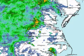 Wakefield Norfolk VA Radar
 Northeast Radar
 East Coast Satellite