Chesapeake Bay From Sandy Point to North Beach MD Marine Forecast
| Rest Of This Afternoon...W Winds 10 Kt With Gusts To 20 Kt. Waves 2 Ft. |
| Tonight...W Winds 5 To 10 Kt...Becoming N Late. Waves 1 Ft. |
| Thu...E Winds 5 To 10 Kt. Waves 1 Ft. Showers Likely With A Chance Of Tstms. |
| Thu Night...E Winds 5 To 10 Kt. Waves 1 To 2 Ft. A Chance Of Showers. |
| Fri...Ne Winds 5 To 10 Kt. Waves 2 Ft. A Chance Of Showers. |
| Fri Night...N Winds 10 Kt. Waves 1 To 2 Ft. |
| Sat...W Winds 5 To 10 Kt...Becoming S. Waves 1 Ft. A Chance Of Showers. |
| Sun...Nw Winds 5 To 10 Kt. Waves 1 To 2 Ft. A Chance Of Showers Through The Day, Then A Chance Of Showers And Tstms In The Evening. Winds And Waves Higher And Visibilities Lower In And Near Tstms. |
| Area Forecast Discussion National Weather Service Baltimore MD/Washington DC 309pm EDT Wednesday May 8 2024 Synopsis A backdoor cold front will move into northern areas tonight before stalling on Thursday. A second stronger cold front will move across the area Thursday night. A third cold front will move across the area early on Sunday. Near Term - Through Tonight Strengthening westerly flow has resulted in significant drying today with surface dewpoints having fallen from 66F this morning to 59F this past hour. Latest trends suggest that any convection would develop over extreme southern areas, more likely in Wakefied's area late this afternoon or early in the evening. It should remain quiet through midnight tonight. Overnight, strengthening warm air and moisture advection will lead to showers and possible thunderstorms across western areas spreading northeast toward daybreak. The risk of severe wx appears zero through 12Z Thursday. Short Term - Thursday Through Friday Night Showers and perhaps thunderstorms should be ongoing Thu morning driven by warm air and moisture advection atop a frontal zone. Additional showers and thunderstorms are anticipated during the afternoon and early evening driven by strengthening low-level convergence and height falls from approaching upper level trough from the NW. The severe risk for Thu has shifted considerably south from previous days and will likely be tied to where backdoor front is forecast to stall tomorrow or roughly I-64 corridor. All modes of severe weather appear possible, but the areal coverage should be confined to areas around Charlottesville and south of Fredericksburg. More showers appear likely Friday as upper trough crosses the area. Long Term - Saturday Through Wednesday Longwave troughing will persist over the Mid-Atlantic and Northeast states through the weekend before pushing offshore early next week. Saturday will start out dry in the wake of a departing shortwave trough pushing offshore. Skies should trend mostly sunny to mostly cloudy as the day progresses with the bulk of the cloud cover especially for the VFR conditions are expected to prevail through the weekend at all terminals. front half of the day confined to areas along and west of the Blue Ridge. As one shortwave trough departs, another will follow from the Ohio River Valley late Saturday night and into the day Sunday. Cloud cover will increase from west to east across the forecast area late Saturday afternoon and into Sunday. Precipitation chances will also increase as well with large scale ascent overspreading the region. The bulk of any shower or thunderstorm activity Saturday will mainly be confined along and west of the Blue Ridge during the morning and afternoon hours. This activity will spread eastward with time late Saturday into Sunday. Coverage will remain scattered across the area both days with more numerous to widespread activity Saturday night into Sunday as the upper trough axis passes overhead. With the added cloud cover and west to northwesterly flow expect weekend high temperatures in the upper 60s and low 70s. Low temperatures will fall back into the upper 40s and low to mid 50s. Rain chances finally decrease Monday as upper level troughing progresses east of the region. High pressure will briefly build over the region from the south before shifting offshore midweek. With the high shifting offshore Tuesday expect diurnal chances for showers and thunderstorms to return to the region. High temperatures Monday will reach into the low to mid 70s with mid to upper 70s expected on both Tuesday and Wednesday. Lows will remain in the upper 40s and low to mid 50s. Marine Possible SCA (Small Craft Advisory) conditions all weekend, but winds and waves could be higher near thunderstorms especially across southern waters. Low end SCA (Small Craft Advisory) level winds in west to southwest flow are expected Saturday before turning toward the northwest Sunday. SCA (Small Craft Advisory) level winds will continue into Monday especially over the open waters of the bay and tidal Potomac under southeasterly flow. Tides / Coastal Flooding Westerly winds should allow water levels to continue to decrease this afternoon and evening. Southerly winds late tonight into Thursday morning, will allow for the potential of additional minor flooding at most sensitive locations (i.e Annapolis, Straits Point, and DC Waterfront). Water levels will drop again late Thursday morning into Thursday evening as the flow turns to the west and eventually north/northeasterly direction. Additional minor flooding is possible at these same locations late Thursday night into early Friday morning as southwest flow returns. It's not until Sunday is when water levels should drop off with offshore northwest flow. NOAA Baltimore MD/Washington DC Office: Watches - Warnings - Advisories DC...None. MD...None. VA...None. WV...None. Marine Small Craft Advisory until 6pm EDT this evening for ANZ530>532-535-536-538>540. |
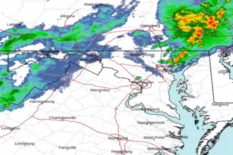 Baltimore/Washington Radar
 Northeast Radar
 East Coast Satellite