Coastal Waters out 25 NM South of Marthas Vineyard and Nantucket Marine Forecast
| Overnight...Sw Winds Around 5 Kt. Seas 2 To 3 Ft. Wave Detail: S 3 Ft At 7 Seconds And E 2 Ft At 11 Seconds. Patchy Fog. Vsby 1 Nm Or Less. |
| Wed...S Winds 5 To 10 Kt. Gusts Up To 20 Kt In The Afternoon. Seas 2 To 3 Ft. Wave Detail: S 3 Ft At 7 Seconds And E 2 Ft At 10 Seconds. Patchy Fog. A Chance Of Showers. Vsby 1 Nm Or Less. |
| Wed Night...Sw Winds 5 To 10 Kt, Becoming W After Midnight. Seas 2 To 3 Ft. Wave Detail: S 3 Ft At 7 Seconds And E 2 Ft At 10 Seconds. Patchy Fog In The Evening, Then Patchy Dense Fog After Midnight. A Chance Of Showers In The Evening. Vsby 1 Nm Or Less. |
| Thu...Nw Winds 5 To 10 Kt, Becoming Ne In The Afternoon. Seas 2 To 3 Ft. Wave Detail: S 3 Ft At 7 Seconds And N 1 Foot At 2 Seconds. Patchy Dense Fog In The Morning, Then Patchy Fog In The Afternoon. A Chance Of Showers In The Afternoon. Vsby 1 Nm Or Less, Increasing To 1 To 3 Nm In The Afternoon. |
| Thu Night...Ne Winds 10 To 15 Kt With Gusts Up To 25 Kt. Seas 2 To 4 Ft. Wave Detail: Ne 3 Ft At 4 Seconds And S 2 Ft At 7 Seconds. Patchy Fog. Showers Likely, Mainly In The Evening. Vsby 1 Nm Or Less, Increasing To 1 To 3 Nm After Midnight. |
| Fri...Ne Winds 10 To 15 Kt With Gusts Up To 25 Kt. Seas 3 To 5 Ft. Wave Detail: Ne 3 Ft At 4 Seconds And S 3 Ft At 8 Seconds. A Chance Of Showers. Patchy Fog In The Morning With Vsby 1 To 3 Nm. |
| Fri Night...Ne Winds 10 To 15 Kt With Gusts Up To 25 Kt. Seas 4 To 6 Ft. A Chance Of Showers. |
| Sat...Nw Winds 10 To 15 Kt With Gusts Up To 20 Kt. Seas 4 To 6 Ft. A Chance Of Showers. |
| Sat Night...Sw Winds Around 10 Kt With Gusts Up To 20 Kt. Seas 4 To 6 Ft. |
| Sun And Sun Night...S Winds 10 To 15 Kt With Gusts Up To 20 Kt. Seas 3 To 5 Ft. A Chance Of Showers. Seas Are Reported As Significant Wave Height, Which Is The Average Of The Highest Third Of The Waves. Individual Wave Heights May Be More Than Twice The Significant Wave Height. |
| Area Forecast Discussion National Weather Service Boston/Norton MA 954pm EDT Tuesday May 7 2024 Synopsis A warm front will bring a round of showers and isolated thunderstorms very late tonight and Wednesday. Chances for a few strong thunderstorms capable of producing hail in western MA/CT Wednesday afternoon. Periods of unsettled weather continue late this week into this weekend...but not expecting a washout either with extended periods of dry weather too. Overall...temperatures will average below normal late this week into the weekend. Milder/Seasonable temperatures should return early next week. Near Term - Until 6am Wednesday Morning 950 PM Stratus and fog confined to Cape/Islands tonight, and as previous forecaster indicated will not likely push much further N than the south coast given the WSW BL flow. No change in timing of warm frontal showers which will begin to move into western MA/CT toward daybreak and overspread rest of SNE after daybreak. Previous discussion... * Areas of low clouds/fog expand onto the south coast overnight * Showers/embedded t-storms approach western MA/CT near daybreak Areas of low clouds and fog were currently impacting Nantucket early this evening. Light southerly flow with the cooling boundary layer should allow the low clouds and fog to overspread areas near the south coast overnight. The low level flow will maintain a westerly component overnight...which should keep the bulk of the low clouds/fog from expanding much further north than a KPVD-KPYM line. The other concern will be shortwave energy/mid level warm front approaching from the west near daybreak Wednesday. This will be associated with a modest southwest LLJ and a pretty good instability burst. Showalter indices drop from nearly 10 to below zero Wednesday morning. There also a band of good lift/deeper moisture associated with the shortwave/mid level warm front. Therefore...while dry weather generally prevails overnight expect showers and possibly embedded t-storms with brief heavy rain to begin to impact western MA/CT near daybreak. This activity will then move across the region Wednesday morning which is discussed in the short term section. Overnight low temps will bottom out in the upper 40s to the middle 50s. Short Term - 6am Wednesday Morning Through Wednesday Night 350pm Update: Wednesday: Key Points... * Overcast with warm frontal showers spreading eastward during the morning to early afternoon hrs. Low chance of a rumble of thunder with this activity. * Better chance at a few strong t-storms later in afternoon (as soon as 2 PM, but more probable ~ 4-7 PM) from Worcester/NW RI westward into western MA/CT. Hail possible in the strongest of storms, which could reach up to 1 inch in diameter. Warm front then spreads showers eastward across the remainder of Southern New England during the morning hours, with continuing/residual showers around in eastern MA into the early afternoon. There is a modest decrease in Showalter indices to around 0 with this morning round of showers, and though I can't rule out a rumble of thunder with the morning warm frontal showers, in many cases it would be the exception vs the rule. This will lock in cloud cover and lead to cooler temperatures with little optimism for breaks in the cloud cover. With overcast here, expect highs to reach into the mid 50s to lower/mid 60s. For the mid to late afternoon...there are indications in a majority of guidance of some breaks in the cloud cover over western and central MA, northern CT and into portions of NW RI. As that occurs, a surge in 700-500 mb lapse rates 7.0-7.5 C/km advects over the aforementioned area, with a pocket of mid 50s to around 60 degree dewpoints in the lower Hudson Valley into western MA and portions of northern CT. With effective shear magnitudes around 40-50 kt, and with a narrow zone of frontal convergence with weak low pressure tracking up the CT Valley, we should see scattered t-storms develop in the lower Hudson Valley/Berkshires, moving ESE during the late- afternoon hours. MUCAPE values for the aforementioned area are forecast around 1000-1200 J/kg per the HREF, with a bullseye in max updraft progs over western and central MA, northern CT into northwest RI. It isn't clear if these storms would be surface- based here, but the steeper lapse rates aloft combined with effective shear magnitudes supporting organized updrafts could favor storms elevated above any surface stable layer/inversion. It's a setting which can yield storms capable of hail in strong storms, and per machine- learning progs from Colorado State and others, there is a lower probability that storms could produce hail satisfying severe criteria. Storm Prediction Center has a large portion of SNE in a Level 1 of 5/Marginal Risk for severe weather, though the best chance is for areas near and southwest of Worcester. Unless storms can become surface based, the primary convective threat would be from hailstones. Opted to include enhanced wording for small hail in thunderstorms encompassing this general area. The biggest uncertainties here are on the spatial coverage and timing of any t- storms, and if storms could become surface- based. Temps in interior MA/CT and northwest RI have a good chance at reaching into the mid 60s to lower 70s with any cloudy breaks. Wednesday Night: Weak low pressure initially near the Hudson Valley moves eastward early tomorrow night, with decreasing rain chances as it moves offshore. It's a pretty uncertain period though in the wake of this wave of low pressure; a number of model guidance wants to clear SNE out from cloud cover too, but with surface ridge nosing in from northern New England and light northerly winds cooling the PBL, I'm a little surprised the guidance is clearing things out to the degree it is. Pattern recognition seems to favor more cloud cover than the guidance is offering. I sided the official forecast more pessimistically, with cloud cover hanging tough and/or filling back in as the PBL cools off. Will be generally dry, but I think tomorrow night could feature a good amt of cloud cover and possible fog, too. Lows in the upper 40s to lower 50s. Long Term - Thursday Through Tuesday Key Points... * Another period of showers sometime later Thu into early Fri * Seasonable high temps away from coast Thu but quite cool on Fri * Relatively cool this weekend with another period of showers by Sun * Milder/more seasonable temps return early next week Details... Thursday and Thursday night... Enough subsidence behind Wednesday/s shortwave to result in mainly dry weather to start off the day on Thursday. However...another piece of shortwave energy will be approaching from the west later Thu and Thu night. So we expect more showers to arrive...but specific timing is uncertain. Right now thinking later Thu into Thu night...but this will need to be refined. High temps are tricky too...but we might have enough of a dry window during the first half of the day to allow highs to reach the 60s to perhaps near 70 in CT River Valley. It probably will be tough though to break 60 in the immediate coast with onshore flow. Friday... A couple waves of low pressure pass to our south on Friday. This generates an easterly flow of cool air into southern New England. High temps will probably be held mainly in the 50s on Friday. Thinking the main shower threat will be during the first part of the day, but perhaps trending drier for the second half of the day as the low pressure system moves east of the region. This Weekend... Upper trough sets up across our region this weekend. This will result in relatively cool/below normal high temps for most of the weekend along with onshore flow. Thinking is that highs will mainly be between 55 and 65...with the coolest of those readings on the immediate coast. It will also be a bit unsettled at times with the risk for some showers...but timing is uncertain and a washout is not expected. Current indications are that much of Sat may turn out dry with the better chance for some showers being sometime on Sun. Early Next Week The upper trough will push east of our region early next week. This should allow for rising height fields and seasonable high temperatures. Marine Forecaster Confidence Levels: Low - less than 30 percent. Medium - 30 to 60 percent. High - greater than 60 percent. Through Wednesday Night: High confidence. Winds and seas below SCA (Small Craft Advisory) thresholds through the period. Mainly easterly winds around 10-15 kt tonight into Wednesday; winds then turn WNW to NW at similar speeds for Wednesday night. Seas mainly 4 ft or less all waters. Fog is likely tonight over the southern waters. Periods of showers Wednesday, with possible embedded thunderstorms. Some storms could produce small hail and locally rough seas. Outlook /Thursday through Sunday/... Thursday: Winds less than 25 kt. Chance of rain showers, patchy fog. Local visibility 1 nm or less. Thursday Night: Low risk for Small Craft Advisory winds with gusts up to 25 kt. Areas of seas approaching 5 ft. Rain showers likely, patchy fog. Local visibility 1 to 3 nm. Friday: Moderate risk for Small Craft Advisory winds with gusts up to 30 kt. Seas up to 5 ft. Chance of rain showers. Friday Night through Saturday: Winds less than 25 kt. Seas up to 5 ft. Chance of rain showers. Saturday Night: Winds less than 25 kt. Seas up to 5 ft. Slight chance of rain showers. Sunday: Winds less than 25 kt. Areas of seas approaching 5 ft. Chance of rain showers. Tides / Coastal Flooding 950 PM We issued a coastal flood statement for the upcoming high tide as a near 1 ft surge may lead to pockets of splashover given high astronomical tides. Previous discussion... High astronomical tides coupled with onshore flow may result in some splashover/very minor coastal flooding late this week. However...wind/waves do not appear high enough to result in a significant issues. NOAA Boston MA Office: Watches - Warnings - Advisories CT...None. MA...None. RI...None. Marine None. |
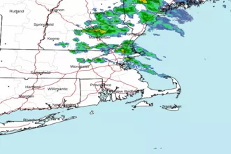 Boston MA Radar
 Northeast Radar
 East Coast Satellite