Deerfield Beach to Ocean Reef, FL Out 20 nm Marine Forecast
| Rest Of Today...E Se Winds 5 To 10 Kt. Seas 2 Ft Or Less. Wave Detail: E Se 2 Ft At 4 Seconds. Intracoastal Waters A Light Chop. |
| Tonight...Se Winds 10 To 15 Kt. Seas 2 Ft Or Less. Wave Detail: E Se 2 Ft At 4 Seconds. Intracoastal Waters A Moderate Chop. |
| Wed...E Se Winds 10 To 15 Kt. Seas 2 Ft Or Less. Wave Detail: Se 1 Foot At 4 Seconds. Intracoastal Waters A Moderate Chop. |
| Wed Night...Se Winds 10 To 15 Kt With Gusts To Around 20 Kt. Seas 2 Ft Or Less. Wave Detail: E Se 2 Ft At 4 Seconds. Intracoastal Waters A Moderate Chop. |
| Thu...S Se Winds 15 To 20 Kt. Seas 2 Ft Or Less. Wave Detail: Se 2 Ft At 4 Seconds. Intracoastal Waters A Moderate Chop. |
| Thu Night And Fri...S Sw Winds 15 To 20 Kt Along The Coast To S Sw 10 To 15 Kt With Gusts To Around 20 Kt In The Gulf Stream. Seas 2 Ft Or Less. Wave Detail: Se 2 Ft At 3 Seconds. Intracoastal Waters A Light Chop. |
| Fri Night...Sw Winds 10 To 15 Kt With Gusts To Around 20 Kt. Seas 2 Ft Or Less. Intracoastal Waters A Light Chop. A Slight Chance Of Showers After Midnight. |
| Sat...Sw Winds 10 To 15 Kt. Seas Less Than 2 Ft. Intracoastal Waters Light Chop. A Chance Of Showers With A Slight Chance Of Tstms. |
| Area Forecast Discussion National Weather Service Miami FL 700pm EDT Tuesday May 7 2024 Long Term (Wednesday night through next Monday) Issued at 241pm EDT Tuesday May 7 2024 The Atlantic ridge of high pressure will shift south as a frontal boundary associated with a low in northeastern Canada pushes into the Atlantic. This will lead to the surface ridge axis sitting over southern Florida from mid to late week period which will enable a warming trend over several days with widespread 90 degree temperatures save for sea breeze cooled areas closer to the coast. Some inland portions of South Florida could see temperatures reach into the upper 90s, particularly on Thursday and Friday. Rain chances will remain minimal, though some convection cannot be ruled out inland. The risk of heat illness will require monitoring Thursday through Saturday as heat index values start entering the triple digits. As drier air aloft mixes to the surface, relative humidity values across interior South Florida could drop into the upper 20 percent range on Thursday and Friday which could lead to enhanced fire weather conditions. Late in the week, the next frontal boundary will move across the southeastern United States but it will lack the support to clear South Florida. Increasing moisture will lead to more shower and thunderstorm activity through the weekend as the front settles over south central to southern Florida. Temperatures will cool slightly with the additional cloud cover and rainfall. Saturday could be more of a transition day where the temperatures could again reach well into the 90s, particularly over the east coast metro where the southwesterly to westerly wind flow and urban heat island could combine to present another day with a heat illness risk above normal for this time of year. Marine Issued at 1241pm EDT Tuesday May 7 2024 A gentle to moderate southeasterly wind flow will continue through the middle of the week across most of the local waters. The exception to this will be over the Gulf waters where winds may shift to the southwest in the afternoon as a Gulf breeze develops. Winds will gradually become south to southwesterly across all local waters heading towards the end of the week as a frontal boundary approaches from the north. Seas across the Atlantic waters will remain at 3 feet or less through the middle of the week while seas across the Gulf waters remain at 2 feet or less. Beaches Issued at 1241pm EDT Tuesday May 7 2024 The rip current risk will remain elevated throughout the rest of the week across the Atlantic Coast beaches with the highest chances of rip currents remaining over the Palm Beaches. NOAA Miami FL Office: Watches - Warnings - Advisories FL...High Rip Current Risk through Wednesday evening for FLZ168. High Rip Current Risk until 8pm EDT this evening for FLZ172-173. AM...None. GM...None. |
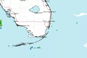
 Miami FL Radar
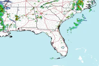
 Southeast Radar