Englewood to Tarpon Springs FL out 20 - 60 NM Marine Forecast
| Rest Of Tonight...South Winds Around 5 Knots, Becoming Southeast Late. Seas Around 2 Feet. Wave Detail: South 1 Foot At 5 Seconds. |
| Wednesday...South Winds 5 To 10 Knots. Seas Around 2 Feet. Wave Detail: South 2 Feet At 4 Seconds. |
| Wednesday Night...South Winds 5 To 10 Knots, Increasing To 10 To 15 Knots With Gusts Up To 20 Knots After Midnight. Seas Around 2 Feet. Wave Detail: South 2 Feet At 5 Seconds. |
| Thursday...South Winds 10 To 15 Knots. Seas Around 2 Feet. Wave Detail: South 2 Feet At 5 Seconds. |
| Thursday Night...South Winds Around 10 Knots. Seas Around 2 Feet. Wave Detail: South 2 Feet At 5 Seconds. |
| Friday...Southwest Winds Around 10 Knots. Seas Around 2 Feet. Wave Detail: Southwest 2 Feet At 4 Seconds. |
| Friday Night...West Winds 10 To 15 Knots With Gusts Up To 20 Knots. Seas Around 2 Feet. A Chance Of Showers With A Slight Chance Of Thunderstorms. |
| Saturday...Northwest Winds Around 10 Knots. Seas 2 To 3 Feet. A Slight Chance Of Thunderstorms. A Chance Of Showers, Mainly In The Morning. |
| Saturday Night...Northwest Winds Around 10 Knots. Seas Around 2 Feet. |
| Sunday...North Winds 5 To 10 Knots. Seas Around 2 Feet. |
| Sunday Night...North Winds 5 To 10 Knots. Seas Around 2 Feet. A Slight Chance Of Showers And Thunderstorms After Midnight. Winds And Seas Higher In And Near Thunderstorms. |
| Area Forecast Discussion National Weather Service Tampa Bay Ruskin FL 831pm EDT Tuesday May 7 2024 Issued at 154pm EDT Tuesday May 7 2024 Minimal changes to the pattern for the next couple of days as high pressure over the western Atlantic remains in control. Ridging aloft will also continue to build over the area today and tomorrow, supporting the unseasonably warm temperatures and lack of rain. A sturdier west coast sea breeze will push any shower development further east once contact with the east coast sea breeze is established. Given the dry conditions of the atmosphere, showers and storms will be very isolated, if they get going at all. The pattern holds steady through Thursday, with afternoon temperatures well into the 90s each day, and minimal PoPs. Moving into Friday a weak cold front dips into Florida, bringing a bit of added moisture and increased chances of rain, especially for areas north of I4. This front is expected to stall to the south, keeping rain chances elevated through the weekend. Another system early next week moving in from the Gulf of Mexico, looks to bring more significant rain chances, but it is still too early to tell the specifics of that system as of now. Marine Issued at 154pm EDT Tuesday May 7 2024 With the high pressure ridge across Florida, winds will continue to be mostly out of the S/SE before turning onshore each afternoon with sea breeze development. Rain stays away from the waters until Friday when a weak cold front moves over the northern waters. Fire Weather Issued at 154pm EDT Tuesday May 7 2024 No major fire weather concerns through the period, even with critically low RH values, winds will remain below criteria. NOAA Tampa FL Office: Watches - Warnings - Advisories FL...None. Gulf waters...None. |
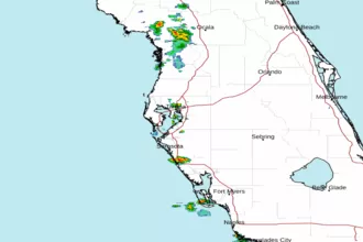 Tampa Bay FL Radar
 Gulf Radar