Fire Island Inlet NY to Moriches Inlet NY out 20 NM Marine Forecast
| This Afternoon...Sw Winds Around 15 Kt With Gusts Up To 20 Kt. Seas Around 4 Ft, Occasionally To 5 Ft. Wave Detail: S 3 Ft At 5 Seconds And E 2 Ft At 10 Seconds. Slight Chance Of Showers And Tstms. |
| Tonight...Sw Winds 10 To 15 Kt With Gusts Up To 20 Kt, Becoming W 5 To 10 Kt After Midnight. Seas 3 To 4 Ft, Occasionally To 5 Ft. Wave Detail: S 3 Ft At 5 Seconds And E 2 Ft At 10 Seconds. Slight Chance Of Tstms In The Evening. |
| Thu...Nw Winds Around 5 Kt, Becoming Ne 10 To 15 Kt In The Afternoon. Seas 2 To 3 Ft. Wave Detail: Se 3 Ft At 6 Seconds And E 1 Ft At 10 Seconds. Chance Of Showers In The Morning, Then Showers Likely In The Afternoon. |
| Thu Night...E Winds 10 To 15 Kt With Gusts Up To 25 Kt. Seas 2 To 4 Ft, Occasionally To 5 Ft. Wave Detail: Se 3 Ft At 5 Seconds And E 1 Ft At 10 Seconds. Showers Likely. |
| Fri...Ne Winds 10 To 15 Kt With Gusts Up To 20 Kt. Seas 3 To 4 Ft, Occasionally To 5 Ft. Wave Detail: E 3 Ft At 5 Seconds And S 3 Ft At 9 Seconds. Chance Of Showers. |
| Fri Night...E Winds Around 10 Kt, Becoming Ne After Midnight. Seas 3 To 4 Ft, Occasionally To 5 Ft. Wave Detail: S 3 Ft At 9 Seconds And E 2 Ft At 5 Seconds. Chance Of Showers. |
| Sat...W Winds 5 To 10 Kt. Seas Around 3 Ft. |
| Sat Night...S Winds Around 10 Kt. Seas 3 To 4 Ft, Occasionally To 5 Ft. Chance Of Showers. |
| Sun...Se Winds 10 To 15 Kt With Gusts Up To 20 Kt. Seas Around 4 Ft, Occasionally To 5 Ft. Chance Of Showers. |
| Sun Night...W Winds 10 To 15 Kt With Gusts Up To 20 Kt. Seas 3 To 4 Ft, Occasionally To 5 Ft. Winds And Seas May Be Higher In And Near Tstms. |
| Area Forecast Discussion National Weather Service New York NY 227pm EDT Wednesday May 8 2024 Synopsis A warm front pushes to the northeast while a cold front moves through late today into this evening. The cold front then stalls just to the south tonight with developing low pressure approaching Thursday and Thursday night and stalling over the area on Friday. The low pressure then moves east of the region Friday night. Weak high pressure briefly builds in Saturday before another low moves across late Saturday into Sunday. Weak offshore high pressure establishes for early next week. Near Term - Until 6am Thursday Morning Forecast remains on track with temperatures warming steadily for the western portions of the area. By early afternoon as the warm front by and large gets northeast of the CWA (County Warning Area) forecast soundings indicate a fair amount of instability in the mid and upper levels. Storm Prediction Center has placed the region in a marginal risk of sever weather. The amount of convective coverage is very much in doubt as convective initiation may be difficult to achieve as some guidance indicates significant drying of the column which would not be conducive for updrafts to survive due to dry air entrainment. Also forecast soundings indicate a weak mid-level CAP. Thus it may be difficult to get parcels to the LFC. With this said, there may be enough to get a few isolated storms to Probability of Precipitation based on potential CAPE of 800 to 1500 J. Mid levels appear rather dry relatively speaking, so the main concern with any pop-up storms would be strong, gusty winds with DCAPE values of 800 to 1000 J with an inverted V type sounding. Chose to go with iso to slight chance of thunder with gusty winds wording with regard to any pop-up storms. Winds will be out of the south and should result in a large temperature spread across the region with developing mid to late afternoon sun from west to east. Temperatures by the afternoon are likely to range anywhere from the lower to middle 80s across western sections, to the 70s, with mainly 60s across coastal and eastern most sections. Overall temperatures average above normal for today into tonight, but there will a wide spread in temperatures this afternoon with a southerly trajectory to the wind. Some 50s are possible or even likely by the start of the evening across the twin forks of Long Island. For tonight the region should be in-between weather disturbances. Another low pressure system takes shape across the Midwest with a frontal boundary extending east into the Ohio Valley. This boundary likely approaches towards midday Thursday as a warm / stationary front as low pressure moves into the Ohio Valley. After some clearing late Wednesday and much of Wednesday night clouds should increase again towards Thursday AM. It should remain rain free through tonight with temperatures averaging somewhat above normal with lows in the 50s, and around 60 in the NYC and NE NJ metro. Short Term - 6am Thursday Morning Through Thursday Night The column is expected to gradually moisten during the day Thursday with more clouds arriving in advance of a frontal boundary to the immediate south and southwest with developing low pressure over the Ohio Valley. The system will move east and with the area being just north of the boundary and low pressure look for the column in the lower and mid levels to remain stable with an onshore flow out of the ENE. This should lead to a stratiform rain / shower activity. This activity will become more widespread Thursday evening. On and off rain is anticipated for Thursday night. WPC has maintained a marginal risk of excessive rainfall for much of the region, but rainfall rates appear quite underwhelming, thus flooding related to heavy rainfall is not a concern at this time. Temperatures should average closer to normal for the most part during this time, perhaps a few degrees below average in some spots during the day Thursday. Long Term - Friday Through Wednesday Upper-levels will have us in a troughing pattern through the weekend with two mid-level shortwaves, one Friday night and a larger, slower- moving one late Saturday into Sunday with high pressure only briefing present between the two. These shortwaves, each with an associated surface low, will bring chances for showers. More rain will be likely across the area with the first shortwave with higher PWATs (Precipitable Waters) in place. After Friday, the column dries out more, but in addition to showers, thunderstorms look to occur on Sunday aided by cold air advection aloft from the deepening trough. Temperatures will be below seasonal with highs in the mid-50s to near 60. Saturday and Sunday will be a little warmer in the low/mid-60s. A fairly zonal pattern settles in aloft for the first half of next week with weak high pressure at the surface. This will keep us in a mostly dry pattern with only slight chance POPs Monday night through Wednesday. Its highs will be warmer by Tuesday near or above seasonal averages in the upper-60s to mid-70s. Marine Winds and seas are expected to remain below SCA (Small Craft Advisory) conditions through Thursday night as seas will essentially average around 3 ft, perhaps approaching 4 ft towards early Friday morning for the southern portions of the ocean waters. Sub-SCA (Small Craft Advisory) conditions are expected through the long-term forecast period with the exception of seas occasionally reaching 5 feet in the eastern ocean Friday through Sunday. Hydrology WPC has placed mainly western interior portions of the areas in a marginal risk of excessive rainfall on Thursday. The risk of flooding from heavy rainfall appears to be limited at this time for later this week, and no hydrologic impacts are expected during the long-term forecast period. Tides / Coastal Flooding Astronomical tides run high the next few days with the new moon from last night. Minor flood benchmarks are likely to be exceeded during the evening high tide cycles tonight through Friday night for southern Nassau, southern Queens, and Fairfield and Westchester counties with inundation up to a foot. Coastal flood statements will be in place for tonight's high tide for Newark Bay in Hudson county and southern Queens with water levels perhaps just touching minor benchmarks. Localized moderate flooding is possible during Fri evening's high tides in the most vulnerable spots of southern Nassau, with advisories and statements likely in similar locations tonight, and perhaps including SW Suffolk and portions of the north shore of Long Island in subsequent evening high tide cycles through Friday. Statements may also be needed for Thursday and Friday evening for portions of coastal NE NJ and Staten Island. NOAA New York NY Office: Watches - Warnings - Advisories CT...Coastal Flood Advisory from 11pm this evening to 2am EDT Thursday for CTZ009. NY...Coastal Flood Advisory from 11pm this evening to 2am EDT Thursday for NYZ071. Coastal Flood Advisory from 8pm to 11pm EDT this evening for NYZ179. NJ...None. Marine None. |
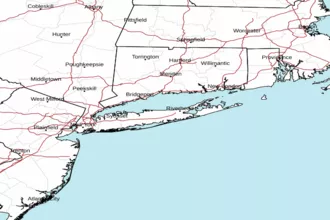
 New York Radar
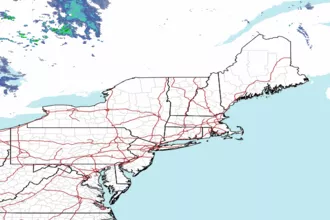
 Northeast Radar
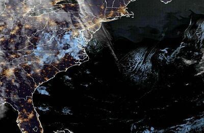
 East Coast Satellite