Florence to Cape Blanco OR out 10 NM Marine Forecast
| Tonight...N Wind 15 To 20 Kt. Wind Waves N 3 Ft At 4 Seconds. Swell Nw 8 Ft At 12 Seconds. |
| Wed...N Wind 15 To 20 Kt...Rising To 20 To 25 Kt In The Afternoon. Wind Waves N 5 Ft At 5 Seconds. Swell Nw 6 To 7 Ft At 12 Seconds. |
| Wed Night...N Wind 30 Kt...Easing To 15 To 20 Kt. Wind Waves N 9 Ft At 6 Seconds. Swell Nw 4 To 5 Ft At 11 Seconds. |
| Thu...N Wind 10 To 20 Kt. Wind Waves N 5 Ft At 6 Seconds. Swell Nw 4 To 5 Ft At 11 Seconds. |
| Thu Night...N Wind 15 To 20 Kt...Veering To Ne 10 Kt After Midnight. Wind Waves Nw 4 Ft At 6 Seconds. Swell Nw 5 To 6 Ft At 11 Seconds. |
| Fri...E Wind 5 To 10 Kt. Wind Waves Nw 2 Ft At 5 Seconds. Swell Nw 5 To 6 Ft At 11 Seconds. |
| Fri Night...N Wind 5 To 10 Kt. Wind Waves N 2 Ft At 4 Seconds. Swell Nw 5 Ft At 11 Seconds. |
| Sat...N Wind 10 To 15 Kt. Wind Waves N 2 Ft At 4 Seconds. Swell Nw 4 Ft At 10 Seconds. |
| Sun...N Wind 10 To 15 Kt. Wind Waves N 3 Ft At 5 Seconds. Nw Swell 3 Ft At 9 Seconds. |
| Area Forecast Discussion National Weather Service Medford OR 847pm PDT Tuesday May 7 2024 A couple of low-topped (read: weak) showers are currently ongoing in Douglas County with satellite showing some cloud cover along the Cascades, Douglas County, the Rogue-Umpqua Divide, and Lake County. These showers and clouds will continue to dissipate overnight as a ridge of high presure begins to build overhead. Freezing temperatures are expected for some West Side Valleys, and a Freeze Warning remains in effect. Please see the NPWMFR for more details. Otherwise, for more information on the forecast, please see the previous discussion below. -Schaaf Marine Updated 845pm Tuesday, May 7, 2024...A thermal trough will allow strong north winds and steep to very steep seas to expand northward tonight into Wednesday. Worst conditions are expected south of Cape Blanco with gales and very steep, wind-driven seas Wednesday afternoon through early Thursday morning. Gusty north winds and very steep seas are expected north of Cape Blanco. Current models show a high chance (50 to 100%) for north gales from Cape Blanco southward, highest (70 to 100%) beyond 5 nm from shore south of Gold Beach. The thermal trough will weaken Thursday, but lingering steep to very steep seas are possible. Lighter winds and seas expected Friday into the weekend. -CC/Spilde /Issued 441pm PDT Tuesday May 7 2024/ SHORT TERM...through Wednesday (5/8) night...Ongoing shower activity north of the Umpqua Divide will gradually wind down this evening. Afternoon temperatures are quite similar to recent days, running about 10 to 15 degrees below normal for early May. Upper level ridging will build into the region tonight and a thermal trough will develop at the surface. Cloud cover will linger against the terrain tonight, but where skies clear, temperatures will drop. There are freeze concerns for those areas that clear, and a Freeze Warning has been issued for the valleys of Siskiyou/Josephine/Jackson counties. Lingering cloud cover could limit the extent of freeze concerns tonight, but there is about a 40- 70% chance of low temperatures reaching 32 degrees for the Illinois and Applegate Valleys. Confidence is higher for the Shasta and Scott Valleys in Siskiyou County where skies are already clear and we don't anticipate additional cloud cover. Chances of freezing temperatures in those locations jump to around 70-90%. After a chilly start Wednesday morning, afternoon temperatures will trend warmer by about 10 degrees across the area. Any lingering cloud cover will give way to sunny skies for all areas for Wednesday afternoon. The thermal trough will strengthen along the coast and induce the Chetco Effect, bringing warm temperatures to the southern Coast. Expect highs in the upper 60s/low 70s for areas west of the Cascades and upper 50s/low 60s for areas east of the Cascades. High pressure will continue to strengthen over the region for the latter half of the week, and this trend in warmer temperatures will continue into the extended period. /BR-y Long TermThursday (5/09) through Tuesday(5/14)... High pressure will be the rule for the majority of the extended term, with dry and very warm conditions expected for all of southern Oregon and far northern California, with a few possible exceptions. Upper level ridging will extend north and east into the Pacific Northwest Thursday, with a thermal trough north from California and along the southern Oregon coast, creating generally east winds through the remainder of the week. Meanwhile, the upper level trough that passed over the area earlier in the week will retrograde, moving back to the west and setting up over the Great Basin, just south of the ridge, creating east winds aloft that will enhance and align with the east winds at the surface. All of this will result in very warm temperatures through the end of the week and into the first part of the weekend. As a result, a strong Chetco effect is forecast for the southern coast near Brookings. This pattern begins to break down late in the weekend, which may allow a weak trough to enter the area early next week, introducing a slight chance of afternoon thunderstorms. This will, in effect, produce the warmest stretch of days so far this season. The Chetco Effect will peak on Thursday, with highs in Brookings expected to reach the 80s (and a few models even suggest 90 degrees is possible) Thursday afternoon and perhaps Friday as well. When the thermal moves inland, the south coast will begin to cool as the marine layer regains control, while temperatures for most inland areas will reach their warmest Friday afternoon and Saturday afternoon. For these areas, high temperatures will be more in line with early July than early May, with highs 10 to 20 degrees above normal for this time of year. We also expect strong inversions and warm ridgelines overnight, which this pattern is known to typically produce. Once the thermal trough moves inland, the prevailing flow will take on a more westerly onshore component, and temperatures will begin to gradually cool Sunday and Monday as a weak trough enters the region from the northwest, followed by a weak trough nudging in from the southwest. These features could be enough to tap into afternoon instability, resulting form the warm temperatures and a slight uptick in atmospheric moisture, resulting in a thunderstorm or two across Siskiyou and Modoc counties, and perhaps even into some of far southern Oregon. This is a pattern known to produce convection, and roughly 33 percent of all the model solutions are depicting this solution, including the bulk of the deterministics, so confidence this far out is moderate. The NBM is not impressed, but typically lags the GFS (Global Forecast System) and ECMWF (European Centre for Medium-Range Weather Forecasts) by a day, so suspect it will come more in line with this thinking by next cycle. -BPN AVIATION...08/00Z TAFs...NNW breezes this evening will subside around sunset. Expect VFR to prevail through Wednesday, though areas of MVFR (Marginal Visual Flight Rules) are possible in portions of the Umpqua Basin toward sunrise Wednesday. These shouldn't last more than a few hours Wednesday morning. Expect gusty north to northeast winds again Wednesday afternoon, peaking 20 to 25 kt at Roseburg/Klamath Falls and around 30 kt at North Bend. -Spilde NOAA Medford OR Office: Watches - Warnings - Advisories OR...Freeze Warning from 2am to 10am PDT Wednesday for ORZ024-026. CA...Freeze Warning from 2am to 10am PDT Wednesday for CAZ080-081. PACIFIC COASTAL WATERS...Small Craft Advisory until 2pm PDT Wednesday for PZZ350-370. Hazardous Seas Warning from 2pm Wednesday to 5am PDT Thursday for PZZ350-370. Small Craft Advisory until 2pm PDT Wednesday for PZZ356-376. Gale Warning until 5am PDT Thursday for PZZ356-376. |
 Medford OR Radar
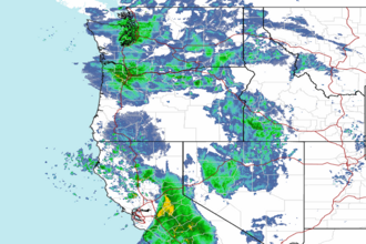 Northwest Radar