Intra Coastal Waters from Schoodic Point ME to Stonington ME Marine Forecast
| Today...E Winds 5 To 10 Kt, Increasing To 10 To 15 Kt With Gusts Up To 20 Kt Late. Seas 1 To 2 Ft, Building To 2 To 3 Ft This Afternoon. Wave Detail: S 2 Ft At 7 Seconds And E 1 Foot At 2 Seconds, Becoming S 2 Ft At 7 Seconds And E 1 Foot At 3 Seconds. A Chance Of Rain Early This Afternoon. Rain Late With Vsby 1 To 3 Nm. |
| Tonight...E Winds 10 To 15 Kt, Becoming Ne 5 To 10 Kt After Midnight. Seas 2 To 3 Ft. Wave Detail: Se 2 Ft At 7 Seconds And E 1 Foot At 3 Seconds. Rain In The Evening, Then Scattered Showers After Midnight. Patchy Fog After Midnight. Vsby 1 To 3 Nm. |
| Thu...Ne Winds Around 10 Kt. Gusts Up To 20 Kt In The Afternoon. Seas 1 To 2 Ft. Wave Detail: Se 2 Ft At 7 Seconds And Ne 1 Foot At 3 Seconds. A Chance Of Showers. Vsby 1 To 3 Nm In The Morning. |
| Thu Night...Ne Winds Around 10 Kt. Gusts Up To 20 Kt After Midnight. Seas 2 To 3 Ft. Wave Detail: Ne 1 Foot At 3 Seconds And S 1 Foot At 7 Seconds. A Chance Of Showers. |
| Fri...Ne Winds 10 To 15 Kt With Gusts Up To 20 Kt. Seas 2 To 3 Ft. Wave Detail: Ne 2 Ft At 3 Seconds And Se 1 Foot At 7 Seconds. A Chance Of Showers. |
| Fri Night...Ne Winds 5 To 10 Kt. Gusts Up To 20 Kt After Midnight. Seas 2 To 3 Ft. Wave Detail: E 1 Foot At 4 Seconds And Se 1 Foot At 7 Seconds. A Chance Of Showers In The Evening. |
| Sat...Ne Winds Around 10 Kt. Seas 2 To 3 Ft. |
| Sat Night...E Winds Around 10 Kt, Becoming N After Midnight. Seas 2 To 4 Ft. |
| Sun...E Winds 5 To 10 Kt, Becoming Se In The Afternoon. Seas 2 To 4 Ft. |
| Sun Night...S Winds 5 To 10 Kt, Becoming Ne After Midnight. Seas 2 To 4 Ft. |
| Area Forecast Discussion National Weather Service Caribou ME 614am EDT Wednesday May 8 2024 Synopsis Weak low pressure will approach today and track through the Gulf of Maine tonight. Low pressure systems will track well to our south Thursday and again Friday as high pressure builds to our north. An upper level trough of low pressure will remain over the area this weekend. Near Term - Through Tonight 6:12 AMForecast remains on track with some high clouds beginning to stray into the area early this morning. Only minor change was to lower temps in some of the colder northern valleys this morning which dipped below freezing overnight. Previous discussion This morning will begin mostly sunny across the north as clouds begin to increase over southern areas. Clouds will increase across the rest of the area today as weak low pressure supported by a shallow shortwave approaches from the Great Lakes region. Rain will begin to spread into southern areas around midday then gradually push north during the afternoon. Forecast models are in good agreement on a light rain across the area. The highest amounts, of a quarter to a half inch, will be over central areas with amounts likely under a tenth of an inch across the north and a quarter inch Downeast through tonight as the low center tracks to our south. Rain will continue through the evening then taper off to showers late tonight as low pressure, tracking through the Gulf of Maine, continues east, passing south of Nova Scotia. Short Term - Thursday Through Friday A positively tilted upper level trough will sit over the area Thursday, maintaining northeasterly flow and enough lift for shower development through the day. The northeasterly flow will downslope off of the higher terrain in New Brunswick, which could keep northeastern Aroostook relatively dry with this system. Downsloping may also help temperatures remain close to average for this time of the year despite the cloud cover and scattered rain showers. Highs on Thursday may reach into the upper 50s across the northeast, but only into the lower 50s further south. The upper level trough axis will begin to pivot through the area through Thursday night into the day on Friday as the trough becomes neutrally tilted. From here, there are split solutions on what will happen to the upper level pattern. The Canadian guidance still holds onto the chance for a cutoff low that would maintain a wetter pattern for the state, while the Euro has jumped on board with other guidance to weaken the primary upper level low as the next shortwave over the Great Lakes begins to pick up energy. At the surface, this would result in a surface low passing well south of the Gulf of Maine, with the primary threat for measurable rainfall being Downeast, but even then forecast rain amounts are light due to the separation from the center of the lift and moisture. With northeast flow continuing, high temperatures on Friday may reach into the upper 50s in areas of downsloping, and lower 50s elsewhere. Long Term - Friday Night Through Tuesday A generally unsettled pattern continues through the weekend and into early next week. Aloft, the next shortwave wraps into the New England region, pulling the new axis of the upper level trough neutrally tilted aloft through the region. With this primary source of lift, there is likely to be diurnally-driven rain showers each afternoon, even if the primary surface low misses the area to the south once more. That said, there is still uncertainty in the strength of the high pressure to the north through this time, and a weaker high pressure could allow for more rainfall to move into the area. In comparing ensemble guidance with climatology through early next week, no strong signals exist, so the forecast does not stray far from climatology through this time period. Marine Near Term: Winds will be light and seas will around 2 to 3 ft today and tonight. Short Term: Winds and seas will generally remain below small craft advisory criteria through the extended. Wind gusts may approach 25 kts on Thursday, and could exceed 25 kts briefly through early Friday morning as a storm approaches south of the Gulf of Maine. Seas may approach 5 ft this weekend. A chance for rain showers continues through at least Friday. NOAA Caribou ME Office - Watches - Warnings - Advisories ME...None. Marine None. |
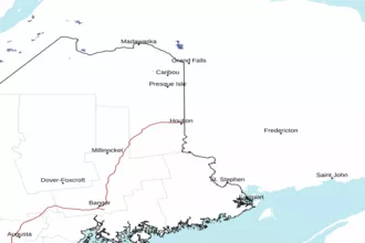
 Caribou ME Radar
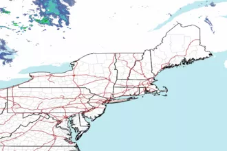
 Northeast Radar