Jupiter Inlet to Deerfield Beach, FL out 20 - 60 NM Marine Forecast
| Tonight...N Winds 10 To 15 Kt With Gusts Up To 25 Kt, Becoming Ne 25 To 30 Kt. Seas 2 To 4 Ft, Occasionally To 5 Ft, Building To 6 To 9 Ft, Occasionally To 11 Ft After Midnight. Wave Detail: Ne 4 Ft At 4 Seconds And E 1 Foot At 9 Seconds, Becoming N 9 Ft At 7 Seconds. Intracoastal Waters Rough. A Chance Of Showers And Tstms. |
| Mon...Ne Winds 25 To 30 Kt. Seas 9 To 12 Ft, Occasionally To 15 Ft. Wave Detail: Ne 12 Ft At 7 Seconds. Intracoastal Waters Very Rough In Exposed Areas. A Chance Of Showers And Tstms In The Morning. |
| Mon Night...Ne Winds 20 To 25 Kt With Gusts Up To 30 Kt, Diminishing To 15 To 20 Kt After Midnight. Seas 8 To 11 Ft, Occasionally To 14 Ft, Subsiding To 6 To 9 Ft, Occasionally To 11 Ft After Midnight. Wave Detail: Ne 9 Ft At 9 Seconds And Nw 5 Ft At 9 Seconds, Becoming Ne 7 Ft At 9 Seconds And N 5 Ft At 9 Seconds. Intracoastal Waters Rough In Exposed Areas. |
| Tue...Ne Winds 15 To 20 Kt. Seas 5 To 8 Ft, Occasionally To 10 Ft. Wave Detail: N 5 Ft At 9 Seconds And Ne 5 Ft At 9 Seconds. Intracoastal Waters Choppy In Exposed Areas. |
| Tue Night...E Winds 15 To 20 Kt. Seas 5 To 7 Ft, Occasionally To 9 Ft. Wave Detail: Ne 5 Ft At 9 Seconds And E 4 Ft At 5 Seconds. Intracoastal Waters Choppy In Exposed Areas. |
| Wed And Wed Night...E Winds 15 To 20 Kt. Seas 3 To 5 Ft, Occasionally To 6 Ft. Wave Detail: E 4 Ft At 5 Seconds And Ne 3 Ft At 9 Seconds. Intracoastal Waters Choppy In Exposed Areas. |
| Thu Through Fri...Ne Winds 10 To 15 Kt. Seas 2 To 3 Ft. Intracoastal Waters A Moderate Chop. Winds And Seas Higher In And Near Tstms. |
| Area Forecast Discussion National Weather Service Miami FL 1234pm EST Sunday Dec 14 2025 .SHORT TERM... (Today through Monday) Issued at 342am EST Sunday Dec 14 2025 An area-wide field of stratiform coverage will continue to produce light to moderate rainfall through the rest of the morning hours with occasional embedded thunderstorms. Latest NBM and ensembles keep the canopy of clouds covering all of SoFlo through around noon, then a dry frontal passage will finally push all the lingering moisture back into the Atlantic by this evening. Consensus(CONSALL) PoP/Quantitative Precipitation Forecast and high-res solutions keep the upper chances of rain in the 50-60 percent range through the late morning hours. 25th prct remain around 0.1-0.2 inches, with 90th prct keeping the possibility of isolated 2-3 inches before noon. However, based on latest HREF probs, WPC has removed the Atlantic metro areas from the marginal risk in their latest outlook. Behind the FROPA, reinforcing high pressure will quickly follow and by this evening another shot of northerly flow will bring colder/drier air advection across Soflo, with wind gusts reaching the 25-30 mph range over the Atlantic coast at times on Monday and Monday evening. Afternoon highs will remain warm today with low 80s across much of SoFlo, then a cooling trend begins in the wake of the FROPA with highs in the low-mid 70s on Monday. Long Term (Monday night through Saturday) Issued at 309am EST Sunday Dec 14 2025 Global solutions remain in good agreement in bringing sprawling high pressure across the region in the wake of a FROPA for much the work week. POPs will remain in single digits through the long term. Therefore, expect generally benign and pleasant weather to prevail through the forecast period. Coolest day should be Tuesday with afternoon highs in the mid-upper 70s. Coldest morning should happen Tuesday before sunrise, with lows dipping into the low-mid 50s around Glades and northern Hendry counties. Warming trend then follows on Wednesday with highs back into the upper 70s to low 80s. Marine Issued at 309am EST Sunday Dec 14 2025 Light winds will begin shifting northerly today while increasing behind a frontal passage. Conditions are expected to reach advisory later this evening for which a Small Craft Advisory has been issued. Winds of 25-30kt with higher gusts are expected, along with seas up to 12 feet over the Atlantic waters. Scattered showers and isolated thunderstorms will still be possible through this afternoon. Beaches Issued at 309am EST Sunday Dec 14 2025 High risk of rip currents for all Atlantic beaches starting Monday morning and continuing through the next several days as coastal winds become breezy behind a frontal passage. NOAA Miami FL Office: Watches - Warnings - Advisories FL...High Surf Advisory from 11pm this evening to 1am EST Tuesday for FLZ168-172. High Rip Current Risk from Monday morning through Thursday evening for FLZ168-172-173. AM...Small Craft Advisory from 7pm this evening to 7pm EST Monday for AMZ610. Small Craft Advisory from 7pm this evening to 1am EST Tuesday for AMZ630. Small Craft Advisory from 7pm this evening to 7am EST Tuesday for AMZ650-651-670-671. GM...Small Craft Advisory from 7pm this evening to 1am EST Tuesday for GMZ656-657-676. |
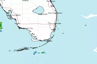 Miami FL Radar
 Southeast Radar
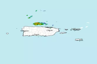 San Juan Radar
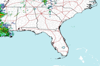 Southeast Radar