Laguna Madre from the Port of Brownsville to the Arroyo Colorado Marine Forecast
| Today...Southeast Winds 10 To 15 Knots, Increasing To 15 To 20 Knots Late This Afternoon. A Moderate Chop On The Bay, Increasing To Choppy Late This Afternoon. Patchy Fog Early This Morning. |
| Tonight...South Winds 10 To 15 Knots. A Moderate Chop On The Bay. Areas Of Dense Fog After Midnight. |
| Thursday...Southeast Winds 10 To 15 Knots. A Moderate Chop On The Bay. Patchy Fog Early In The Morning. |
| Thursday Night...Southeast Winds 10 To 15 Knots, Diminishing To 5 To 10 Knots After Midnight, Then Becoming East Early In The Morning. A Moderate Chop On The Bay, Diminishing To Light Chop After Midnight. |
| Friday...Northeast Winds 5 To 10 Knots, Increasing To 15 To 20 Knots. Light Chop On The Bay, Increasing To Choppy. |
| Friday Night...Northeast Winds 15 To 20 Knots, Becoming East 10 To 15 Knots In The Late Evening And Overnight. Choppy On The Bay, Diminishing To A Moderate Chop In The Late Evening And Overnight. |
| Saturday...East Winds 10 To 15 Knots. A Moderate Chop On The Bay. A Slight Chance Of Showers And Thunderstorms. |
| Saturday Night...East Winds 10 To 15 Knots, Becoming Southeast Early In The Morning. A Moderate Chop On The Bay, Diminishing To Light Chop Early In The Morning. A Slight Chance Of Showers And Thunderstorms. |
| Sunday...Southeast Winds 10 To 15 Knots. A Moderate Chop On The Bay. A Slight Chance Of Showers And Thunderstorms. |
| Sunday Night...Southeast Winds 10 To 15 Knots. A Moderate Chop On The Bay. A Slight Chance Of Showers And Thunderstorms Early In The Evening. Winds And Waves Higher In And Near Thunderstorms. |
| Area Forecast Discussion National Weather Service Brownsville TX 320am CDT Wednesday May 8 2024 ...New SHORT TERM, LONG TER Marine .SHORT TERM... (Today through Thursday) Issued at 319am CDT Wednesday May 8 2024 Key Messages: - Unseasonable heat, including triple-digit temperatures and heat index values, are expected across Deep South Texas. - A Heat Advisory is in effect for portions of the region this afternoon, and will likely be needed again on Thursday. - Those spending a prolonged period outside will need to take necessary heat precautions to avoid heat-related illnesses. - Moderate risk of rip currents through Thursday. The hottest days of the week are expected today and tomorrow across all of Deep South Texas. Forecast model soundings reveal a sharp inversion at 850mb as westerly winds transport much more subsident air overhead, keeping the higher moisture content (humidity) in place near the surface. Additionally, model guidance suggests 850mb temperatures will continue to increase each afternoon, measuring around 24-27C this afternoon and 27-29C Thursday afternoon, which will further promote unseasonably hot afternoon temperatures. Well established low level southerly to southeasterly flow will maintain high dew points along the coast each afternoon, but the presence of a dryline across the western half of the region will allow for drier air to filter in. Dew points will range from the mid to upper 70s east of the dryline to upper 40s and 50s west of the dryline. While the hottest temperatures will be observed generally west of the dryline, the lower dew points will result in heat index values measuring closer the ambient temperature. Conversely, temperatures will be a few degrees lower (but still quite hot and in the triple-digits) east of the dryline, but the higher dew points will result in heat index values 10-15 degrees above the ambient temperature. For this afternoon, high temperatures will range from the upper 90s across the Lower Rio Grande Valley to around 108 degrees across the Rio Grande Plains. The dryline is expected to push as far east as US-281 this afternoon and presence of higher humidity along/east of US-281 will yield heat index values ranging from 110-114 degrees. As a result, a Heat Advisory is in effect for inland Cameron, inland Willacy, inland Kenedy, Hidalgo, and Brooks counties this afternoon. Daily records for May 8th may be tied or broken at Brownsville (95 in 2020), Harlingen (99 in 2003), and McAllen (100 in 2019). Thursday will be the hottest day of the short-term period. Daily records for May 9th will likely be tied or broken as well at Brownsville (97 in 1998), Harlingen (100 in 1998), and McAllen (103 in 1998). Probabilistic guidance indicates there is a high chance (70% or greater) that most of Deep South Texas will observe a high temperature of 100 degrees or higher. The current forecast calls for temperatures ranging from 100 degrees across the Lower Rio Grande Valley to around 109 degrees across the Rio Grande Plains. Fortunately, high res model guidance suggest the dryline will push as far east as the I-69 corridor on Thursday, which would temper the heat index values for a large portion of Deep South Texas. Still, portions of Cameron, Willacy, and Kenedy counties will likely realize heat index values ranging from 110-114 degrees Thursday afternoon as dew points remain in the upper 60s to low 70s. A Heat Advisory will likely be needed once again Thursday afternoon. Remember to take the necessary precautions against the heat to limit the risk of heat-related impacts and illnesses. Never leave children or pets in vehicles, drink plenty of fluids to stay hydrated, and take frequent breaks if spending a prolonged period outside. Long Term (Thursday night through Tuesday) Issued at 319am CDT Wednesday May 8 2024 A weak cold front across the Hill Country Thursday evening is expected to push southward and move into Deep South Texas late Thursday night into Friday morning. In the wake of the front, more seasonal temperatures are expected Friday and into the weekend. Daytime high temperatures will be in the upper 80s to low 90s Friday into Sunday. Overnight lows Friday and Saturday night are expected to be in the low to mid 70s. Light east to southeast winds Thursday night will become northeast on Friday with the frontal passage. Easterly winds Saturday and Saturday night are expected to become southeasterly on Sunday as the boundary retreats northward as a warm front and lingers across the area. Abundant moisture combined increased forcing and ample instability could support a slight chance for showers and thunderstorms along the weak cold front Friday. Additional, weak overrunning will support isolated to scattered showers and thunderstorms across the area on Saturday. Onshore flow with increased moisture and instability could again support a slight chance of showers and thunderstorms Sunday and Monday. Temperatures gradually warm through the middle of next week. Marine Issued at 319am CDT Wednesday May 8 2024 Today through Thursday...Generally favorable marine conditions will prevail with light to moderate southeast winds and moderate seas. Brief periods of Small Craft Exercise Caution conditions will be possible each afternoon, especially across the Laguna Madre and northern Gulf waters as the pressure gradient tightens. Thursday night through Tuesday...Light to moderate winds and moderate seas are likely Thursday night. Stronger northeasterly winds will develop behind a cold front Friday will likely require Small Craft Exercise Caution or Small Craft Advisories by Friday afternoon. Winds are expected to diminish Friday night as high pressure settles across the region. Light to moderate winds and moderate seas will prevail along the Lower Texas through the rest of the period. NOAA Brownsville TX Office: Watches - Warnings - Advisories TX... Heat Advisory from 1pm this afternoon to 7pm CDT this evening for TXZ250-251-253>255-353. GM...None. |
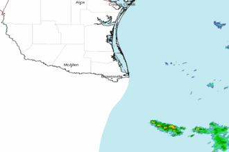 Brownsville TX Radar
 Gulf Radar