Lake Borgne Marine Forecast
| Today...South Winds 15 To 20 Knots With Gusts Up To 25 Knots. Waves 3 To 4 Feet. |
| Tonight...South Winds 20 To 25 Knots With Gusts Up To 30 Knots. Waves 2 To 4 Feet. |
| Thursday...South Winds 10 To 15 Knots With Gusts Up To 20 Knots. Waves 2 To 3 Feet. |
| Thursday Night...Southwest Winds 10 To 15 Knots. Waves 2 To 3 Feet. A Slight Chance Of Showers And Thunderstorms In The Evening, Then A Chance Of Showers And Thunderstorms After Midnight. |
| Friday...Northwest Winds Around 10 Knots, Becoming North In The Afternoon. Waves Around 2 Feet. A Chance Of Showers And Thunderstorms, Mainly In The Morning. |
| Friday Night...North Winds 15 To 20 Knots With Gusts Up To 25 Knots. Waves 2 To 4 Feet. |
| Saturday...Northeast Winds 15 To 20 Knots, Becoming East 5 To 10 Knots In The Afternoon. Waves 2 To 3 Feet In The Morning, Then 1 Foot Or Less. |
| Saturday Night...Southeast Winds Around 5 Knots, Becoming Northeast After Midnight. Waves 1 Foot Or Less. |
| Sunday...East Winds Around 10 Knots. Waves Around 2 Feet. A Slight Chance Of Showers And Thunderstorms In The Morning, Then A Chance Of Showers And Thunderstorms In The Afternoon. |
| Sunday Night...Southeast Winds 10 To 15 Knots. Waves Around 2 Feet. A Chance Of Thunderstorms. A Chance Of Showers. Winds And Waves Higher In And Near Thunderstorms. |
| Area Forecast Discussion National Weather Service New Orleans LA 620am CDT Wednesday May 8 2024 Long Term (Friday through Tuesday) Issued at 330am CDT Wednesday May 8 2024 Any residual shower/storm activity lingering over from the short term period will quickly exit stage east and south. At the surface, the cold front will continue to drop southward as an upper level Canadian trough continues to amplify over the eastern U.S. With lower heigheights and thicknesses along with low level CAA, temperatures will be slightly cooler on Friday. That said, above average temperatures are anticipated to continue especially closer to the coast. Despite the weak cold air advection, strong insolation/sun angle will help keep things on the warm side. Going into the weekend, a more progressive pattern takes over. Temperatures start out around average on Saturday and Sunday with a more zonal flow over the region. However, all eyes begin to shift upstream later into Sunday. The next H5 shortwave, this one with Pacific roots, will migrate over the high plains. This will help the front that pushes through late in the short term period or early in the long term period lift back closer toward our region. With surface convergence and perhaps some help from isentropic upglide, POPs increase later into the weekend and especially to start the new workweek. One question is how far north the front will get and how progressive the H5 trough will be. The surface high takes some time to migrate eastward into the Mid Atlantic states this weekend and so return flow will be limited initially. That said, a very moisture rich environment isn't far and with the front lifting northward it wouldn't take long to moderate the low level moisture profile. Going deeper into the new workweek next week, it appears that a series of upper level impulses within the flow move over our region leading to perhaps periods of showers and thunderstorm activity. Models are still in a bit of a disagreement with the exact strength of upper level features and any surface trough/low development that takes place across the northern Gulf, but feeling a bit more confident with strong Quantitative Precipitation Forecast signals despite the slight disagreements amongst the ECM and GFS. Needless to say with the increase in cloudiness and rainfall, temperatures will be held down or more closer to climo norms. (Frye) Marine Issued at 330am CDT Wednesday May 8 2024 Winds will gradually increase today through Thursday with cautionary headlines needed up until a cold frontal boundary passes through the region early Friday. Behind the front, moderate winds and seas will continue with northerly flow developing. This northerly flow will begin to breakdown quickly going into the upcoming weekend as surface high pressure begins to settle across our local waters. (Frye) NOAA New Orleans LA Office: Watches - Warnings - Advisories LA...None. GM...None. MS...None. GM...None. |
 New Orleans LA Radar
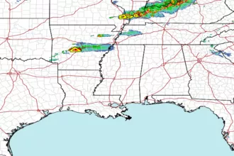
 Gulf Radar