Little Egg Inlet to Great Egg Inlet NJ out 20 NM Marine Forecast
| Overnight...S Winds 5 To 10 Kt. Seas Around 3 Ft. Wave Detail: S 2 Ft At 6 Seconds And E 2 Ft At 11 Seconds. Patchy Fog. A Slight Chance Of Showers Late. |
| Wed...S Winds 10 To 15 Kt With Gusts Up To 20 Kt. Seas 2 To 3 Ft. Wave Detail: S 3 Ft At 6 Seconds And E 2 Ft At 10 Seconds. A Chance Of Showers In The Morning. Patchy Fog In The Morning. |
| Wed Night...Sw Winds 5 To 10 Kt. Seas 2 To 3 Ft. Wave Detail: S 3 Ft At 5 Seconds And E 2 Ft At 10 Seconds. |
| Thu...S Winds 5 To 10 Kt. Seas 2 To 3 Ft. Wave Detail: S 2 Ft At 6 Seconds And E 2 Ft At 10 Seconds. A Chance Of Showers In The Morning, Then Showers Likely In The Afternoon. |
| Thu Night...E Winds Around 10 Kt, Becoming Ne After Midnight. Seas 3 To 4 Ft. Wave Detail: S 3 Ft At 6 Seconds And E 2 Ft At 10 Seconds. Showers Likely, Mainly In The Evening. |
| Fri...Ne Winds Around 10 Kt, Becoming E With Gusts Up To 20 Kt In The Afternoon. Seas 3 To 4 Ft. Wave Detail: E 3 Ft At 6 Seconds And S 2 Ft At 8 Seconds. A Chance Of Showers In The Afternoon. |
| Fri Night...Ne Winds Around 10 Kt, Becoming N After Midnight. Seas 3 To 4 Ft. A Chance Of Showers. |
| Sat...N Winds Around 10 Kt, Becoming Sw In The Afternoon. Seas 3 To 4 Ft. |
| Sat Night...S Winds Around 10 Kt. Seas 3 To 4 Ft. A Chance Of Showers After Midnight. |
| Sun...Sw Winds 10 To 15 Kt. Seas 3 To 4 Ft. A Chance Of Showers In The Morning. |
| Sun Night...Sw Winds Around 10 Kt. Seas 3 To 4 Ft. |
| Area Forecast Discussion National Weather Service Mount Holly NJ 946pm EDT Tuesday May 7 2024 Synopsis An area of low pressure tracks by to our north late tonight and early Wednesday morning. This will be followed by a stronger area of low pressure moving across the region Thursday. This low will track east of the area Friday with additional upper level disturbances tracking through the area this weekend. A warmer, drier pattern looks to return early next week. Near Term - Through Wednesday As of 935 PM, the last of the showers have dissipated with the loss of daytime heating. Mostly just some bands of mid to high level cloudiness streaming across our area. Some stratus and/or fog was along and off the Delaware Beaches at sunset, and some of this should expand northward and inland some late tonight as moisture is on the increase from the south and southwest. Slowed the Probability of Precipitation increase some from west to east overnight, as most of the guidance including the recent runs of the HRRR (High-Resolution Rapid Refresh) have the bulk of the showers/thunder closer to daybreak. Adjusted the hourly temperature, dew point, wind and sky grids to account for the latest observations and trends. Otherwise, low pressure pivots around the Great Lakes. As the associated warm front reaches the area, showers will commence. The heaviest and most widespread will be north of Philadelphia. A few thunderstorms are possible late as some instability is forecast to advect eastward late tonight in response to strengthening flow and low-level warm air advection. Rainfall amounts up to a third of an inch are anticipated. Overnight lows will be in the 50s to lower 60s. For Wednesday, the showers (and maybe a thunderstorm) associated with the warm front will be moving out in the morning. For most of us, it will be the first part of the morning. Clouds will diminish in the afternoon allowing temperatures to rise quite a bit. Wednesday's highs will be the warmest of the week, with temperatures ranging from the upper 70s well north and west to the mid to upper 80s south away from the cooler waters. It will become breezy with southwest to west winds gusting 20-25 mph. There could be some isolated afternoon showers/storms developing, however the forcing for ascent is weak and this should limit the coverage. The model forecast soundings do show a well mixed boundary layer developing in the afternoon (inverted-V signature), and this could result in an isolated gusty thunderstorm. Short Term - Wednesday Night Through Friday A fairly busy/active weather pattern persists across the area through the short term period. For Wednesday night, one low pressure system moves out to sea as it passes east of New England with a new low starting to move into the midwestern states. This will eventually push a warm front towards the area by Thursday morning which could start to bring in some showers/storms towards sunrise across eastern PA and Delmarva. Thursday is shaping up to be more unsettled as this next area of low pressure referenced above moves across the region bringing more widespread showers and storms. That said, there is still a lot of uncertainty on the track of this system which will have implications both on the high temperatures and the severe weather threat. Model consensus maintains a low tracking eastward near Delmarva which would limit how far north the warm front gets. Deep layer shear will be quite strong meaning anywhere near and south of the warm front will have a heightened severe weather threat Thursday afternoon into the evening but right now the most favored area looks to be over Delmarva and southern NJ. The Storm Prediction Center has a Marginal and Slight Risk for severe weather across this region. This could change, however, if the system and its warm front tracks farther north. Currently expect highs Thursday ranging from the upper 60s/low 70s north to the mid/upper 70s south but again, this is contingent on the track of the low. With an overall slower trend with the system, showers/storms could last through a good portion of Thursday night although any severe weather threat should diminish through the nighttime hours with the loss of daytime heating. On Friday surface, our earlier low pressure will track east of the region while an upper level trough axis lags behind and pushes through the mid Atlantic. This will keep chances for showers in the forecast, especially north (POPs ranging from around 40 percent south to 70 percent north), under generally overcast skies. It will also be cooler with highs mostly in the upper 50s to mid/upper 60s. Long Term - Friday Night Through Tuesday In the big picture, the weather pattern will remain on the unsettled side through the weekend as a long wave upper level trough lingers in the east. This should be followed by a drying trend into early next week. Heading into Saturday, chances for showers diminish, as the initial shortwave trough moves out and shortwave ridging builds in briefly for a time. However by late day the next disturbance will be approaching and this could bring some more showers back into the region, especially over eastern PA. So we keep the mention of shower chances in the forecast but POPs are generally only in the 20 to 30 percent range. Expect highs mainly in the 60s under a mix of sun and clouds so certainly not a washout. A better chance for showers arrives by Sunday as the next shortwave trough swings through (POPs 40 to 60 percent) and there will also be more in the way of cloud cover. Finally by early next week it should start to trend warmer and drier as the upper trough moves out and the flow over the east becomes more zonal. Marine Tonight and Wednesday...Sub-SCA (Small Craft Advisory) conditions. Some fog develops tonight before dissipating Wednesday morning. Outlook... Overall, sub-SCA (Small Craft Advisory) conditions through the period. Scattered showers and thunderstorms will result in locally higher wind gusts and seas, with biggest impacts coming on Thursday afternoon and evening. Tides / Coastal Flooding Tidal ranges increasing this week as the new moon arrives this evening. Limited onshore flow means that there won't be much in the way of serious flooding concerns, but still widespread minor tidal flooding is expected with the high tide this evening for Atlantic coastal zones, the Delaware Bay, and the tidal Delaware River. A Coastal Flood Advisory remains in effect for these areas. Another round of minor coastal flooding is probable for these areas with the high tide cycle Wednesday night. Flooding is not expected for our Maryland zones along the Chesapeake. NOAA Mount Holly NJ Office: Watches - Warnings - Advisories PA...Coastal Flood Advisory from midnight tonight to 5am EDT Wednesday for PAZ070-071-104-106. NJ...Coastal Flood Advisory to 2am EDT Wednesday for NJZ016. Coastal Flood Advisory to 1am EDT Wednesday for NJZ012>014-020>027. Coastal Flood Advisory from midnight tonight to 5am EDT Wednesday for NJZ017>019. DE...Coastal Flood Advisory to 2am EDT Wednesday for DEZ001. Coastal Flood Advisory to 1am EDT Wednesday for DEZ002>004. MD...None. Marine None. |
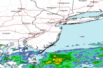 Mount Holly NJ Radar
 Northeast Radar
 East Coast Satellite