Lower Atchafalaya River to Intracoastal City, LA from 20 - 60 NM Marine Forecast
| Tonight...South Winds 15 To 20 Knots With Gusts Up To 25 Knots, Diminishing To 10 To 15 Knots With Gusts Up To 25 Knots Late. Seas 3 To 5 Feet, Occasionally To 6 Feet. Wave Detail: South 5 Feet At 6 Seconds. Patchy Fog Late This Evening And Overnight. |
| Thursday...South Winds 10 To 15 Knots With Gusts Up To 20 Knots. Seas 3 To 5 Feet, Occasionally To 6 Feet. Wave Detail: South 5 Feet At 7 Seconds. Patchy Fog In The Morning. |
| Thursday Night...South Winds 10 To 15 Knots With Gusts Up To 25 Knots. Seas 3 To 5 Feet, Occasionally To 6 Feet. Wave Detail: South 4 Feet At 7 Seconds. |
| Friday...West Winds 5 To 10 Knots, Becoming North In The Afternoon. Seas 3 To 4 Feet. Wave Detail: South 4 Feet At 7 Seconds And North 1 Foot At 3 Seconds. A Slight Chance Of Showers And Thunderstorms In The Morning. |
| Friday Night...Northeast Winds 5 To 10 Knots, Increasing To 10 To 15 Knots With Gusts Up To 20 Knots After Midnight. Seas 3 To 4 Feet. Wave Detail: Southeast 3 Feet At 6 Seconds And North 2 Feet At 4 Seconds. |
| Saturday...East Winds 10 To 15 Knots With Gusts Up To 20 Knots. Seas 2 To 4 Feet. Wave Detail: Northeast 3 Feet At 5 Seconds And South 3 Feet At 6 Seconds. |
| Saturday Night...East Winds Around 10 Knots. Seas 2 To 3 Feet. A Slight Chance Of Showers And Thunderstorms After Midnight. |
| Sunday...East Winds 10 To 15 Knots. Seas 2 To 4 Feet. A Chance Of Showers With A Slight Chance Of Thunderstorms. |
| Sunday Night...Southeast Winds Around 15 Knots. Seas 3 To 4 Feet. A Chance Of Showers. A Slight Chance Of Thunderstorms In The Evening, Then A Chance Of Thunderstorms After Midnight. |
| Monday...South Winds 10 To 15 Knots. Seas 4 To 5 Feet, Occasionally To 6 Feet. A Chance Of Thunderstorms. Showers Likely. |
| Monday Night...Southeast Winds Around 15 Knots. Seas 4 To 5 Feet, Occasionally To 6 Feet. A Chance Of Thunderstorms. A Chance Of Showers In The Evening, Then Showers Likely After Midnight. Winds And Seas Higher In And Near Thunderstorms. |
| Area Forecast Discussion National Weather Service Lake Charles LA 338pm CDT Wednesday May 8 2024 ...New SHORT TERM, LONG TER Marine .SHORT TERM... (Tonight through Friday night) Issued at 338pm CDT Wednesday May 8 2024 A very warm and humid day has unfolded. Most areas have topped out in the upper 80s to nearly 90F; ironically the water content in the air (high humidity) has kept temps from hitting 90 area wide. This hasn't stopped heat indices from soaring - areas like Jasper and DeRidder have HI's over 100F this afternoon. It's official... the first real taste of Summer is here. The feed of warm, humid air will continue through tomorrow ahead of an approaching cold front boundary. Temps in the daytime will top out similar to day - mid to upper 80s with some areas seeing 90 degrees; humidity pushing the heat index into the upper 90s to isolated lower 100s. Late tomorrow (Thursday) the cold front approaches. This boundary will be the focus for development of showers and thunderstorms across north Louisiana and east Texas. Storm motion indicates most shower and thunderstorm will skirt across north central Louisiana in the late evening or early morning hours of Friday. However, in the event storms take on a more southern track, there does remain the chance of storms as far south as I-10 (the chance of this solution is much lower). With storms, the primary concerns are damaging winds and hail up to an inch. To account for this concern, the Storms Prediction Center has placed all of central Louisiana and down to the I-10 corridor in a Slight Risk (2 out of 5) for severe weather. Another concern is for the chance of flooding rains with any convection. Areas north of I-10 have been included in a Marginal Risk of Excessive Rainfall (1 out of 4). In the event of training rainfall or heavy downpours, there could be some flash flood risk. Most convection should be pretty progressive, so the chance of this is low, but not zero. Those concerned parties should continue to monitor forecast trends in coming forecast cycles tonight and tomorrow. Much cooler and drier conditions to follow on Friday in the wake of the cold front passage. 11/Calhoun Long Term (Saturday through next Tuesday) Issued at 338pm CDT Wednesday May 8 2024 The long-term portion of the forecast period begins on Saturday with the area in a nwrly flow aloft behind a departing eastern CONUS trough while surface high pressure extending across the Plains yields a nerly low-level flow...with the combo of these features maintaining a dry and pleasant day/night across the forecast area. However this looks to be short-lived as by Sunday, a digging shortwave is forecast to cut off over the southern Rockies, while the surface high pushes ewd and ushers in a moister southerly flow off the Gulf. With forecast soundings indicating mean RH values rising to around 90 percent and PWAT (Precipitable Water) values climbing to around 1.9 inches (well above the 90th percentile per Storm Prediction Center sounding climo), scattered to numerous showers and thunderstorms are expected to develop and linger through Monday night before the shortwave ejects ewd, dragging a cold front into the area. With the potential for potentially heavy rains during this period, WPC is highlighting mainly our TX zones in a slight risk for excessive rainfall on Sunday (the remainder of the area is generally in a marginal risk). By Tuesday, the surface boundary is forecast to wash out over the region, with return flow off the Gulf re-establishing itself quickly. Along with weak/nil capping and another weak disturbance looking to scoot past the area, small POPs linger in the forecast through Wednesday. With cool (IE seasonal) temps expected to begin the long-term after Friday's frontal passage, expect to see a warming trend by late in the period with temps jumping back to the mid/upper 80s for highs with mins back to pushing 70 degrees. Marine Issued at 338pm CDT Wednesday May 8 2024 A light to moderate onshore flow and seas with seas 2 to 3 feet will prevail through Thursday. Areas of patchy to isolated dense fog will be possible tonight through Thursday morning. Forecast confidence is not high enough to warrant a Marine Fog Advisory tonight, although if one becomes necessary it will be issued. A cold front will push through the coastal waters Thursday night accompanied by isolated showers and thunderstorms. Offshore flow will develop behind the front Friday and Saturday. Onshore flow becomes reestablished Sunday as high pressure slides east of the area. Precipitation chances will also increase again Sunday and Monday as a series of upper level disturbance moves across the area. 66/11 NOAA Lake Charles LA Office: Watches - Warnings - Advisories LA...None. TX...None. GM...None. |
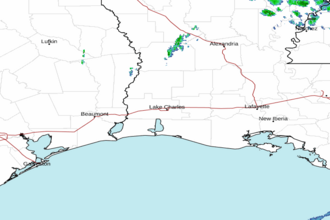 Lake Charles LA Radar
 Gulf Radar