Lower Atchafalaya River to Intracoastal City, LA Marine Forecast
| Today...North Winds 15 To 20 Knots, Increasing To 20 To 25 Knots Late This Morning And Afternoon. Seas 2 To 4 Feet. Wave Detail: Northeast 3 Feet At 3 Seconds. Showers Likely With A Slight Chance Of Thunderstorms This Morning. A Chance Of Sprinkles This Afternoon. |
| Tonight...Northeast Winds 20 To 25 Knots, Diminishing To 15 To 20 Knots After Midnight. Seas 2 To 4 Feet. Wave Detail: Northeast 3 Feet At 3 Seconds. |
| Monday...Northeast Winds 10 To 15 Knots With Gusts Up To 20 Knots, Diminishing To 5 To 10 Knots In The Afternoon. Seas 2 To 3 Feet, Subsiding To 1 To 2 Feet In The Afternoon. Wave Detail: Northeast 2 Feet At 3 Seconds. |
| Monday Night...East Winds 5 To 10 Knots. Seas 1 Foot Or Less. Wave Detail: East 1 Foot At 2 Seconds. |
| Tuesday...East Winds 5 To 10 Knots. Seas 1 Foot Or Less. Wave Detail: East 1 Foot At 3 Seconds. |
| Tuesday Night...East Winds 5 To 10 Knots. Seas 1 Foot Or Less. Wave Detail: Southeast 1 Foot At 3 Seconds. A Chance Of Sprinkles After Midnight. |
| Wednesday...East Winds 5 To 10 Knots. Seas 1 Foot Or Less. A Slight Chance Of Showers. |
| Wednesday Night...Southeast Winds Around 10 Knots. Seas Around 2 Feet. A Chance Of Showers In The Evening, Then A Slight Chance Of Showers And Thunderstorms After Midnight. |
| Thursday...South Winds 5 To 10 Knots. Seas Around 2 Feet. A Slight Chance Of Thunderstorms In The Morning. A Slight Chance Of Showers. |
| Thursday Night...Southwest Winds Around 5 Knots, Becoming North After Midnight. Seas Around 2 Feet In The Evening, Then 1 Foot Or Less. A Chance Of Showers, Mainly In The Evening. Winds And Seas Higher In And Near Thunderstorms. |
| Area Forecast Discussion National Weather Service Lake Charles LA 1125am CST Sunday Dec 14 2025 .SHORT TERM... (Today through Tuesday night) Issued at 1120am CST Sunday Dec 14 2025 The cold front is now offshore and strong cold air advection is well underway, with today’s temperatures peaking around 8 am. The wind advisory has already verified, as we have gusts up to 35 mph across Acadiana, with 20 mph gusts elsewhere. Temperatures will continue to tumble due to the cold air advection, and with the overcast skies early in the day, heating will be reduced. Skies will clear out this afternoon, allowing for ideal conditions for overnight cooling, and based on current temperature trends, our lows tonight will be colder than originally forecasted. Lows will be in the mid to low 20s in central Louisiana, with freezing temperatures reaching down to the coast. Because of this very cold air mass, there is a cold weather advisory and freeze warning in place for tonight. Monday morning will be very cold, with temperatures in the 20s as people are commuting to work. Make sure to dress appropriately and stay warm! While we will be chilly Monday, we will see a bit of a warm up, and Monday night we could see a light freeze across the region, with lows around 28 to 32 °F. As we move into Tuesday, warm air advection will start to kick in as south winds return, and temperatures will rise a few degrees each day. Long Term (Wednesday through Sunday) Issued at 1120am CST Sunday Dec 14 2025 The extended forecast looks a lot less impactful than the short term. Midweek we will have a decent chance for rain (40-50%) as a trough and its associated cold front move through on Wednesday and Thursday. Ahead of the front, robust warm air advection will push our highs into the 70s with humid and muggy conditions. After the front, there will be a little bit of relief from the heat and humidity before the upper-level pattern becomes zonal, and we will slowly warm back up. For Christmas week, the weather is looking like it will be warm and muggy. Marine Issued at 1120am CST Sunday Dec 14 2025 A Gale Warning is in effect for the coastal waters due to frequent gusts over 35 knots. Waves will be between 6 to 10 feet, with the higher values farther offshore. The cold front that is helping to produce these gusty winds is moving well offshore, and conditions will begin to improve overnight, with the Gale dropping to a small craft advisory around midnight. As the winds decrease, so will the waves, and by midnight, wave heigheights will fall to 5–7 feet, then below 5 feet by sunrise. We do not expect that a low water advisory will be needed, as the strongest offshore winds will be occurring before low tide. For the rest of the week, Marine conditions will be benign with onshore winds. Fire Weather Issued at 1120am CST Sunday Dec 14 2025 Gusty winds between 25 and 35 mph, along with a low RH, will occur today. While the strong winds will decrease after today, low RH will remain a concern, with values dropping to 25 to 35% on Monday. With the recent rain, KBDI values are below 300 area-wide. Still, burning in strong winds and low RH is not recommended. Onshore flow will return by midweek, with an increase in temperatures and RH. NOAA Lake Charles LA Office: Watches - Warnings - Advisories LA...Cold Weather Advisory from 6pm this evening to 10am CST Monday for LAZ027>033-044-045-055-073-074-141>143-152>154-241>243- 252>254. Freeze Watch from 8pm CST this evening through Monday morning for LAZ027>033-044-045-055-073-074-141>143-152>154-241>243- 252>254. Wind Advisory until 6pm CST this evening for LAZ028-029-032-033- 044-045-055-073-074-141>143-152>154-241>243-252>254. TX...Cold Weather Advisory from 6pm this evening to 10am CST Monday for TXZ180-201-259>262-515-516-615-616. Freeze Watch from 8pm CST this evening through Monday morning for TXZ180-201-259>262-515-516-615-616. Wind Advisory until 6pm CST this evening for TXZ515-516-615-616. GM...Small Craft Advisory until 6am CST Monday for GMZ430-432-435- 436. Gale Warning until midnight CST tonight for GMZ450-452-470-472- 475. Small Craft Advisory from midnight tonight to 9am CST Monday for GMZ450-452-470-472-475. Small Craft Advisory until 9am CST Monday for GMZ455. |
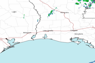 Lake Charles LA Radar
 Gulf Radar