Mississippi Sound GMZ532 Marine Forecast
| This Afternoon...North Winds 20 To 25 Knots With Gusts Up To 30 Knots. Waves 4 To 5 Feet. |
| Tonight...Northeast Winds 20 To 25 Knots With Gusts Up To 30 Knots. Waves 4 To 5 Feet. |
| Monday...Northeast Winds 15 To 20 Knots With Gusts Up To 25 Knots, Diminishing To 5 To 10 Knots In The Afternoon. Waves 2 To 4 Feet. |
| Monday Night...Northeast Winds 5 To 10 Knots. Waves 1 Foot Or Less. |
| Tuesday...East Winds 5 To 10 Knots. Waves 1 Foot Or Less. |
| Tuesday Night...East Winds 5 To 10 Knots. Waves 1 Foot Or Less. |
| Wednesday...East Winds 5 To 10 Knots. Waves Around 2 Feet. |
| Wednesday Night...Southeast Winds 10 To 15 Knots. Waves Around 2 Feet. A Slight Chance Of Showers In The Evening, Then A Chance Of Showers After Midnight. |
| Thursday...South Winds Around 10 Knots. Waves Around 2 Feet. A Slight Chance Of Thunderstorms In The Morning. A Chance Of Showers. |
| Thursday Night...Southwest Winds 5 To 10 Knots, Becoming North After Midnight. Waves Around 2 Feet. A Chance Of Showers, Mainly In The Evening. Winds And Waves Higher In And Near Thunderstorms. |
| Area Forecast Discussion National Weather Service New Orleans LA 544am CST Sunday Dec 14 2025 Issued at 528am CST Sunday Dec 14 2025 Cold front progressing rapidly through the area, although falling temperatures will lag the front a bit. Had already expired the Fog Advisory on the Mississippi coast at 4am CST, and will update the CWF for the expiration of the Marine Fog Advisory at 6 AM. Main forecast issue for the remainder of the day will be the timing of skies clearing. Most available guidance indicates this should occur prior to noon for much of the area, although one or two convection allowing models linger it until early afternoon south of Interstate 10. Calendar day highs have likely already occurred in most areas, although there could be some minor temperature recovery this afternoon. .SHORT TERM... (Today through Monday) Issued at 102am CST Sunday Dec 14 2025 It has been a little busy tonight watching the strong cold front work down towards the area and forecasting the development and advancement of fog along coastal areas. Fog began to develop quickly over coastal MS and then began to popup across areas of the immediate SELA coast. This is far enough ahead of the cold front where the air is not being mixed and moisture has piled up but this will not last long. The cold front which was right on the doorstep of the CWA (County Warning Area) by 5z will continue to quickly work south and could already be moving into the Gulf by 12Z the drier and cooler air will not be far behind. We will also see some light rain and maybe even a few rumbles of thunder associated with the front this morning. So the obvious forecast concern is, how cold do we get tonight? Well, that is the million dollar question and yes it will get cold tonight, likely the coldest temperatures we have seen so far this season and by a few degrees at that. The cold front already stretches southwest from western NC and northern GA into central and southwest MS and then back to the west through central TX while a 1038/1039 surface high is centered over the northern and into the central Plains. Looking at the mid levels the L/W trough over the eastern CONUS is broad but the trough axis is all the way down into the southern Gulf while a ridge dominates the 4 corners with the ridge axis extending north just west of the continental divide into southwestern Canada. The main embedded s/w associated with our cold air mass is actually just barley moving through the Mid MS Valley and will be move into the OH and TN Valleys by late morning/midday. This continues to work east- southeast with the main trough axis moving off of the Atlantic coast this evening. This keeps the area under northwest flow aloft while the ridge to our west broadens out some moving east into the southern Plains. At the surface high pressure will continue to diver south across the Plains this morning before surging more to the east and southeast during the day and overnight. By Monday morning high pressure will dominate most of the southeastern CONUS and Appalachians but still not centered over the area. This will usher a very cold and dry airmass into the area today and overnight. This airmass will be very shallow. Models and forecast sndgs indicate strong cold air advection during the day today and will cool things off considerably around h925 and below but not much in the way of Cold Air Advection at h85. The other interesting and forecast problem is h925 temps actually warm overnight. All models CAMs, regional, and global models indicate LL temps warming overnight indicating how shallow this airmass really is. Looking upstream it was definitely cold across MO and KS but most of the evening it was struggling to dive south as it hit the Ozarks and then finally around 4/5z the colder air began to surge south across northern AR and eastern OK. Given that the surface high is not going to be centered over the area and Cold Air Advection is likely going to continue into the early evening hours before finally leveling off the radiational cooling potential is not the primary factor tonight. Winds around h925 will still be near 15- 20kts at 6z before finally starting to drop. This would suggest some mixing still and given that all models were showing h925 temps increasing overnight that gives me pause on how cold we get tonight. However, MOS guidance has trended slightly colder for tonight with lows near 20 for a good chunk of the northern half of the CWA. If that happens combined with the wind not decoupling, Apparent Temps could drop below 15 degrees for more than just isolated locations. That would necessitate an Extreme Cold Warning. That said there are still too many questions and will stick with the latest NBM showing lower to mid 20s across the northern half of the CWA. However, with the MET, MAV, and ECS all showing lows around 20 for ASD, MCB, and even lower 20s for BTR and PQL confidence is not as high in the forecast. Things that i don't like to ultimately achieve those colder temps, the placement of the trough, I would prefer it being a little deeper amplified and stronger northwest to north-northwest flow aloft helping to drive the colder air more south and not shunt it to our east, the LL warm air advection overnight, the raw models showing surface temps about 5 almost 10 degrees above MOS, and I would even like to see the snow pack a little farther south. All of that is giving me pause to lower the min T forecast and actually has me leaning to bump up the lows a degree or two but like I said we will stick with the NBM for now which is on the high side of its on probabilistic forecast. So with that we will continue to forecast lows of lower to mid 20s across southwest MS and down to the I 10/12 corridor and coastal MS. While south of I-10 lows will range from the mid 20s to near freezing. Winds will remain strong enough to make the air feel even colder with Apparent temps in the mid to upper teens across northern half of the CWA and in the lower to mid 20s across the southern half overnight tonight. A Cold Weather Advisory was already issued for the entire area and will not make any changes to that. Given that the Cold Weather Advisory is higher priority hazard than the Freezing Warning that is why there is no Freeze Warning out for anywhere in the CWA. One other aspect that was looked at closely for today was the wind. Strong cold air advection during the day and very high sf pressure rises early will give way to gusty northerly winds over the land areas late this morning and through the afternoon. Contemplated a wind advisory but held off for now. Winds don't look like they will be quite strong enough to necessitate one. Clouds may hang out for at least the first half of the day hurting the mixing potential and (again with the very shallow nature of this airmass) the h925 winds are not unidirectional with the surface winds and are off by as much as 20-30 degrees during the midday and afternoon hours. This will also hurt the efficiency of mixing down the stronger h925 winds which could be as high as 30-35kt. If we can mix those down a few gust could range between 35 and 40 mph. As one forecast brought up even though the winds may not be in the wind advisory criteria range there could still be impacts given the amount of Christmas decorations outside. So if you do have things that are not tethered/tied down that may be a good call to secure those items today. Monday will be cool but things look to quickly moderate as we head into the work week. Northwest flow aloft and high pressure still dominating the region will keep the area generally below normal for a little longer with highs in the upper 40s to mid 50s. /CAB/ Long Term (Monday night through Saturday) Issued at 102am CST Sunday Dec 14 2025 Things quickly moderate heading into Tuesday. Ridging aloft starts to push into the area Tuesday but a disturbance currently moving onshore over CA will quickly work east across the 4 corners and into the southern Plains and northern Mexico. How much of this continues east into the Lower MS Valley Wednesday is still unknown as it could surge more south into Mexico and try to close of or just continue to plow on east towards the Lower MS Valley Wednesday. If it does it could bring another chance of rain to the area but if it work south into Mexico we may not have to wait long as the pattern become mostly zonal across the region mid week with a strong disturbance moving across the northern and middle portions of the central CONUS Thursday bring another cold front into the region. This will be more of a Pacific airmass so not really strong but still a slightly cooler and drier airmass for the end of the week. /CAB/ Marine Issued at 102am CST Sunday Dec 14 2025 A strong cold front with a very shallow cold airmass will quickly move through this morning with strong offshore winds developing after it moves through. The fog that has developed near the coast and MS Sound will quickly begin to improve during the early morning hours. Winds will quickly pickup to around 20-25kt out of the north with gusts over 30 by midday. Winds will gusts from 30-35kt over all of the waters with frequent gusts near Gale in the outer waters through Monday morning. Small Craft Advisories and Gale Warnings are already in effect for the waters over this time period. Another high will then quickly settle over the area on Tuesday, and this will allow winds to turn more easterly and fall back to less than 10 knots. Seas will also begin to subside as the winds decrease Monday night into Tuesday. /CAB/. NOAA New Orleans LA Office: Watches - Warnings - Advisories LA...Cold Weather Advisory from 9pm this evening to 9am CST Monday for LAZ034>037-039-046>048-056>060-064>071-076>090. GM...Small Craft Advisory until 9am CST Monday for GMZ530-532-534- 536-538-550-552-555-557. Dense Fog Advisory until 6am CST early this morning for GMZ532- 534. Gale Warning until 9am CST Monday for GMZ570-572-575-577. MS...Cold Weather Advisory from 9pm this evening to 9am CST Monday for MSZ068>071-077-083>088. GM...Small Craft Advisory until 9am CST Monday for GMZ532-534-536- 538-550-552-555-557. Dense Fog Advisory until 6am CST early this morning for GMZ534. Gale Warning until 9am CST Monday for GMZ572-575-577. |
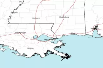 New Orleans LA Radar
 Gulf Radar