Ochlockonee River to Apalachicola FL out 20 NM Marine Forecast
| This Afternoon...South Winds 10 To 15 Knots. Seas 2 To 3 Feet. Wave Detail: South 2 Feet At 6 Seconds. Protected Waters A Moderate Chop. |
| Tonight...South Winds 10 To 15 Knots. Seas 2 To 3 Feet. Wave Detail: South 3 Feet At 5 Seconds. Protected Waters A Moderate Chop. |
| Thursday...South Winds 10 To 15 Knots. Seas 2 To 3 Feet. Wave Detail: South 3 Feet At 5 Seconds. Protected Waters A Moderate Chop. |
| Thursday Night...Southwest Winds 10 To 15 Knots. Seas 2 To 3 Feet. Wave Detail: South 3 Feet At 6 Seconds. Protected Waters A Moderate Chop. A Slight Chance Of Showers And Thunderstorms After Midnight. |
| Friday...Southwest Winds 10 To 15 Knots. Seas 2 To 4 Feet. Wave Detail: Southwest 4 Feet At 5 Seconds. Protected Waters A Moderate Chop. A Chance Of Showers And Thunderstorms. |
| Friday Night...West Winds 15 To 20 Knots, Becoming North 10 To 15 Knots After Midnight. Seas 2 To 4 Feet. Wave Detail: West 4 Feet At 5 Seconds. Protected Waters Choppy. A Chance Of Showers And Thunderstorms In The Evening. |
| Saturday...North Winds 10 To 15 Knots. Seas 2 To 3 Feet. Protected Waters A Moderate Chop. |
| Saturday Night...Northwest Winds Around 10 Knots, Becoming North After Midnight. Seas Around 2 Feet. Protected Waters A Light Chop. |
| Sunday...Northeast Winds Around 10 Knots, Becoming East In The Afternoon. Seas Around 2 Feet. Protected Waters A Light Chop. |
| Sunday Night...Southeast Winds 5 To 10 Knots, Becoming East After Midnight. Waves 1 Foot Or Less. Protected Waters A Light Chop. A Slight Chance Of Showers And Thunderstorms After Midnight. Winds And Waves Higher In And Near Thunderstorms. |
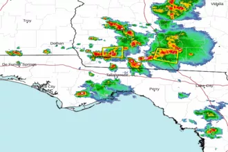
| Area Forecast Discussion National Weather Service Tallahassee FL 749pm EDT Wednesday May 8 2024 .SHORT TERM... (Thursday night through Friday night) Issued at 344pm EDT Wednesday May 8 2024 The main story will be the potential for severe weather. The D2 forecast from Storm Prediction Center added an Enhanced Risk for severe weather from about Berrien Co GA to Coffee Co AL northwards, south of that line, a Slight Risk of severe weather to about I-10, with a marginal risk dipping down into the the coastal counties and most the FL Big Bend. The situation is a one-two punch for severe weather. The first round could be an MCS (Mesoscale Convective System, a complex of thunderstorms which becomes organized on a scale larger than the individual thunderstorms) dropping into SW GA from the north which is talked about in the near term. Then we have the main event Thu night into Friday where we could have a squall line come through. This is expected to be the larger event where we could see numerous severe storms capable of producing damaging and potentially destructive winds, large hail, and even embedded tornadoes. There is the potential for a third event / squall line Friday afternoon which will be dependent on boundaries and prior convective systems. Long Term (Saturday through Tuesday) Issued at 344pm EDT Wednesday May 8 2024 We will be post frontal by Saturday with high pressure building in for the weekend. Northerly winds will usher in cooler air to the region, placing highs in the upper 70s and low 80s for the GA and AL counties, and in the low to mid 80s in FL. The reprieve in temperatures will continue overnight with lows falling into the mid to upper 50s for most of the region. Warming returns on Sunday with highs in the low to mid 80s. By early next week the pattern looks to change and become wet again. Another shortwave looks to move across the northern Gulf states with our region possibly being impacted on Tuesday as winds turn to being southeasterly. With this shortwave possibly moving overhead, a stationary boundary to our south, left behind from the previous system, and a low-level wind field again around 30-45 kts, the potential for severe is once again present as well as the threat for heavy rain. We'll have to see how this progresses over the next few days to have better confidence, be sure to come back for updates. Marine Issued at 344pm EDT Wednesday May 8 2024 A high pressure ridge will extend from from south of Bermuda across the Florida Peninsula through Thursday. Gentle southerly breezes of 5-10 knots will slowly increase to moderate southerlies around 10-15 knots as we move through the middle of the week. Chances for showers and thunderstorms will increase Thursday night into Friday night as a cold front approaches. The front is expected to pass the waters Friday night with north-northwest winds in its wake. Seas will generally be 2 to 3 feet this week, with 2-4 feet seas building late Friday as the front pushes through. Saturday, we'll be post front. Winds remain slightly elevated, but decreasing while seas slowly subside. High pressure briefly holds through Sunday. Fire Weather Issued at 344pm EDT Wednesday May 8 2024 Wetting rains and severe storms are expected for our northern GA districts Thursday afternoon through Friday. All regions are expected to receive a wetting rain from early Friday through the afternoon. Along with the rain; gusty, damaging winds are expected in thunderstorms, with large hail, and possible tornadoes. Outside of rain and thunderstorms, high dispersions are expected for Thursday afternoon for areas south and east of the storms. So, along the I-75 corridor will have dispersion indices around 75 units. Mixing heigheights will be around 4000 feet. The cold front will pass through during the day on Friday, shifting the winds northerly by Friday night. Dispersions will increase to about 60-70 units with the front on Friday afternoon for our northwestern most counties. Elevated dispersions are expected for Saturday afternoon with northerly winds and dry conditions. The MinRH for Saturday will be around 35-40%. Hydrology Issued at 344pm EDT Wednesday May 8 2024 The forecast generally remains on track with a Slight Risk clipping our extreme northern counties in AL and GA for Excessive Rainfall with a Marginal Risk extending from Ben Hill Co in GA to Geneva Co in AL. For Friday, the Marginal Risk is expanded south clipping most of the CWA. Moisture looks to be bountiful with PWATs (Precipitable Waters) around 2 inches or so. The main concern looks to be with flash flooding if storms move slowly or train. NOAA Tallahassee FL Office: Watches - Warnings - Advisories FL...High Rip Current Risk through Thursday morning for FLZ108-112- 114-115. GA...None. AL...None. GM...None. |
 Tallahassee FL Radar
 Gulf Radar