Oregon Inlet to Cape Hatteras, NC out 20 NM Marine Forecast
| This Afternoon...Sw Winds 15 To 20 Kt. Seas 3 To 4 Ft. Wave Detail: S 4 Ft At 6 Seconds And E 2 Ft At 11 Seconds. A Slight Chance Of Showers And Tstms Late. |
| Tonight...Sw Winds 15 To 20 Kt With Gusts Up To 25 Kt. Seas 3 To 5 Ft. Wave Detail: S 4 Ft At 5 Seconds And E 2 Ft At 11 Seconds. A Chance Of Showers And Tstms, Mainly In The Evening. |
| Thu...Sw Winds 15 To 20 Kt, Increasing To 20 To 25 Kt In The Afternoon. Gusts Up To 30 Kt. Seas 3 To 4 Ft, Building To 4 To 6 Ft In The Afternoon. Wave Detail: S 4 Ft At 6 Seconds And Ne 2 Ft At 11 Seconds, Becoming S 6 Ft At 6 Seconds And Ne 2 Ft At 11 Seconds. A Chance Of Showers And Tstms. |
| Thu Night...Sw Winds 20 To 25 Kt, Diminishing To 15 To 20 Kt After Midnight. Gusts Up To 30 Kt. Seas 5 To 7 Ft. Wave Detail: S 6 Ft At 7 Seconds And Ne 2 Ft At 10 Seconds. Showers And Tstms Likely. |
| Fri...W Winds 10 To 15 Kt. Seas 3 To 5 Ft. Wave Detail: S 5 Ft At 7 Seconds And Ne 1 Ft At 12 Seconds. A Chance Of Tstms. A Chance Of Showers In The Morning, Then Showers Likely In The Afternoon. |
| Fri Night...Nw Winds 10 To 15 Kt. Seas 3 To 4 Ft. Wave Detail: Nw 3 Ft At 6 Seconds And Ne 2 Ft At 12 Seconds. Showers Likely With A Chance Of Tstms In The Evening, Then A Chance Of Showers After Midnight. |
| Sat...N Winds 10 To 15 Kt. Seas 3 To 4 Ft. |
| Sat Night...Se Winds 5 To 10 Kt, Becoming Sw 10 To 15 Kt After Midnight. Seas Around 3 Ft. |
| Sun...W Winds 10 To 15 Kt. Seas Around 3 Ft. |
| Sun Night...W Winds Around 10 Kt. Seas 2 To 3 Ft. Winds And Seas Higher In And Near Tstms. |
| Area Forecast Discussion National Weather Service Newport/Morehead City NC 1123am EDT Wednesday May 8 2024 Synopsis High pressure will continue to strengthen offshore while weak troughing continues for the next few days, as warm moist southerly flow leads to unsettled conditions. A strong frontal system will move through Friday. Drier and more seasonable temperatures expected this weekend. Near Term - Through Tonight As of 1045am Wednesday... Latest surface analysis shows a stationary frontal boundary draped west to east across Tennessee, with weak lee-troughing noted from VA south through western NC. Convection is currently ongoing along the stationary front, and is just now approaching the spine of the Appalachians. East of the mountains, RAP analysis shows a modestly capped, but unstable, airmass characterized by MLCAPE of 1000- 2000j/k and deep layer shear of 30-35kt. Continued heating and moistening of the airmass should allow the TN convection to continue across the mountains and into the NC Piedmont over the next several hours. The mean steering flow today is easterly, although radar trends suggest a bit more of an ESE steering flow. Based on recent radar trends, the forecast environment, and recent model guidance, the most likely scenario is for clusters of thunderstorms to continue east into NC through the day, with an attempt to reach the coast by this evening. The boundary layer will be stabilizing some by this evening, and most guidance points towards a weakening trend with any MCS, or cluster of storms, as it reaches ENC. Given the instability and shear forecast today, though, the weakening trend seen in some guidance may be a bit aggressive, but still plausible. This will be one opportunity for strong/severe convection locally, primarily with a wind threat, and mainly focused in the 7pm-10pm timeframe. Another opportunity for severe weather today will be along the seabreeze. Like yesterday, I expect the seabreeze to be pinned close to the coast thanks to the background westerly low-level flow. One difference today is that there should be less dry air entrainment potential, as well as less subsidence. It appears the primary window for this threat will be in the 3pm-7pm timeframe. Westerly deep layer shear oriented perpendicular to the seabreeze will favor discrete cells. If any longer-lived storm can develop along the seabreeze, the combination of moderate to strong instability and ~30kt of shear appears supportive of both a wind and hail threat. A tornado threat cannot be ruled out in this area as well, but the risk appears low due to higher LCLs and weaker low-level shear forecast. Finally, one last potential focus for severe weather will be with any additional MCS (Mesoscale Convective System, a complex of thunderstorms which becomes organized on a scale larger than the individual thunderstorms) that develops upstream across the TN Valley later today. This could be a more substantial MCS that has more potential to survive all the way to the coast, but would be a late-night (ie. after midnight) threat, if it holds together. This would also be primarily a wind threat, but with some hail potential as well. Lastly, it's worth noting that this type of pattern generally carries a lower confidence in convective evolution. The environment is more than supportive of severe weather, with some higher-end potential (ie. 60+ mph gusts and hail greater than 1"). Stay tuned for updates through the night. Short Term - Thursday and Thursday Night As we get into Thurs, upper level trough over the Great Lakes begins to pivot to the south and east while a jet streak begins to expand over the Mid-Atlantic increasing lift. At the mid levels a fairly potent mid level shortwave rounds the base of the trough and tracks over the Mid-Atlantic Thurs afternoon/evening while at the surface deepening low pressure system in the Great Lakes tracks NE'wards into the Northeast with its associated cold front nearing western NC and a prefrontal trough setting up over the Coastal Plain Thurs evening. With this in mind, early morning shower and thunderstorm activity is forecast to clear out before additional development is forecast in the afternoon with activity likely beginning to the west and quickly moving E'wards into the FA. Out ahead of the trough and approaching cold front the environment across ENC appears rather supportive for severe weather. Model soundings and latest Hi-Res guidance suggest ample MLCAPE (1000-2000 J/kg) as well as ample DCAPE (700-900 J/kg) and inverted V soundings across the region. In addition to this, deep layer wind shear of 30-40 kts, slightly stronger forcing, and mid level lapse rates closer to 6.5- 7.0 C/km all suggest we will have another threat for strong to severe thunderstorms on Thurs afternoon and evening with storms bringing a threat for damaging wind gusts and hail given the environment. ENC remains in a slight risk (level 2 out of 5) for severe weather Thurs afternoon and evening. One potential failure mode for the Thurs threat would be what happens with Wednesdays convective activity. While it seems to be the outlier, some of the CAM guidance does suggest more robust tstm activity Wednesday night with a MCS moving to our south Thurs morning. If this were to occur, we could see lower instability values and thus a potentially lower severe threat as ENC gets robbed of more robust dynamics and moisture from the MCS to the south. With this in mind, current thinking is this solution has a 20% or less chance of occuring with an 80% chance for strong to severe thunderstorm activity on Thurs and the current forecast reflects this. Stay tuned to the forecast as we continue to refine it on the coming updates to see how this threat trends. Highs get into the low 90s inland and 80s across the OBX while lows only get down into the 60s. Long Term - Friday Through Wednesday As 315am Wed...ENC then dries out over the weekend as high pressure ridge builds in from the west and remains over the area into early next week. Next potential round of unsettled weather begins to approach the area around midweek next week. Friday through Early Next Week Upper level troughing finally pivots out of the Great Lakes and overspreads the Mid-Atlantic on Fri into Sat with the last and likely strongest mid level shortwave rounding this troughs base on Fri. At the surface, low pressure in the Northeast will continue to trek NE'wards while its associated cold front finally tracks across the region slowing as it pushes offshore. A wave of low pressure then develops along this frontal boundary on Fri as well and tracks along or near the coast. Once again kept thunder in the grids for Fri as HREF and NBM probs continue to highlight the potential for about 250-500 J/kg of SBCAPE to remain over the area. Either way Friday looks to have the best shot at widespread precip. Through the weekend and into next week general troughing remains over the Eastern Seaboard before gradually ejecting out into the Canadian Maritimes as upper level ridging begins to overspread the Southeast. Dry frontal passage currently forecast Sunday evening into Monday before surface ridging begins to overspread ENC from the west on Mon. Temps do cool over the weekend closer to normal. Marine SHORT TERM Through Tonight As of 645am Wed...Latest obs show SW winds 5-10 kt north of Hatteras and 5-15 kt south of Hatteras, with seas 2-4 ft. SW winds will be increasing through the day as the thermal gradient strengthens. Could see a brief period of SCA (Small Craft Advisory) conditions across the waters and Pamlico Sound late this afternoon and evening, with gusts to 25 kt, and seas building to 3-5 ft. Think gusty winds will be too short lived for SCA (Small Craft Advisory) headlines. There will be a risk of showers and thunderstorms, especially late afternoon through the overnight hours. Some storms may be strong to severe. Long Term - Thursday Through Sunday As of 315am Wed... Still expecting a cold front passage Fri morning with shower and thunderstorm activity out ahead of the front Thurs afternoon and evening. Additional shower and thunderstorm activity possible once again on Fri across all waters as the front pushes offshore and a weak wave of low pressure develops along the front. Locally enhanced winds and seas will be possible within any thunderstorm that impacts our waters. Drier weather then expected this weekend and into early next week. Otherwise we start the period out under SCA (Small Craft Advisory) conditions from Oregon Inlet south and across the Pamlico Sound as SW'rly winds out ahead of the cold front quickly increase after daybreak on Thursday to 15-25 kts with gusts in excess of 25-30 kts. Elsewhere across the northern waters and sounds as well as the inland rivers, slightly lighter winds will persist closer to 15-20 kts with a few gusts up around 25 kts, though will have to monitor trends in case inclusion of SCA's (Small Craft Advisories) becomes necessary especially along the N'rn coastal waters and Neuse river. As the front nears and eventually pushes offshore Fri morning SW'rly winds then decrease down to 10-15 kts, thus ending SCA's (Small Craft Advisories) across all waters. Behind the front winds gradually turn to a W and then NW direction at 10-15 kts. By Sat light and variable winds are forecast as high pressure ridge gradually builds in from the west with W'rly flow at 10-15 kts returning Sunday into early next week. 3-5 ft seas along our coastal waters to start the period quickly increase on Thurs to 5-8 ft. Seas then lower just as quickly on Fri morning back down to 3-5 ft and then to 2-4 ft by Fri evening remaining at these heigheights into early next week. NOAA Newport/Morehead City NC Office - Watches - Warnings - Advisories NC...None. Marine Small Craft Advisory from 10am Thursday to 5am EDT Friday for AMZ135(Pamlico Sound). Small Craft Advisory from 10am Thursday to 8am EDT Friday for AMZ152(Oregon Inlet to Cape Hatteras NC)-154. Small Craft Advisory from 8am Thursday to 8am EDT Friday for AMZ156-158. |
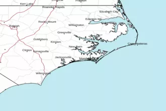 Newport NC Radar
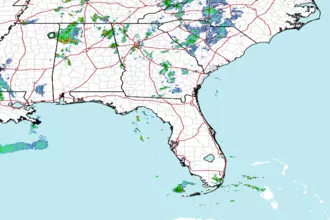 Southeast Radar
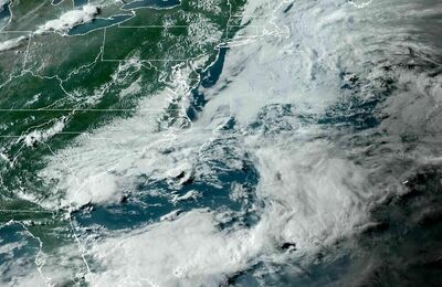 East Coast Satellite