Pensacola FL to Pascagoula MS out 20 to 60 NM Marine Forecast
| Today...South Winds 10 To 15 Knots. Seas Around 3 Feet. Wave Detail: South 3 Feet At 6 Seconds. |
| Tonight...South Winds 10 To 15 Knots With Gusts Up To 20 Knots. Seas 3 To 4 Feet, Occasionally To 5 Feet. Wave Detail: South 4 Feet At 6 Seconds. |
| Thursday...South Winds 10 To 15 Knots. Seas 3 To 4 Feet, Occasionally To 5 Feet. Wave Detail: South 4 Feet At 6 Seconds. |
| Thursday Night...Southwest Winds 10 To 15 Knots. Seas Around 3 Feet. Wave Detail: South 3 Feet At 6 Seconds. A Chance Of Showers And Thunderstorms After Midnight. |
| Friday...West Winds 10 To 15 Knots. Seas Around 3 Feet. Wave Detail: Southwest 3 Feet At 6 Seconds. A Chance Of Showers And Thunderstorms, Mainly In The Morning. |
| Friday Night...Northwest Winds 10 To 15 Knots, Becoming North With Gusts Up To 20 Knots After Midnight. Seas Around 3 Feet. Wave Detail: West 3 Feet At 6 Seconds And North 2 Feet At 4 Seconds. |
| Saturday...Northeast Winds 10 To 15 Knots, Becoming North 5 To 10 Knots In The Afternoon. Seas 2 To 3 Feet. Wave Detail: North 3 Feet At 4 Seconds And South 2 Feet At 6 Seconds. |
| Saturday Night...Northwest Winds 5 To 10 Knots, Becoming North After Midnight. Seas Around 2 Feet. Wave Detail: West 2 Feet At 5 Seconds And Northeast 1 Foot At 4 Seconds. |
| Sunday...East Winds Around 10 Knots. Seas Around 2 Feet. Wave Detail: South 2 Feet At 5 Seconds And Northeast 1 Foot At 3 Seconds. |
| Sunday Night...East Winds 10 To 15 Knots. Seas Around 2 Feet. Wave Detail: Southeast 2 Feet At 4 Seconds. A Chance Of Showers And Thunderstorms After Midnight. Winds And Seas Higher In And Near Thunderstorms. |
| Area Forecast Discussion National Weather Service Mobile AL 641am CDT Wednesday May 8 2024 /issued 454am CDT Wednesday May 8 2024/ ..New NEAR TERM, SHORT TERM, LONG TER Marine Near Term (Now through Tonight) Issued at 453am CDT Wednesday May 8 2024 Zonal flow aloft is expected through tonight as an upper-level ridge over the Gulf of Mexico builds northward across the Gulf Coast. At the surface, southerly flow continues as a persistent high pressure system lingers over the western Atlantic. Overall, with strong subsidence in place from the upper ridge and a lack of any large-scale forcing, expecting the area to remain mainly dry through this evening. Cannot rule out an isolated shower or storm to develop over our far northern counties as these areas are further from the ridge and closer to a shortwave moving across the Tennessee River Valley. Similar to previous days, although storm coverage is very low, any storm that does manage to overcome the subsident effects of the ridge and develop will be able to utilize CAPE values of around 2000 J/kg, DCAPE values greater than 1200 J/kg, and deep layer shear of around 35kts, with straight- lined hodographs. Therefore, cannot rule out a localized gusty to damaging wind or even a few hailstones up to quarter-sized. The next system which will impact our area will begin approaching our area late tonight and into Thursday. This overall shift to a more active pattern will be discussed in detail in the following short term discussion, however, rain chances will start to increase over our northern zones by around sunrise on Thursday as a lead shortwave impulse approaches the area. Temperatures will be very warm today, with highs climbing into mid to upper 80s over coastal counties and the low 90s inland. This, paired with dew points in the lower 70s, will give way to heat indices in the mid to upper 90s, with a few interior spots reaching 100-101 degrees. Lows tonight will be very mild, with temperatures dropping only into the low to mid 70s. The rip current risk remains high through the rest of the week. /96 SHORT TERM... (Thursday through Friday night) Issued at 453am CDT Wednesday May 8 2024 An active weather period is anticipated through much of the short term forecast period. A mid level shortwave ejecting across the Mid South tonight and into the Middle Tennessee Valley on Thursday will result in the development of numerous showers and thunderstorms across these areas. This cluster of storms will progress southeastward across central Alabama Thursday morning and may develop as far south as portions of south central Alabama (northeastern portions of our forecast area) by late morning into the afternoon hours. The thermodynamic and kinematic environment will be conditionally favorable for severe thunderstorms if if sufficient ascent were to overspread these locations and lift out any residual capping inversion. Strong instability develops with SBCAPES up to 3500j/kg and mid level lapse rates greater than 7.5c/km. This volatile thermodynamic environment will combine with a favorable shear environment represented by enlarged cyclonically curved hodographs in response to a 35kt low level jet and strong shear aloft. The biggest question is whether a residual warm nose around 3km with the capping inversion can erode sufficiently to support deep convection. The positioning of a mid level ridge nearby brings into question the degree of available large scale forcing that will occur over our forecast area. If the cap were to erode out, then storms would be capable of producing all severe weather hazards, including tornadoes, large hail, and damaging winds. The latest model trends suggest that the most likely scenario is for the capping inversion to hold strong enough to keep any convection that develops shallow and weak which would preclude the potential for severe storms. It is most probable that the best storm potential Thursday afternoon would remain confined to areas north and east across southeast Alabama into west central Georgia where a severe weather threat during the day is more likely. We will need to closely monitor the severe weather potential for Thursday afternoon over the next couple of forecast shifts and make adjustments as confidence in the convective evolution increases. Any convection from Thursday afternoon will be east of our region by evening. Focus will then shift back to the west for later Thursday night into Friday. Unfortunately the overall model spread has increased both with respect to timing and location of the best forcing for ascent and convective evolution. Much of the available model guidance has slowed the timing of the next upstream shortwave/s. A split in the guidance has developed with the GFS based models favoring a lead southern stream shortwave moving east with an earlier start to deep convection by Thursday evening and quickly moving east and exiting the region prior to sunrise Friday. Much of the remainder of the reliable guidance to include the ECMWF (European Centre for Medium-Range Weather Forecasts) and CAMs ensemble model suite, delays convective evolution until late Thursday night into Friday morning as the primary northern stream trough digs southeast towards the Gulf Coast. Currently favoring the ECMWF/HREF scenario over the GFS scenario, but it is too soon to rule either solution out completely at this time. Regardless, the atmosphere should remain moderate to strongly unstable in advance of the large scale forcing mechanism with probabilities for SBCAPE values exceeding 2000j/kg and deep layer shear greater than 40kts exceeding 40-50%. This is a result of a very moist low level air mass represented by theta values between 355-360k and temperatures likely remaining in the mid 70s to near 80 degrees in advance of any convection. As the forcing encroaches upon the area and interacts with the available instability and deep layer shear, expect storms to develop and intensify with an increased threat for severe storms. Uncertainty regarding overall storm mode has increased this morning, with half of the guidance suggesting a well developed QLCS and the other half suggesting supercell development over our area initially which may grow upscale with time. In either scenario, damaging winds and large hail are the most likely threats as straight hodographs which become large above 2km are suggested in all scenarios. Weak low level flow should preclude a tornado threat with this event. So the most likely storm evolution appears to favor the later solution with the most likely timing for severe storms from after midnight Thursday night through mid/late morning Friday. We will continue to provide updates as hopefully the models begin to better converge on an eventual solution. Storms should clear the area by later Friday afternoon into Friday night as a cold front progresses through the area and stalls over the northern Gulf. /JLH Long Term (Saturday through Tuesday) Issued at 453am CDT Wednesday May 8 2024 High pressure returns for the weekend with dry conditions along with cooler temperatures and lower humidity levels. The front to our south returns back to the north as a warm front ahead of the next approaching upper level trough with a return to warm and humid conditions and increased chances for showers and storms by early next week. /JLH Marine Issued at 453am CDT Wednesday May 8 2024 A moderate onshore flow will persist through much of the week, with seas offshore gradually building to around 3 to 4 feet by the middle to latter part of the week. Slightly higher winds are expected in the afternoon hours near the coast in association with an enhanced sea breeze circulation. A front moves through the marine zones on Friday, allowing for a light to moderate offshore wind to return for Friday and into Saturday. /96 NOAA Mobile AL Office: Watches - Warnings - Advisories AL...High Rip Current Risk through Friday afternoon for ALZ265-266. FL...High Rip Current Risk through Friday afternoon for FLZ202-204- 206. MS...None. GM...None. |
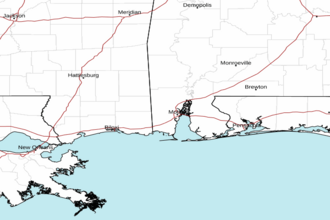 Mobile AL Radar
 Gulf Radar