Pigeon Point to Point Pinos CA out 10 NM Marine Forecast
| Today...Nw Wind Around 5 Kt, Rising To 5 To 10 Kt Late. Seas Around 3 Ft. Wave Detail: W 2 Ft At 12 Seconds. Patchy Fog Early This Morning. Areas Of Fog Late This Morning, Then Patchy Fog Early This Afternoon. |
| Tonight...Nw Wind 5 To 10 Kt. Seas Around 3 Ft. Wave Detail: W 2 Ft At 11 Seconds. |
| Mon...Nw Wind 10 To 15 Kt. Seas Around 3 Ft. Wave Detail: W 3 Ft At 10 Seconds. |
| Mon Night...Nw Wind 10 To 15 Kt. Seas 3 To 5 Ft. Wave Detail: W 4 Ft At 13 Seconds And Sw 2 Ft At 13 Seconds. A Slight Chance Of Rain After Midnight. |
| Tue...Nw Wind 5 To 10 Kt, Rising To 10 To 15 Kt In The Afternoon. Seas 5 To 7 Ft. Wave Detail: W 6 Ft At 12 Seconds And Sw 3 Ft At 14 Seconds. A Slight Chance Of Rain In The Morning, Then A Chance Of Rain In The Afternoon. |
| Tue Night...Nw Wind 5 To 10 Kt. Seas 5 To 7 Ft. Wave Detail: S 3 Ft At 11 Seconds And W 6 Ft At 12 Seconds. Patchy Dense Fog In The Evening. Rain Likely. |
| Wed...Nw Wind 5 To 10 Kt. Seas 5 To 7 Ft. Wave Detail: W 6 Ft At 12 Seconds And S 3 Ft At 15 Seconds. Rain Likely, Mainly In The Morning. |
| Wed Night...N Wind 5 To 10 Kt. Seas 6 To 7 Ft. Wave Detail: W 7 Ft At 11 Seconds And S 3 Ft At 14 Seconds. |
| Thu...Nw Wind 5 To 10 Kt. Seas 5 To 7 Ft. Wave Detail: W 7 Ft At 11 Seconds And S 3 Ft At 13 Seconds. A Chance Of Rain In The Afternoon. |
| Thu Night...Nw Wind Around 5 Kt, Backing To W After Midnight. Seas 4 To 6 Ft. Wave Detail: W 5 Ft At 11 Seconds And Sw 3 Ft At 12 Seconds. A Chance Of Rain. |
| Area Forecast Discussion National Weather Service San Francisco CA 950am PST Sunday Dec 14 2025 Issued at 841am PST Sunday Dec 14 2025 Extensive stratus coverage persists across the lower elevations as the coastal stratus and Tule Fog outgrowth combine. Expecting a pattern similar to yesterday where the stratus takes its sweet time to mix out across the region, but does eventually mix out across most of the interior valleys during the late morning and afternoon hours, while the coastal regions and the far interior East Bay remain socked in through the day. At this time, the temperature forecast is generally on track, but will continue to monitor observations through the day in case cooler conditions persist through the day. Touched up the wind forecast a little bit to account for updated information, but no major changes to the forecast at this time. DialH .SHORT TERM... Issued at 1202am PST Sunday Dec 14 2025 (Today and tonight) We are now on the backside of the 500 mb ridge that dominated the weather for the last couple weeks. A short wave trough is further weakening the long wave ridging. This feature brought a strong southerly surge of stratus on Saturday, but wasn't enough to mix out the radiation fog across the valleys. So now we have both coastal stratus and inland valley fog. Boundary layer averaged winds have shifted from easterly to southerly over the last 24 hours, but remain weak at the surface. Dense fog is being reported across the North Bay valleys and interior East Bay valleys. This fog will persist through late morning before clearing, and a Dense Fog Advisory is in effect until 11 AM. Afternoon temperatures will be cooler than they have been with more cloud coverage and dropping 850 mb temps. Both the long wave ridge and short wave trough will continue to slide East through the day. There is another good chance for fog impacts Sunday night as the lower atmosphere remains poorly mixed. Long Term Issued at 1202am PST Sunday Dec 14 2025 (Monday through Saturday) 500 mb zonal flow with a tighter pressure gradient will move in by Tuesday and persist through the week. As this new pattern lines up with higher moisture it will support a few rounds of light rain. Without a deep trough there is no real threat of heavy rain this week. High clouds on Monday will warn of the approaching rain, with the first round expected Tuesday through Wednesday. The current forecast has been pretty consistent with around 1/4" in the North Bay and less than 1/10" everywhere else. While the zonal flow will persist, drier air will move in Thursday likely bringing a break in the rain. The next round will move in Friday and persist through the weekend. Beyond next weekend there is a lot of uncertainty in the details, but the ensemble cluster analysis reveals good agreement in the overall pattern evolving to feature deep troughing just off the coast. This could support an atmospheric river early next week if the moisture plume lines up right. The Climate Prediction Center continues to show a moderate risk for both strong winds and heavy rain from 12/20-12/26. Marine (Today through Friday) Issued at 841am PST Sunday Dec 14 2025 High pressure over the region will maintain gentle to moderate breeze continues across the coastal waters today. Southerly flow will prevail north Pigeon Point and northerly flow will prevail south of Pigeon Point. Winds increase to moderate to fresh across the southern coastal waters Monday as the first in a series of weak systems reaches the coastal waters. Rain chances increase this week. Low seas persist through the remainder of the weekend before building to moderate to rough by mid week. NOAA San Francisco Bay Area Office: Watches - Warnings - Advisories CA...Dense Fog Advisory until 11am PST this morning for CAZ506-510- 513. PZ...Small Craft Advisory from 3pm to 9pm PST Monday for Pt Pinos to Pt Piedras Blancas 0-10 nm. x.com/nwsbayarea |
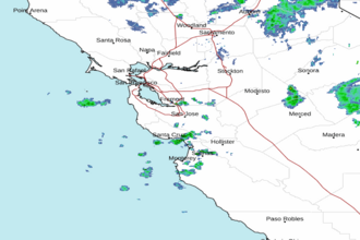 San Francisco Radar
 Southwest Radar