Point Arena to Point Reyes CA out 10 NM Marine Forecast
| Tonight...Nw Winds 15 To 20 Knots...Becoming N 10 To 15 Knots After Midnight. Gusts Up To 30 Knots. Wind Waves 7 To 8 Ft... Subsiding To 5 To 7 Ft After Midnight. Nw Swell 4 To 6 Ft At 11 Seconds And S Around 2 Ft At 17 Seconds. |
| Thu...Nw Winds 10 To 15 Knots With Gusts Up To 25 Knots. Wind Waves 3 To 4 Ft. Nw Swell 4 To 6 Ft At 11 Seconds And S Around 2 Ft At 15 Seconds. |
| Thu Night...Nw Winds 10 To 15 Knots. Wind Waves 2 To 3 Ft. Nw Swell 3 To 5 Ft At 11 Seconds And S Around 2 Ft At 15 Seconds. |
| Fri...Sw Winds 5 To 10 Knots. Wind Waves 2 To 3 Ft. Mixed Swell Nw 3 To 4 Ft At 12 Seconds And S Around 2 Ft At 14 Seconds. |
| Fri Night...Nw Winds 5 To 10 Knots. Wind Waves Around 2 Ft. Mixed Swell Nw 3 To 4 Ft At 12 Seconds And S Around 2 Ft At 19 Seconds. Patchy Fog. |
| Sat...Nw Winds 10 To 15 Knots. Wind Waves 3 To 4 Ft. Mixed Swell Nw 2 To 4 Ft At 11 Seconds And S Around 2 Ft At 17 Seconds. Patchy Fog. |
| Sat Night...Nw Winds 10 To 15 Knots. Wind Waves 4 To 5 Ft. Mixed Swell Nw 2 To 3 Ft At 11 Seconds And S Around 2 Ft At 17 Seconds. |
| Sun...Nw Winds 15 To 20 Knots With Gusts Up To 25 Knots. Wind Waves 4 To 5 Ft. Mixed Swell Nw 2 To 4 Ft And Sw Around 2 Ft. |
| Mon...Nw Winds 15 To 20 Knots With Gusts Up To 25 Knots. Wind Waves 4 To 5 Ft. Nw Swell 3 To 5 Ft And Sw Around 2 Ft. |
| Area Forecast Discussion ...CORRECTED National Weather Service San Francisco CA 1242pm PDT Wednesday May 8 2024 ...New SYNOPSIS, SHORT TERM, Long Term Synopsis Issued at 1241pm PDT Wednesday May 8 2024 Warming trend begins today with the warmest temperatures expected Thursday and Friday. Offshore winds continue through Thursday with a Wind Advisory in effect for the North Bay interior mountains through Thursday morning. A slight cooldown will begin this weekend and continue into the early part of next week. .SHORT TERM... (This evening through Thursday) Issued at 1241pm PDT Wednesday May 8 2024 Summary: * Warming trend begins today and peaks Thursday and Friday * Minor HeatRisk throughout the region, Moderate HeatRisk in the interior Bay Area * Breezy northerly winds continue today * Wind Advisory for the North Bay interior mountains through 8 AM Thursday * Gradual cooldown begins this weekend through early next week The warmup has begun as temperatures across the region are generally running around 5 to 10 degrees above the same time yesterday. A ridge is building over the eastern North Pacific, building into British Columbia and the Pacific Northwest through the next couple of days. At the same time, an upper level low centered over the northern Plains is elongating along a generally east-west axis, the trough regressing into the Great Basin and breaking off into a weak cut-off low. The combination of these two systems is leading to north to northeast flow aloft, a situation that generally leads to warmer temperatures in the area. Forecast highs are generally reflecting today's warming trend, with interior locations seeing highs into the lower 80s, the Bayshore seeing highs in the upper 70s, and mid to upper 60s expected along the coast. Breezy north winds continue to develop with wind gusts up to 20-25 miles per hour across the valley regions. The higher elevations, especially in the North Bay, are in a lull through the afternoon, but gusts up to 45 to 55 miles per hour are expected to resume later this evening and continue through Thursday morning. Thus, the Wind Advisory for the North Bay interior mountains continues through 8am on Thursday. Overnight lows will be quite warm across the Bay Area, with temperatures on Thursday morning in the mid to upper 50s. The Central coast will see somewhat cooler lows overnight in the upper 40s to low 50s. The heat event starts to peak on Thursday, with interior highs in the mid to upper 80s and coastal highs in the low to mid 70s. Of note, downtown San Francisco is currently expected to reach 81 on Thursdsay; if the forecast verifies, it would be the first 80-degree day in the city since last October. Winds are expected to diminish through the day Thursday. This section from yesterday continues to apply today: The seasonably warm temperatures are causing a minor to moderate HeatRisk, meaning that a low to moderate risk for heat related illnesses exists for vulnerable populations (children, the elderly, pregnant women, or those without adequate shelter or cooling), with moderate HeatRisk values concentrated in the interior regions of the North, East, and South Bays. With the significant warm up expected for the rest of the week, here's a reminder of some heat safety tips: * Stay hydrated and drink plenty of fluids. * Wear lightweight, light-colored clothing. * Reduce time spent outdoors or stay in the shade. * Never leave people or pets unattended in vehicles. * Use sunscreen if going to the coast or the pool. Long Term (Thursday night through next Tuesday) Issued at 1241pm PDT Wednesday May 8 2024 Friday will be the second day of the peak heat event, and while areas closer to the coast might see temperatures drop by a few degrees, the interior areas should expect temperatures to rise even further, as high as the lower 90s in the warmest locations. Cooling begins Saturday, as a decaying ridge allows onshore flow to reassert itself. Coastal regions will see the most cooling, and by Sunday, should return to seasonal temperatures for this time of year (generally, the low to mid 60s). At the same time, the interior will continue to see highs in the low to mid 80s, warmer than the seasonal average, through the early part of next week. Ensemble models and clusters are showing that another ridge approaches the West Coast next week, which could help maintain temperatures above the seasonal averages. CPC products are showing temperatures above seasonal averages continuing into the third week of May. Marine (Today through Monday) Issued at 908am PDT Wednesday May 8 2024 High pressure to the north and low pressure to the south will maintain moderate to locally strong northerly winds over the coastal waters and bays through tonight. The stronger northerly winds will result if fresh steep swell today. By Friday, winds are largely light to moderate across much of the waters. Wave heigheights gradually diminish to around 5 to 7 feet by late week. Dry weather continues through the forecast period as high pressure dominates. NOAA San Francisco Bay Area Office: Watches - Warnings - Advisories CA...Wind Advisory until 8am PDT Thursday for CAZ504. PZ...Small Craft Advisory until 9pm PDT this evening for SF Bay N of Bay Bridge. Small Craft Advisory until 9pm PDT this evening for Mry Bay-Pt Arena to Pt Reyes 0-10 nm. Small Craft Advisory until 9pm PDT this evening for Pigeon Pt to Pt Pinos 0-10 nm-Pt Pinos to Pt Piedras Blancas 0-10 nm. Gale Warning until 3pm PDT this afternoon for Pt Arena to Pt Reyes 10-60 NM. Small Craft Advisory until 3am PDT Thursday for Pigeon Pt to Pt Pinos 10-60 NM. |
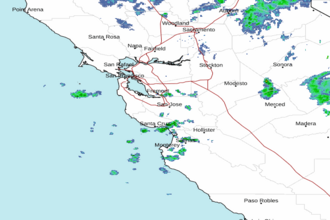
 San Francisco Radar
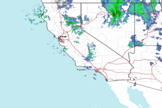
 Southwest Radar