Point Reyes to Pigeon Point CA out 10 NM Marine Forecast
| Today...Nw Winds 15 To 25 Knots. Gusts Up To 25 Knots This Afternoon. Wind Waves 6 To 8 Ft. Nw Swell 4 To 6 Ft At 12 Seconds And Sw Around 2 Ft At 17 Seconds. |
| Tonight...N Winds 10 To 15 Knots. Wind Waves 5 To 7 Ft. Nw Swell 3 To 5 Ft At 12 Seconds And Sw Around 2 Ft At 17 Seconds. |
| Thu...Ne Winds 10 To 15 Knots. Wind Waves 3 To 4 Ft. Nw Swell 4 To 6 Ft At 12 Seconds And Sw Around 2 Ft At 15 Seconds. |
| Thu Night...W Winds 5 To 10 Knots. Wind Waves 2 To 3 Ft. Nw Swell 3 To 5 Ft At 11 Seconds And Sw Around 2 Ft At 15 Seconds. |
| Fri...S Winds 5 To 10 Knots. Wind Waves Around 2 Ft. Mixed Swell Nw 2 To 4 Ft At 12 Seconds And Sw Around 2 Ft At 14 Seconds. |
| Fri Night...W Winds 5 To 10 Knots. Wind Waves Around 2 Ft. Mixed Swell Nw 2 To 4 Ft At 12 Seconds And S Around 2 Ft At 19 Seconds. |
| Sat...W Winds 10 To 15 Knots. Wind Waves 3 To 4 Ft. W Swell 2 To 4 Ft And S Up To 2 Ft. |
| Sun...W Winds 10 To 15 Knots. Wind Waves 3 To 4 Ft. Mixed Swell W 2 To 4 Ft And S Around 2 Ft. .....San Francisco Bar/Fourfathom Bank Forecast..... In The Deep Water Channel...Mixed Seas Of 5 To 7 Ft At 11 Seconds. Across The Bar...Mixed Seas Of 6 To 8 Ft At 11 Seconds. Maximum Ebb Current Of 4.8 Kt At 04:45 Am Wednesday And 1.5 Kt At 05:46 Pm Wednesday. |
| Area Forecast Discussion National Weather Service San Francisco CA 303am PDT Wednesday May 8 2024 ...New SYNOPSIS, SHORT TERM, LONG TER Marine Synopsis Issued at 300am PDT Wednesday May 8 2024 A warming trend begins Wednesday as offshore winds develop, with a Wind Advisory in effect for the North Bay Interior Mountains until Thursday morning. Warmest temperatures are expected Thursday and Friday before a slight cooldown into the early part of next week. .SHORT TERM... (Today and tonight) Issued at 300am PDT Wednesday May 8 2024 Clear sky conditions continue across the region this morning and offshore winds have developed aloft. This will result in a warming trend today with temperatures reaching the low-to-mid 80's across the interior while 60's will be common near the coast (70's in places such as Santa Cruz). A Wind Advisory remains in effect for the North Bay Interior Mountains with gusts expected to reach 45 mph and may exceed 55 mph in the Mayacamas Mountains through Thursday morning. Gusts in the East Bay Hills are not expected to be widespread enough to warrant an advisory, but Mount Diablo is expected to see similarly strong, gusty winds. Overnight lows will be warmest in the North Bay and interior part of the East Bay given the offshore flow with temperatures only expected to cool into the mid-to-upper 50's (lower 60's in the highest peaks). Elsewhere, upper 40's to mid 50's are expected overnight. Long Term (Thursday through Tuesday) Issued at 300am PDT Wednesday May 8 2024 The warming trend continues into the early part of the upcoming weekend, with Thursday and Friday expected to be the warmest days of the week. High temperatures will range from the upper 60's to lower 70's near the coast (lower 80's in places such as Santa Cruz and downtown San Francisco), to the upper 80's to lower 90's inland, especially by Friday. From previous forecaster: "The seasonably warm temperatures are causing a minor to moderate HeatRisk, meaning that a low to moderate risk for heat related illnesses exists for vulnerable populations (children, the elderly, pregnant women, or those without adequate shelter or cooling), with moderate HeatRisk values concentrated in the interior regions of the North, East, and South Bays. With the significant warm up expected for the rest of the week, here's a reminder of some heat safety tips: * Stay hydrated and drink plenty of fluids. * Wear lightweight, light-colored clothing. * Reduce time spent outdoors or stay in the shade. * Never leave people or pets unattended in vehicles. * Use sunscreen if going to the coast or the pool. The heat should start to abate on Sunday as onshore flow returns to the region, but temperatures warmer than the seasonal averages are expected to continue for the foreseeable future, with CPC products stating that temperatures above seasonal averages continue into the third week of May." Marine (Today through next Monday) Issued at 300am PDT Wednesday May 8 2024 Strong and gusty northerly winds continue through the evening tonight, but slowly ease to become fresh to moderate by Thursday. By Friday, winds are largely gentle across much of the waters. As a result of the stronger winds today, wave heigheights 13 to 14 feet can be expected in the outer waters today and early Thursday. Wave heigheights gradually diminish to around 5 to 7 feet by late week. Dry weather continues through the forecast period as high pressure dominates. NOAA San Francisco Bay Area Office: Watches - Warnings - Advisories CA...Wind Advisory until 8am PDT Thursday for CAZ504. PZ...Small Craft Advisory from 9am this morning to 3pm PDT this afternoon for SF Bay N of Bay Bridge. Small Craft Advisory from 3pm this afternoon to 9pm PDT this evening for Mry Bay-Pt Arena to Pt Reyes 0-10 nm. Small Craft Advisory from 9am this morning to 9pm PDT this evening for Pigeon Pt to Pt Pinos 0-10 nm. Small Craft Advisory until 9pm PDT this evening for Pt Pinos to Pt Piedras Blancas 0-10 nm. Gale Warning until 3pm PDT this afternoon for Pt Arena to Pt Reyes 10-60 NM. Small Craft Advisory until 3am PDT Thursday for Pigeon Pt to Pt Pinos 10-60 NM. |
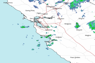 San Francisco Radar
 Southwest Radar